| Western Terminus: |
US-31 at Exit 140, 2½ miles west of New Era |
| Eastern Terminus: |
US-10 at Exit 128 (the eastern BUS US-10 interchange) on the eastern limits of Midland |
| Length: |
133.207 miles |
| Maps: |
 Route Map of M-20 Route Map of M-20
M-20/M-120/M-82 Maps (1969–1971) |
| Notes: |
M-20, while not a true "coast-to-coast" cross-peninsular route, is still a major east-west travel corridor in the central Lower Peninsula. It runs from near Lake Michigan on the west to Midland on the east, just 14 miles from downtown Bay City near Saginaw Bay. (Indeed, M-20 formerly extended east to Bay City, making it truly a "coast-to-coast" route.) Today, the portion of M-20 between Midland and Mount Pleasant is a heavily-travelled route, while the portions to the west are largely rural in nature and carry a lower traffic volume. |
| |
 In October 1982, the Reflective Systems Unit of MDOT began reviewing the state trunkline sytem and "discovered a substantial number of dual and some triple routing on both the free access and limited access system." The result of which was forwarded to
"the Trunkline Numbering Committee in an attempt to reduce as much of this unnecessary routing as possible in an attempt to avoid driver confusion and save funds." That December, the MDOT Traffic & Safety Division proposed to "End M-20 at US-10BR" so that it would no longer run concurrently with BUS US-10 for the last 4¼ miles of its route at Midland, leaving the latter route the only one posted along that segment. In March 1983, the Supervising Engineer of the Reflective Safety Unit concurred and recommended to the Trunkline Numbering Committee those changes be implemented. This change has never been enacted, however, as M-20 and BUS US-10 have continued to run concurrently to this day. In October 1982, the Reflective Systems Unit of MDOT began reviewing the state trunkline sytem and "discovered a substantial number of dual and some triple routing on both the free access and limited access system." The result of which was forwarded to
"the Trunkline Numbering Committee in an attempt to reduce as much of this unnecessary routing as possible in an attempt to avoid driver confusion and save funds." That December, the MDOT Traffic & Safety Division proposed to "End M-20 at US-10BR" so that it would no longer run concurrently with BUS US-10 for the last 4¼ miles of its route at Midland, leaving the latter route the only one posted along that segment. In March 1983, the Supervising Engineer of the Reflective Safety Unit concurred and recommended to the Trunkline Numbering Committee those changes be implemented. This change has never been enacted, however, as M-20 and BUS US-10 have continued to run concurrently to this day. |
| |
In "State Trunkline Needs, 1960–1980," a set of maps prepared by the State Highway Dept's Office of Planning, Programming Division in 1960 showing possible additions, upgrades and improvements to the state trunkline system over the ensuing twenty years, MSHD staff recommended several upgrades to the route of M-20 during that timeframe. They included:
- Converting M-20, which then began at Muskegon State Park and continued via North Muskegon, Twin Lakes, Fremont and White Cloud to Big Rapids, to a divided highway between Muskegon State Park and the western edge of North Musekgon and from the eastern edge of North Muskegon through Twin Lakes to the M-20 (now M-120) & M-82 jct west of Fremont.
- Rerouting M-20 east of Fremont to continue east along 48th St (instead of turning north along Baldwin Ave) for four additional miles, then skirting around the north side of Sylvan Lake before teeing into M-37, 3½ miles north of Newaygo. M-20 would have then run concurrently with M-37 into White Cloud.
- Rerouting M-20 to run east from White Cloud via Base Line Rd for 6½ miles to Elm Ave, then angling northeasterly on a new alignment before merging back into 8 Mile Rd just east of the Newaygo/Mecosta Co line. It would continue east along 8 Mile Rd to Stanwood where it would bend northeasterly on a new alignment to meet up with Buchanan Rd at 160th Ave, then continuing easterly along Buchanan for 8 miles to 90th Ave. M-20 would then bend northeasterly again on a new alignment between the corner of Buchanan Rd & 90th Ave to 9 Mile Rd & 80th Ave, then continue east along 8 Mile Rd to its existing route one mile to the east. The vast majority of the existing route of M-20 would be turned back to local control in this scenario.
- Converting five miles of M-20 from 7 Mile Rd easterly to Vance Rd west of Midland to a divided highway.
Of these four recommendations,
only half of the third one (rerouting M-20 between White Cloud and Stanwood in 1998—and then, it was only rerouted along existing roadways with no new alignment constructed) and a modified version of the last one (where M-20 was converted to a five lane facility with a continuous left-turn lane instead of a divided highway in the 1980s and '90s) were ever completed. |
| |
A major change in the routing of M-20 took place on November 2, 1998 when the portion of M-20 from M-37 north of White Cloud to the Newaygo/Mecosta County line west of Big Rapids was turned back to county control as part of the short-lived Rationalization process. Simultaneously, all of county B-88 in Newaygo and Mecosta Cos was transferred to state control. The route of B-88 in its entirety (from White Cloud to US-131 at Stanwood) was then redesignated as M-20. The resultant gap in M-20 between Stanwood and Big Rapids was filled by running M-20 concurrently with US-131 between Exits 131 and 139. The former route of M-20 is now an un-numbered county road in Newaygo Co. The short portion of the former M-20 in Mecosta Co has since been turned back to local control and is now also an un-numbered county road. |
| |
By early February 1999, all but a handful of the M-20 route marker assemblies from White Cloud to US-131 at Big Rapids had been removed, even the ones at the junction of M-20 & M-37, potentially leaving motorists unfamiliar with the area without guidance! As of April 1999, only one lonely M-20 marker remained, obviously overlooked in the process, and all traces of B-88 were removed. Also in April, M-20 route marker assemblies had been erected at the US-131 & 8 Mile Rd interchange (Exit 131) near Stanwood, as well as a solitary M-20 marker on the east side of White Cloud. No other indication of the changes was apparent on M-37 or on eastbound M-20 as one approached the junction with M-37. By May 1999, however, the new highway routing was completely signed. |
| |
From 1926–1969, M-20 ran southwesterly from White Cloud via Fremont to end in Muskegon. The White Cloud-to-Fremont stretch was for many years an un-numbered state trunkline, while the remainder was re-designated as portions of M-82 and M-120. On October 31, 1999, the un-numbered "Old M-21" between Fremont and White Cloud was turned back to county control. |
| |
One of the earlier stretches of freeway of any length in Michigan was the M-20 freeway between Bay City and Midland in 1958. This is now part of the US-10 freeway. |
| History: |
1913 (Aug 14) – The majority of the route of Trunk Line 20 (T.L. 20) in Midland and Bay Cos is officially established as a state trunkline route. The first 20.25-mile segment begins at the Coleman east village limit, then southeasterly via Pere Marquette Rd, then jogging northeasterly along Barden Rd through North Bradley, then turning southeasterly again along Saginaw Rd through Sanford, then easterly on Wackerly Rd before turning southerly along Eastman Rd to a terminus one mile south of the Saginaw Rd intersection in Midland. The second 16.25-mile portion of T.L. 20 established begins at Jefferson Ave southeast of downtown Midland and continues easterly along Bay City Rd to the Midland/Bay Co line where it then continues via Midland Rd through Auburn to Euclid Rd on the Bay City west city limit. |
| |
1913 (Aug 15) – The next day, a total of 7.4 miles of T.L. 20 are officially established as a trunkline route in Clare Co's Grant Twp, outside of the Farwell village limits, in two segments. First, a 6.9-mile segment from the Garfield/Surrey Twp line easterly along Surrey Rd, then south-southwesterly via North St to the Farwell north village limit. Second, a 0.5-mile segment from the Farwell east village limit easterly along Ludington Dr (present-day M-115) to the Surrey/Grant Twp line. |
| |
1913 (Aug 28) – Two weeks later, two additional segments of T.L. 20 are officially established in Lake and Osceola Cos. In Lake Co, the 7.0-mile segment runs from the Mason/Lake Co line at Branch southerly along Tyndall Rd to the Pere Marquette Ry (later C&O, then Chessie System, now Marquette Rail) line, then southeasterly along Wingleton Rd for 0.4 miles, continuing parallel to the rail line for another 0.65 miles on a roadway that no longer exists present-day to South Branch Rd, where it picks up Wingleton Rd again into the hamlet of Wingleton on the Sweetwater/Lake Twp line. In Osceola Co, a 3.0-mile section of T.L. 20 is established along 5 Mile Rd from the Hersey/Evart Twp line easterly to the (then-)Evart west village limit. |
| |
1913 (Sept 13) – A couple more weeks later, an additional dozen miles of T.L. 20 are established in Osceola Co, although five of those miles, the establishment date is unknown—State Highway Dept documentation from the 1920s note "Determination Lost" in lieu of a date for those segments—so the establishment date is being inferred from the adjacent segment. From the Lake/Osceola Co line easterly for two miles along 4 Mile Rd to the Reed City city limit at 220th Ave and the three mile segment running largely along present-day US-10 from the Reed City east city limit to 185th Ave, southerly via 185th to Craft Rd, then eastery along Craft to the Richmond/Hersey Twp line at 180th Ave are the segments where the determination has been lost. Then for 7.0 miles from the Richmond/Hersey Twp line easterly along Craft Rd from 180th Ave, northerly on 160th Ave, then easterly along the present-day route of US-10 to 5 Mile Rd and then easterly on 5 Mile Rd to the Hersey/Evart Twp line. |
| |
1913 (Oct 10) – An additional five miles of T.L. 20 are established in Osceola Co beginning at the hamlet of Sears east of Evart and proceeding easterly via the present-day route of US-10 for 3½ miles to 15th Ave, then southerly for another 1½ miles along 15th Ave to the hamlet of Chippewa on the Pere Marquette Ry. |
| |
1913 (Nov 5) – A total of 18½ miles of additional T.L. 20 mileage are established in Lake Co in two segments. First, 3.6 miles from Wingleton on the Pere Marquette Ry southeasterly via Wingleton Rd, then easterly along 52nd St to the Baldwin west village limit. The second segment begins on the Baldwin east village limit and easterly generally along present-day US-10 through Nirvana and Chase, then southerly via Hawkins Rd for one mile, then easterly again on 64th St to the Lake/Osceola Co line. |
| |
1914 (June 24) – Two more sections of T.L. 20 are established in Mason Co. The first is a 2.0-mile segment from the Scottville east city limit easterly to the Custer west village limit. The second is a 9.0-mile segment from the Custer east village limit easterly to the Mason/Lake Co line. |
| |
1914 (June 27) – Three days later, a 6.6-mile portion of T.L. 20 in Clare Co's Garfield Twp is established beginning on the Osceola/Clare Co line at Clarabella Rd and continuing easterly via Eight Point Lake Rd, then southeast on Mystic Lake Dr into the community of Lake Station, then turning north along Gibson Ave and easterly again via the present-day route of US-10 to the Garfield/Surrey Twp line. |
| |
1915 (May 28) – The 3.0-mile long section of T.L. 20 established a year-and-a-half earlier from the Hersey/Evart Twp line easterly via 5 Mile Rd to the Evart west village limit is cancelled as a state trunkline route, while simultaneously a new 3.24-mile route is established from the same starting point on the Hersey/Evart Twp line and heading easterly via 5 Mile Rd, then northerly on 100th Ave, then easterly along the present-day route of US-10 to the Evart west village limit. (The cancelled and newly-re-established route coincide for the westernmost two miles.) |
| |
1915 (Dec 17) – The 5.0-mile segment of T.L. 20 established in Osceola Co from Sears easterly and southerly to Chippewa almost exactly 26 months earlier is cancelled as a state trunkline. Simultaneously, a new 7.9-mile trunkline is established from Sears southerly via 50th Ave, then easterly along 3 Mile Rd to the Osceola/Clare Co line where it meets the segment established 18 months earlier along Eight Point Lake Rd. (Ironically, the 3½-mile portion of the cancelled route from Sears easterly to 15th Ave would become part of the route of US-10 in 22 more years.) |
| |
1917 (June 27) – A 3.4-mile westerly extension of the trunkline established in Osceola Co beginning at Sears is established from Sears westerly via 6 Mile Rd to the Evart east city limit. |
| |
1918 (Apr 24–25) – On April 24, the gap in T.L. 20 between Farwell and Clare in southern Clare Co is filled when a 3.8-mile trunkline segment is established beginning at the Surrey/Grant Twp line and continuing easterly along present-day M-115, then southeast and east-southeast along a no-longer extant roadway (in present-day), then southerly on Harrison Rd, and then easterly via Maple Rd to the Clare west city limit. The next day on April 25, an additional 1.4 miles of trunkline are established from the Clare city limit easterly via Clarabella Rd to Cornwell Rd along the Clare/Isabella Co line. |
| |
1919 (July 7) – The route of T.L. 20 through the City of Reed City in Osceola Co is officially established from the end of the previously established trunkline segment northerly along 220th Ave, easterly via Upton Ave, southerly with T.L. 13 along Chestnut St, then easterly on Church St to the east city limit, and then northerly along the east city limit to present-day Commerce Dr. |
| |
1919 (Aug 15) – On August 15, the portion of T.L. 20 through Isabella Co is established along an 8.1-mile route beginning at Cornwell Rd then easterly along Clarabella Rd, southerly via Loomis Rd into Loomis, easterly on Washington St, southerly via Buchtel St and then southeasterly along Saginaw Rd to the Isabella/Midland Co line. Forty days later on September 24, a gap in T.L. 21 is filled when a 2.0-mile long route along Saginaw Rd from the Isabella/Midland Co line into Coleman, then Railway St through downtown Coleman, southwesterly one block along Brown St and then southeasterly again on Webster Rd to the Coleman east village limit is officially established. |
| |
1919 (Dec 15) – The stairstep route of T.L. 20 through the Village of Baldwin is established as a trunkline route from the west village limit then easterly along Carr Rd, northerly on Cherry St, easterly via Seventh St, northerly along Michigan Ave past the Lake Co Court House, then easterly via the present-day route of US-10 on Washington St to the east village limit. |
| |
1919 (Dec 24) – The route of T.L. 20 within the City of Midland is established as a state trunkline from the end of the established route along Eastman Rd a mile south of Saginaw Rd, then southerly into downtown where it runs southeasterly via Ellsworth St through the heart of the city, then easterly via Bay City Rd to the beginning of an already-established trunkline segment at Jefferson Ave. |
| |
1920 (Apr 15–30) – T.L. 20 is signed in the field as M-20 as all state trunkline highways in the Lower Peninsula are scheduled to be signed with route markers during the last half of April. However, as the trunkline has not yet been officially established within the corporate limits of Scottville, Custer, Evart and Clare, the route is signed along streets still under municipal jurisdiction (not an uncommon occurrence at the time). |
| |
1920 (May 28) – The 1.1 miles of M-20 in the Village of Farwell in Clare Co is officially established as a state trunkline route beginning on the north village limit, heading south-southwesterly along Superior St, then east-southeasterly via Main St to the east village limit. |
| |
1920 (July 2) – The 1.0 miles of M-20 in the Village of Custer in Mason Co is officially established as a state trunkline route beginning on the west village limit traversing the northern edge of the village via State St to the east village limit. |
| |
1920 (July 28) – The 0.5 mile of M-20 in the Village of Custer in Mason Co is officially established as a state trunkline route beginning at jct M-11 (later US-31) downtown at cnr State St & Main St and proceeding easterly along State St to the east city limit. |
| |
1921 (Mar 16) – The 1.0 mile of M-20 in the Village of Evart in Osceola Co is officially established as a state trunkline route beginning on the west village limit and passing through the village along Seventh St to the east village limit. |
| |
1925 (Apr 2) – The 1.6 miles of M-20 in the City of Clare in Clare Co is officially established as a state trunkline route beginning on the west city limit and continuing easterly via Maple Rd, then southeast and eaterly along present-day M-115 and Fifth St, jogging one block to the south with M-14 (later US-27, now BUS US-127) along McEwan St, then easterly again Fourth St and southeasterly along the present-day route of BUS US-10 to the to the south city limit (and Clare/Isabella Co line). |
| |
1925 (Sept 1) – A 7.9-mile state trunkline route is established beginning on E Center Ave at the New York Central Railroad crossing near the Bay City east city limit and continues easterly and southeasterly via the present-day route of M-25 to the Bay/Tuscola Co line. No route designation for this establishment seems to be given and internal State Highway Dept maps show the route from Bay City to M-31 at Unionville as a state trunkline, but with no route designation indicated. This may have been planned as an easterly extension of M-20 from Bay City to Unionville, but no definitive proof has been found to date. The portion of this route in Tuscola Co is established in four segments between 1925 and 1932, although the M-29 designation is applied to it beginning in May 1927. |
| |
1925 – The first proposals for the US Highway System assigned the US-12 designation to the Ludington–to–Midland portion of the M-20 routing, then continuing via M-24 into Saginaw and then picking up M-10 from there to Detroit. However, as with route designation changes in other states prior to arriving at a final numbering plan, the plan in Michigan undergoes modifications as well through the remainder of 1925 and 1926 (see below). |
| |
1926 – When the final US Highway System plan is adopted in 1926, US-10—not US-12—is to be designated along most of M-20 in Michigan, from Ludington through Reed City and Clare to Midland. While the Bay City-to-Midland portion of M-20 will remain as-is, all of M-24 from Midland westerly to US-31 (formerly M-11) at Musekgon well be redesignated as M-20. |
| |
1926 (Oct 4) – M-20 undergoes a major realignment in Lake Co, with a new 12.3-mile segment from the Mason/Lake Co line at Branch then easterly via the present-day route of US-10 to present-day M-37 north of Baldwin, then southerly to the existing route of M-20 at jct M-54 (present-day southern jct of US-10 & M-37) on the Baldwin north village limit, then easterly for approximately ½ mile to the east limits of Baldwin being officially established as a state trunkline route. This new alignment would not be completed and opened to traffic until late 1928, after it had become part of US-10. While the 12.2-mile former route of M-20 from Branch to Baldwin via Wingleton is cancelled as a trunkline route and transferred to local control, M-20 remains signed along it as the newly-established route is being constructed. |
| |
1927 (May 2) – Road crews erect temporary cardboard route markers over the existing state trunkline route markers for all new US Highways and changed state highways as a result of the new US Highways. US-10 supersedes the portion of M-20 from Ludington through Baldwin, Reed City, and Clare to Midland where US-10 then takes over the route of what had been M-24 and proceedes toward Saginaw, while the Midland–Bay City portion remains part of M-20. The M-20 designation then replaces what had been designated M-24 from Midland westerly through Mount Pleasant, Big Rapids, and Fremont to US-31 at Muskegon. (The State Highway Dept plans to have permanent markers in place by midsummer.)
Note: All changes to the route of M-20 from Midland westerly to Muskegon after this point occur along the route which had been designated M-24 from 1913–1927. |
| |
1927 (June 29) – As originally established in March 1914, the route of M-24 (newly redesignated as M-20) approached White Cloud from the southwest via an alignment continuing due easterly from the curve in Echo Dr 2¼ miles southwest of downtown White Cloud for 0.8 miles along a no-longer-extant roadway to the cnr of 8th St & Post Rd, then northerly along Post Rd for 0.2 mile, then easterly and northeasterly along a now abandoned private roadway to the White Cloud city limit at the cnr of Townline Rd & Lester St. (From there, the signed route of M-20 likely continued north along Lester St to Wilcox St, then east through downtown to M-37.) This 1.4-mile trunkline route is cancelled, while a new 2.0-mile route via Echo Dr and Wilcox St to M-37/Charles St downtown is officially established. |
| |
1927 (Dec 30) – M-20 is realigned to run directly between Twin Lake and Holton in northeast Muskegon Co along the 6.1-mile present day route of M-120/Holton Rd is officially established as a state trunkline route, while the former 7.4-mile route between those communities easterly via Fourth St–Ryerson Rd and northerly along Holton-Duck Lake Rd is cancelled and turned back to county control. |
| |
1928 (Sept 19) – The 0.9-mile gap in the established trunkline route of M-20 on the east side of White Cloud is officially established between M-37/Charles St and the east city limit along Wilcox Ave, Morgan St and Pine Hill Ave. It has been signed along this route since becoming M-20 in May 1927 as was M-24 before it. |
| |
1932 (Oct 29) – At Mount Pleasant in Isabella Co, the 4.5-mile portion of M-20 from US-27/Mission St easterly along Broadway St and northerly via Shepherd Rd to Pickard Rd is cancelled as a trunkline, while the new 4.0-mile route via Pickard Rd from Shepherd Rd westerly to US-27/Mission St on the north side of Mount Pleasant is established as the new route for M-20, which then turns southerly for ½ mile with US-27 to its exisiting route at Broadway St. |
| |
1933 (Mid) – By midyear, the new spur trunkline route from US-31 at North Muskegon to Muskegon State Park along the north shore of Muskegon Lake, which had been established in late October 1932 and given the M-148 designation, is redesignated as an extension of M-20. This is likely due to M-20 and M-148 sharing a terminus at US-31. Now, instead, M-20 continues through the US-31/Whitehall Rd intersection and westerly for six miles along Memorial Dr to Scenic Dr on Lake Michigan. The remaining 1.3 miles of what had been preliminarily designated as M-148 along the proposed southerly extension of Scenic Dr from Memorial Dr to the Muskegon Lake Channel is also redesignated as M-20, although the roadway has yet to be built. |
| |
1936 (Feb 20) – M-20 is realigned to run directly between Holton and Brunswick in northeast Muskegon Co along the 2.1-mile present day route of M-120/Holton Rd is officially established as a state trunkline route, while the former 2.0-mile route via Marvin Rd from Holton to the newly-established M-213 along Maple Island Rd is cancelled and turned back to county control. The portion of Maple Island Rd from Marvin Rd northerly to Holton Rd is incorporated into the route of the new M-213. |
| |
1936 (May 23) – The State Highway Dept purchases 15 miles of 100-foot-wide Pere Marquette Railway right-of-way from the railroad company from White Cloud northeasterly to the Newaygo/Mecosta Co line for a relocation of M-20. The abandoned railroad runs on a much more direct alignment while the existing highway generally sticks to section- and quarterline roads and features numerous 90° turns. The portion of the former railroad line from the county line into Big Rapids may have also been purchased around this same time as well. (The proposed relocation is never constructed, however, and the State Highway Dept removes the proposed trunkline from its maps by the late 1950s. The former railroad right-of-way is mostly sold off between 1958 and 1961 to either abutting landowners or the Newaygo Co Road Commission.) |
| |
1939 – While M-20 was extended into Muskegon State Park along a route officially established in October 1932, the actual roadway from Scenic Dr southerly to the Muskegon Lake Channel is not completed until this year. (This is now the main park road within the state park.) |
| |
1940 (Nov 12) – Two changes in the route of M-20 are official today:
- At Mount Pleasant, the completion of a new bridge spanning the Chippewa River and an underpass under the Ann Arbor Railroad along High St–Remus Rd are completed and High St from US-27/Mission St westerly for 1.469 miles to existing M-20 at Bradley Rd is officially established as a state trunkline route. M-20 is now routed concurrently with US-27 along Mission St from Broadway St southerly to High St. The former route from Remus Rd northerly via Bradley Rd then easterly through downtown along Broadway St is cancelled as a state trunkline route and turned back to local control.
- In western Midland Co, M-20 is modernized with some sharper turns in the route replaced with more gradual ones as well as a new bridge spanning the Chippewa River at Oil City and the new route is officially established as the route of M-20, while the two bypassed portions are either obliterated, abandoned as a public road or, in the case of the former Chippewa River bridge, removed and the segments cancelled as state trunkline routes.
|
| |
1955 (July 12–Aug 3) – A new, 672-foot long, seven span M-20 bridge spanning the Tittabawassee River at Midland, featuring a 52-foot wide bridge deck and costing a total of $1 million (including the bridge approaches, digging a new channel for the Chippewa River, and a 1½ mile relocation of M-20) is completed and opened to traffic on July 12. The new bridge, opened with a ribbon-cutting ceremony attended by former Mayor Karl B. Robertson and current Mayor Glenn W. Warren, also spans the Chesapeake & Ohio Railway in addition to the river and replaces an older, one-way bridge upstream which often closed during flooding events. The new Tittabawassee River bridge had originally been approved in 1939 with bids let for the first phase of construction in 1940, however the onset of the U.S. involvement in World War II prevented any further work on the project. The 1.23-mile long new alignment of M-20 between Currie Pkwy on the west and Main St on the east is officially established as a trunkline route on August 3. Simultaneously, the 1.28-mile long former route along Currie Pkwy and Main St (between Currie Pkwy and Jerome St) is cancelled as a trunkline route and turned back to city control.
|
| |
c.1957 – Sometime around 1957, the entirety of US-10A at Midland is redesignated as BUS US-10. The concurrent segment of M-20/US-10A becomes M-20/BUS US-10. No other changes to the route of M-20 occur because of this change. |
| |
1958 – The final 6½ miles of gravel-surfaced M-20 are paved, from Spruce St & One Mile Rd near White Cloud to 6 Mile Rd & Thornapple Ave southwest of Woodville in Newaygo Co. |
| |
1958 (Oct 29) – The 13.666-mile M-20 Midland–Bay City Freeway is officially established as a state trunkline route from the Midland/Bay Co line easterly past Auburn to US-23/M-47/Euclid Ave at the Bay City west city limit. The former route of M-20 along Midland Rd through Auburn is retained as an unsigned state trunkline highway for the time being. |
| |
1959 (Fall) – The new M-20 freeway from Bay City is extended westerly from Bay City Rd near the Bay/Midland Co line (present-day Exit 129) westerly, parallel to and north of existing M-20/ Bay City Rd for a total of 3.488 miles. The first 3.0 miles, from Bay City Rd westerly to just west of US-10/Saginaw Rd is a continuation of the fully controlled-access freeway. From that point westerly back to existing M-20 at Ellsworth St, M-20 utilizes a one-way pair of streets—Lyon Rd eastbound and Patrick Rd westbound. The existing route of M-20 along Bay City Rd from the M-20 freeway westerly to Ellsworth St and Ellsworth St from there to Lyon Rd remains an unsigned trunkline for the time being, while the new M-20 route hasn't yet been officially established as a trunkline route (although it is open to traffic and signed as one!). It is likely the BUS US-10 designation at Midland is relocated onto the new M-20 route from US-10/Saginaw Rd westerly to Ellsworth St with the former segment of M-20/BUS US-10 along Ellsworth St from Lyon Rd to Bay City Rd and via Bay City Rd easterly to US-10/Saginaw Rd becoming an unsigned trunkline route for the time being. |
| |
1959 (Oct 19) – Just shy of an entire year after the M-20 freeway through southern Bay Co is completed and opened to traffic, the 13.666-mile segment is officially established as a state trunkline highway route. Simultaneously, the former 13.0-mile alignment of M-20 along Midland Rd is officially canceled as a trunkline route and turned back to local control. |
| |
1960 (July 29) – With the completion and opening of a new two-lane undivided limited-access "Super 2" expresway is completed between Freeland and the M-20 freeway approximately 1½ miles east of the Midland/Bay Co line, the US-10 designation is routed northerly along the new expressway route, then joins M-20 to run concurrently into Midland, where US-10 departs M-20 at its existing route along Saginaw Rd. |
| |
1960 (Nov 15) – A year after opening to traffic, the 3.650-mile long former route of M-20 on the southeast side of Midland is cancelled as a state trunkline highway route and turned back to local control. The segments in question are Ellsworth St from Lyon Rd southeasterly to Bay City Rd and Bay City Rd from there to the east Midland city limit at the Midland/Bay Co line. Simultaneously, the new segment of M-20/BUS US-10 opened the previous fall between Ellsworth St and the Midland/Bay Co line is officially established as a trunkline route as well. |
| |
1960 (Dec 5) – A 14.93-mile long segment of freeway is opened to traffic beginning at the north end of the existing US-23 "Saginaw East Belt" bypass at M-81 northwesterly over the Saginaw River via a new four-lane bascule Zilwaukee Bridge, then curving northerly past Bay City, terminating at existing US-23 at Kawkawlin. The new freeway is designated as I-75/US-10/US-23 from Saginaw to an interchange with the M-20 freeway west of Bay City. Here, US-10 now turns westerly replacing the M-20 designation on the freeway into Midland. (North of M-20, the new freeway segment continues north as I-75/US-23 to Kawkawlin.) The eastern end of M-20 is then scaled back from Bay City to a new terminus at the US-10 & BUS US-10 interchange east of Midland (present-day Exit 128) with BUS US-10 and M-20 running concurrently into downtown Midland. East of the new I-75/US-23 freeway, the former M-20 continuing easterly into Bay CIty is redesignated as a westerly extension of M-15/M-25, joined by BL I-75 as well. |
| |
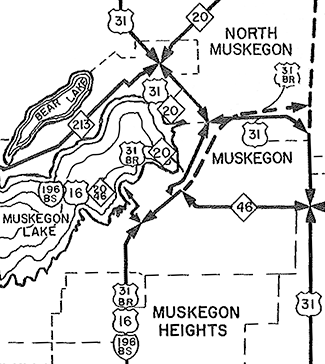 1961 (Aug 22) – M-20 is rerouted in the Muskegon area. Formerly running from North Muskegon along the north shore of Muskegon Lake to a terminus in Muskegon State Park, that segment west of US-31/Whitehall Rd is redesignated as M-213, while the M-20 designation is rerouted to the southeast concurrently with US-31 over the Veterans Memorial Causeway into Muskegon. At Access Highway where US-31 departs to bypass the city, M-20 now runs concurrently with BUS US-31 southwesterly along Ottawa St. At Eastern Ave, both BUS US-31 and M-20 now split into a brand-new one-way pair: Northbound BUS US-31 and eastbound M-20 follow the existing trunkline route on Clay Ave between Terrace Ave and Eastern Ave, while the State Highway Dept temporarily begins marking and maintaining Eastern Ave from Ottawa west to Western Ave, Western Ave from Eastern to Terrace St, and Terrace St from Western to Clay Ave, back to the existing route of BUS US-31 (now just the northbound/eastbound route). M-20 then continues southeasterly with BUS US-31 along Terrace St. At Webster Ave, westbound M-20 turns southwesterly with southbound BUS US-31/westbound M-46 while the additional block of Terrace to Muskegon Ave becomes just eastbound M-20 concurrent with northbound BUS US-31. Through the remainder of downtown, Webster Ave between Sixth St and Terrace St is sbd BUS US-31/wbd M-20/wbd M-46 while Muskegon Ave between those same streets is nbd BUS US-31/ebd M-20/ebd M-46. At Sixth St (jct US-16), M-20 and M-46 turn northwesterly with US-16 to run via Sixth St, Western Ave and Mart St to collectively terminate on the Wisconsin & Michigan Steamship Company's carferry dock (the Mart Dock) on the shores of Muskegon Lake. 1961 (Aug 22) – M-20 is rerouted in the Muskegon area. Formerly running from North Muskegon along the north shore of Muskegon Lake to a terminus in Muskegon State Park, that segment west of US-31/Whitehall Rd is redesignated as M-213, while the M-20 designation is rerouted to the southeast concurrently with US-31 over the Veterans Memorial Causeway into Muskegon. At Access Highway where US-31 departs to bypass the city, M-20 now runs concurrently with BUS US-31 southwesterly along Ottawa St. At Eastern Ave, both BUS US-31 and M-20 now split into a brand-new one-way pair: Northbound BUS US-31 and eastbound M-20 follow the existing trunkline route on Clay Ave between Terrace Ave and Eastern Ave, while the State Highway Dept temporarily begins marking and maintaining Eastern Ave from Ottawa west to Western Ave, Western Ave from Eastern to Terrace St, and Terrace St from Western to Clay Ave, back to the existing route of BUS US-31 (now just the northbound/eastbound route). M-20 then continues southeasterly with BUS US-31 along Terrace St. At Webster Ave, westbound M-20 turns southwesterly with southbound BUS US-31/westbound M-46 while the additional block of Terrace to Muskegon Ave becomes just eastbound M-20 concurrent with northbound BUS US-31. Through the remainder of downtown, Webster Ave between Sixth St and Terrace St is sbd BUS US-31/wbd M-20/wbd M-46 while Muskegon Ave between those same streets is nbd BUS US-31/ebd M-20/ebd M-46. At Sixth St (jct US-16), M-20 and M-46 turn northwesterly with US-16 to run via Sixth St, Western Ave and Mart St to collectively terminate on the Wisconsin & Michigan Steamship Company's carferry dock (the Mart Dock) on the shores of Muskegon Lake. |
| |
1962 (Dec 12) – The concurrent US-16/M-20/M-46 designation in downtown Muskegon becomes BS I-196/M-20/M-46 with the decommissioning of US-16 in the state of Michigan. The BS I-196 designation replaces US-16 on the Norton-Glade Expwy (Seaway Dr) between the Mart Dock and the western terminus of I-196 at US-31 southeast of Muskegon. |
| |
1963 (Jan 25) – Although it has been signed as part of the routes of M-20, M-46, BS I-196 and US-16 (until that route was decommissioned in Michigan in its entirety in December 1962) since 1961, the 0.426-mile trunkline spur route serving Muskegon's Mart Dock (the carferry dock for the Wisconsin & Michigan Steamship Company) along Sixth St, Western Ave and Mart St is technically established as a state trunkline route. This 4½ block segment has apparently been a "marked-and-maintained" route until now. |
| |
1963 (July 1) – The routes of M-20 & BUS US-10 in downtown Midland are rerouted onto a pair of one-way streets to improve traffic flow through the city. The former route of M-20 & BUS US-10 along Ellsworth St is turned back to local control, as are other associated street segments, including the one block of Lyon Rd from Ellsworth to Buttles St, the two blocks of Patrick Rd from Ellsworth to Indian St, and the one block of Eastman Rd from Ellsworth to Buttles. The new one-way pair transferred to state control consists of Buttles St from Eastman Rd to Lyon Rd for eastbound traffic and Indian St from Patrick Rd to Eastman Rd for westbound traffic. Additionally, the two-block long segment of Jerome St from Ellsworth St to Indian St is established as a trunkline routing to allow for M-20 to connect with BUS US-10 and with its own new routing along Buttles–Indian. |
| |
1963 (Late) – The concurrent BS I-196/M-20/M-46 designation in downtown Muskegon becomes BS I-96/M-20/M-46 with the re-designation of I-196 between Grand Rapids and Muskegon as I-96. |
| |
1964 (Oct) – With the completion of the US-31 freeway from northeast of Muskegon northerly past Whitehall and Montague, major state trunkline route concurrency changes occur on M-20 at Muskegon. First, the concurrent stretch of US-31/M-20 over the Veterans Memorial Causeway between Muskegon and North Muskegon temporarily becomes M-20/BUS US-31 since the northside expressway connector between downtown Muskegon and the new US-31 freeway is not yet completed. Then, from the cnr of Whitehall Rd, Lake Ave & Holton Rd at North Muskegon, BUS US-31 continues its tempoary concurrency with M-20 along Holton Rd for an additional 2¾ miles to a new (albeit temporary) terminus at the new US-31 freeway & M-20 interchange northeast of North Muskegon (present-day Exit 118). |
| |
1964 (Dec 3) – A 0.33-mile portion of the BUS US-31/M-20/Skyline Dr (present-day Moses J Jones Pkwy) is completed and opened to traffic between Eastern Ave on the northeast end of downtown Muskegon and Bayou Ave just shy of the South Branch of the Muskegon River. The new segment of four-lane expressway replaces Prospect Ave along its route. Due to settling problems at Ryerson Creek, the northbound and southbound roadways will not be complete until next year when the tons of sand placed by construction crews has a chance to settle. Until the gap between Spring St and Eastern Ave is completed, southbound BUS US-31/M-20 traffic is directed to continue to use the existing route from Bayou Ave southwesterly into downtown via Ottawa St–Eastern Ave–Western Ave–Terrace St. |
| |
1965 (Jun 9) – The final link in the route of Muskegon's BUS US-31 route of Seaway Dr/Skyline Dr is finally completed and opened to traffic on the northeast end of downtown Muskegon linking Muskegon and Webster Aves at Spring St with the previously completed expressway portion at Eastern Ave. (This was the portion delayed due to settling problems at Ryerson Creek.) At this point, the M-20 designation is also likely scaled back to terminate at the southern end of the Veterans Memorial Causeway where it meets BUS US-31 north of downtown, resulting in the removal of all M-20 route markers from the route of BUS US-31 between that point through downtown to Sixth St and along US-16/M-46 along Sixth St–Western Ave–Mart St out onto the Mart Dock. |
| |
1969 (Mar 28) – As part of a long-term project to reroute M-20 to run due westerly from the White Cloud area directly toward the Lake Michigan shoreline region instead of winding its way southwesterly toward Muskegon via Fremont and Twin Lake, a 6.966-mile long segment of state trunkline highway route is officially established along One Mile Rd in Newago Co (South Ave in Hesperia) beginning at M-82/Division St (present-day M-120) in Hesperia and running easterly to Croswell Ave near the community of Aetna. This portion of One Mile Rd is upgraded to modern trunkline standards, but not yet designated or signed as M-20 while the remainder of the One Mile Rd route easterly to M-37 north of White Cloud is still under construction. |
| |
1970 (Feb 3) – The 1970 Michigan Official Highway Map is released by the Dept of State Highways... but with changes indicated that aren't going to be reflected in reality until July. Specifically, the M-20 realignment along One Mile Rd between White Cloud and Hesperia in Newaygo Co is shown as complete (albeit without an M-20 symbol on the map) even though the road will not be complete until July 1. From Hesperia to US-31 at New Era, what had been M-82 is now shown on the map sans route designation! The former M-20 between Muskegon and "Fremont Junction" west of Fremont is shown as M-120, but terminating at "Fremont Junction" instead of continuning northerly supplanting the M-82 designation to Hesperia, which is what the Dept of State Highways had anticipated being the case come July. Because of the premature mapping changes, State Highways maintenance workers hastily erect new route markers largely conforming to what is depicted on the map: M-120 now takes the place of M-20 from Muskegon northeasterly to "Fremont Junction," but also runs concurrently with M-82 to Hesperia (even though the original plan was to remove M-82 from this segment of highway). M-82 signs are swapped out for M-20 markers between New Era and Hesperia and removed from the White Cloud-to-Fremont Junction route. (The former M-20 from White Cloud to M-82 east of Fremont is simply an unsigned trunkline, while M-20/M-82 from that point west through Fremont to "Fremont Junction" is signed only as M-82 now.) However, since the One Mile Rd alignment is not yet complete, M-20 is temporarily a discontinuous route due to the mapping issues and the rushed route signing changes caused by it. See: M-20/M-120/M-82 Maps (1969–1971) for a graphical depiction. |
| |
1970 (July 1) – The 6.548 miles of One Mile Rd in Newaygo Co from Croswell Ave easterly to M-37/Evergreen Dr ½ mile north of the White Cloud city limit as well as the 1.5 miles of Monroe Rd from M-37/Evergreen Dr easterly to existing M-20 at cnr of Monroe Rd & Spruce Ave northeast of White Cloud are transferred to state control and established as a state trunkline route and part of the relocated M-20 route. Coming from the northwest in Newaygo Co, M-20 now continues westerly along Monroe Rd at Spruce Ave (instead of turning southerly) to M-37, then runs southerly concurrently with M-37 for 1½ miles to One Mile Rd where it turns westerly along One Mile Rd along both the newly-completed portion (to Croswell Ave) and the portion completed and transferred to state control in March of 1969 from Croswell Ave into Hesperia. At Hesperia, M-20 now takes over the former route of M-82 constructed in the mid-1960s to US-31 at New Era. The former route of M-20 along Spruce Ave from Monroe Rd southerly to Base Line Rd, then along Base Line Rd westerly to White Cloud, and Pine Hill Ave, Morgan St and Wilcox Ave in the City of White Cloud to the western city limit is turned back to county and city control. Old M-20 on the stair-step route between White Cloud and Fremont via Echo Dr, Bingham Ave, 12th St, Wisner Ave, 24th St, Baldwin Ave, and 48th St becomes an unsigned state trunkline highway route (known internally to the Dept of State Highways as OLD M-20). The rest of M-20 had been re-signed earlier in the year due to the premature mapping changes (see above): M-20/M-82 through Fremont to Fremont Junction becomes just M-82, while the portion from Fremont Junction southwesterly to Muskegon is redesignated as part of M-120. |
| |
1975 (Apr 16, Dec 23) – A 2.515-mile long westerly extension of M-20 is officially established as a state trunkline highway route on April 16 beginning at US-31/Oceana Dr and continuing southwesterly along a newly-built alignment, merging into Garfield Rd between Water Rd and 72nd Ave west of New Era, then continuing westerly along Garfield (present-day Stony Lake Rd), terminating 0.125 mile east of 64th Ave at the currently-under-construction interchange for the future US-31 freeway. The new US-31 freeway is completed and opened to traffic from north of Montague to this new M-20/Stony Lake Rd interchange (present-day Exit 140) on December 23 and US-31 traffic is temporarily routed easterly from the new freeway via the M-20 extension back to Oceana Dr where US-31 turns northerly along its existing alignment. |
| |
1980 (Oct 15) – A new 2.17-mile long state trunkline route is officially established on the southwest side of Big Rapids in anticipation of the future completion of the US-131 freeway in the area. The new route begins at the corner of US-131/S State St by the campus of Ferris State Univ and heads westerly for approx 1,600 ft along Perry Ave to its terminus (roughly where the Fellowship CRC Church is located), then continues westerly via a highway to be constructed for one mile before swinging west-southwesterly to the proposed interchange with Future US-131 approx ½ mile later before finally merging back into the existing route of M-20/15 Mile Rd 550 feet west of 220th Ave. This newly established route will become both the new alignment for M-20 as well as a component in a future BUS US-131 routing at Big Rapids once it is constructed and the freeway opens to traffic. |
| |
1983 (Dec 9) – An additional 11 miles of US-131 freeway is completed and opens to traffic in Mecosta Co from B-88/8 Mile Rd
(present-day M-20) at Stanwood northerly to 19 Mile Rd northwest of Big Rapids. As part of the new US-131 freeway project, the new Perry Ave alignment (see October 15, 1980 item above) becomes both the new routing of M-20 between exisitng US-131 at State St and the new intersection with 220th Ave (approx 550 feet west of the now-obliterated intersecton of 13 ile Rd & 220th Ave) as well as a leg of the newly-designated BUS US-131 between the new freeway interchange and the former route of US-131. The new BUS US-131 is concurrently designated with M-20 along State St northerly from Perry Ave to Maple St near downtown where M-20 turns easterly and BUS US-131 continues northerly along the former route of US-131. The former route of M-20 along the east-west segment of Ferris Dr and 15 Mile Rd from OLD US-131/State St westerly to the dead-end at the US-131 freeway right-of-way remains an unsigned state trunkline for the time being. |
| |
1988 (Feb 1) – OLD M-20—the former route of M-20 on the southwest side of Big Rapids, replaced by the new BUS US-131/M-20 alignment via Perry Ave and Perry Ave extended 4¼ years prior—is cancelled as a state trunkline route and turned back to local control. This route consists of the 0.482-mile segment of Ferris Dr from OLD US-131/State St westerly to 205th Ave and the 1.19 miles of 15 Mile Rd from 205th Ave westerly to the dead-end at the US-131 freeway right-of-way. |
| |
1988–89 – BUS US-10/M-20 is realigned just outside downtown Midland. Until this time, the eastbound route of BUS US-10/M-20 followed Buttles St southeasterly to a 90-degree corner at Lyon St where it turned easterly via Lyon. Meanwhile, the westbound trunkline route followed Patrick St westerly to a 90-degree turn at Patrick St where it turned northwesterly into downtown. Due to long traffic backups at the various traffic signals at these intersections, two new curvilinear alignments were constructed so that Buttles would follow a sweeping route onto Lyon for eastbound traffic while Patrick similarly curved into Indian St. Several other local streets in the area were closed and abandoned to eliminate other potential traffic conflicts. The former route via Buttles St from Haley St to Lyon St is turned back to local control, while the portion of Lyon from Buttles to Grove and Patrick from Grove to Buttles and Indian from Patrick west to Haley is obliterated and abandoned as a public roadway. —Thanks much to Phil Putnam for the heads-up! |
| |
1992 (Mar 23) – As part of the overall US-131 Freeway and M-20/BUS US-131/Perry Ave construction project on the southwest side of Big Rapids, MDOT also constructs a new access roadway from 15 Mile Rd northerly along the northerly "extension" of 205th Ave to Perry Ave including a sweeping curve to the southeast at the south end to create one consistent roadway, now named Ferris Dr. MDOT issues an order on the "Assumption of Jurisdiction and Maintenance of Ferris Drive" to officially assign jurisdiction of the newly-constructed roadway segments to the City of Big Rapids. |
| |
1998 (Oct 1–Nov 2) – As one of the changes precipitated from the short-lived Rationalization effort in late 1998, the routing for M-20 undergoes a major change between White Cloud in Newaygo Co to Big Rapids in Mecosta Co. The 4.00 mile portion of B-88 in Mecosta Co along Newcosta Ave and 8 Mile Rd from the Newagyo Co line easterly to US-131 at Exit 131 is transferred from county to state control on October 1. Then, just over a month later on November 2, the 13.701 miles of B-88 running east from M-37/Charles St in downtown White Cloud along Wilcox Ave, Morgan St and Pine Hill Ave in White Cloud (1.101 miles), then via Baseline Rd and Newcosta Rd from the White Cloud city limit to the Mecosta Co line (12.6 miles) is similarly transferred from the county to the state. Simultaneously, the 17.153-mile segment of existing M-20 from M-37/Evergreen Dr north of White Cloud northeasterly in a stair-step fashion via Woodville to the Newaygo/Mecosta Co line is cancelled as a state trunkline and turned back to county control. (The portion of existing M-20 from the county line easterly to US-131 at Exit 139 remains an unsigned state trunkline for the time being.) Over the next four months, the route markers are removed from the former route and M-20 is routed southerly from its jct with M-37 north of White Cloud southerly with M-37 into downtown White Cloud where it picks up the newly-established route along the former B-88 between White Cloud and US-131 near Stanwood. From there, M-20 run concurrently with US-131 between Exit 131 and Exit 139 where it rejoins is existing route at Big Rapids. The distance between the (now) north jct of M-20 & M-37 north of White Cloud and Big Rapids is now 3½ miles longer, but generally about 1–2 minutes (or more) shorter in actual travel time due to a less curvy route and a portion along the US-131 freeway. |
| |
1998 (Nov 2) – At the same time of the M-20 jurisdictional transfers to the east of M-37 in the White Cloud area, the 12.15-mile segment of OLD M-20 from the Fremont east city limit at Luce Rd easterly and northerly in a stair-step manner to the White Cloud west city limit is transferred to county control. This unsigned trunkline route has been unsigned for 28 years since the M-20 designation was relocated to the One Mile Rd alignment into Hesperia in 1970. (The portion of OLD M-20 in Fremont from M-82/Stewart Ave easterly to the city limit at Luce Ave remains an unsigned state trunkline for the time being, while the portion of the pre-1970 route of M-20 within the White Cloud city limit had been transferred to city control in 1970.) |
| |
1999 – February 1999 saw the removal of most M-20 route markers between M-37 and US-131. As of April, only one lonely M-20 marker remains and all traces of B-88 are removed. Also in April, M-20 route marker assemblies are erected at the US-131 & 8 Mile Rd interchange (Exit 131) near Stanwood, as well as a solitary M-20 marker on the east side of White Cloud. No other indication of the changes are apparent on M-37 or on eastbound M-20 as one approaches the jct with M-37. All signage changes are completed by May, though. |
| |
1999 (July 8) – The 1.902-mile segment of OLD M-20 in Mecosta Co from the Newaygo Co line easterly to the US-131 interchange at Exit 139, replaced by the rerouted M-20 between White Cloud, Stanwood and Big Rapids nine months prior, is cancelled as a state trunkline route and turned back to county control. This completes the turnback of all of the former M-20 which had been rerouted in 1998. |
| |
2000 (Nov 14) – Almost 30½ years after it became an unsigned trunkline route due to the rerouting of M-20 westerly from White Cloud through Hesperia to New Era, the one-mile segment of OLD M-20 in the City of Fremont along E Main St from M-82/Stewart Ave east to Luce Ave at the east city limit is transferred to city control, finally completing the transfer of all segments of the former route of M-20 between White Cloud and Fremont. |
| Controlled-Access: |
Two segments of M-20 exist as freeway:
- Concurrently with US-131 from Exit 131 at Stanwood to Exit 139 at Big Rapids. (7.4 miles)
- Concurrently with BUS US-10 in Midland from Saginaw St to US-10 at Exit 128. (2.5 miles)
|
| NHS: |
M-20 is part of the National Highway System (NHS) in two different segments:
- In Mecosta Co from the southern jct with US-131 at Exit 131 northerly to jct BUS US-131 at State St & Maple St in downtown Big Rapids. (5.9 miles) (The segment of M-20 concurrent with BUS US-131 in Big Rapids was added in 2012 with the passage of the MAP-21 funding and authorization bill.)
- From the southern jct with BUS US-127 in Mount Pleasant (at cnr High St & Mission St) to the eastern terminus of M-20 at US-10 at Midland. (31.6 miles) (The segment of M-20 in Mount Pleasant west of US-127 was added in 2012 with the passage of the MAP-21 funding and authorization bill.)
|
| Memorial Highway: |
At present, no portion of M-20 has been designated as part of a Memorial Highway. |
| Photographs: |
|
| Weblinks: |
|
| |
|