

Historical Overview
Michigan has long been known as a pioneer in many aspects of roads and highways.
Many of today's commonplace road features were originally conceived of or
perfected in Michigan. Some of these innovations and improvements had their
genesis in the burgeoning automobile industry, which blossomed in Michigan
in the late-19th and early-20th centuries. Because of all the new motorized
vehicles on the road, certain improvements were borne of necessity. Later,
Michigan remained at the forefront of highway-related improvements and today
continues in that role.
 Just a few of Michigan's contributions to the motoring public include:
- the first mile of rural concrete pavement in 1909 (Woodward Ave between 6 Mile and 7 Mile Rds, Wayne Co)
- the nation's first centerline separating streams of opposing traffic (Marquette Co)
- the "crow's nest," a forerunner to the modern-day traffic signal (Detroit)
- the world's first four-way traffic signal with red, yellow and green lights replacing the "crows nest" above (Woodward Ave & Fort St, downtown Detroit)
- the marking of roadside telephone poles in different colors to designate different routes by William B. Bachman of Detroit, founder of the Automobile Club of Michgan in 1912—a forerunner of signing highway routes worldwide
- the second state (and second jurisdiction in the world) to number and post a state trunkline system (Wisconsin was first)
- the first roadside park was created along US-2 in the Upper Peninsula by Herbert Larson of the Iron Co Road Commission in 1919
- development of the first practical highway snowplow in the U.S. by Edward Levy, Munising public works superintendent in 1922
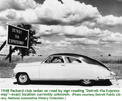
- the nation's first intercity "superhighway"—an 18-mile long, eight-lane segment of Woodward Ave between Detroit and Pontiac—is constructed between 1923 and 1927 and features a 40-foot median for public transit services
- the first roadside picnic tables, built using planks from old guardrails, were made by Ionia County engineer Alan Williams and placed along US-16 in 1929, which later became "a symbol of Michigan hospitality"
- the nation's first permanent travel information center—now referred to as Welcome Centers—was opened on US-12 near New Buffalo at the Indiana state line in 1935, the idea of Murray D. Van Wagoner, then State Highway Commissioner and later Governor of Michigan
- passing zone signs ("Pass With Care"/"Do Not Pass")
- the nation's first modern, depressed urban freeway was the Davison Frwy through Highland Park in greater Detroit in 1944
- one of the nation's first states to have a generally-complete freeway network. On average, Michigan's freeway system is seven years older than that of other states
- the nation's first five-lane highway with a center left-turn-only lane was established in 1952 in Detroit
- the nation's first closed-circuit television monitoring system to monitor freeway traffic (John C Lodge Frwy, Detroit)
- the nation's first border-to-border Interstate highway was I-94
- the nation's first demonstration for European-designed asphalt and concrete
- the nation's first system of using lasers to gage pavement smoothness
As noted in the list above, Michigan was the second state in the US—the second jurisdiction anywhere in the world, for that matter—to set
up and mark a state trunkline system. The numbering and posting of state
highways began in neighboring Wisconsin, where the state legislature grew
increasingly frustrated with the haphazard system of "Auto Trails" then
in use. These Auto Trails were generally set up by commercial interests
(e.g. tire manufacturers) trying to increase use of their products or tourism
entities trying to get motorists to pass through their towns. As these
Auto Trails were far from being impartial, many meandered far and wide
from the most direct or best course between points. Plus, a single roadway
may have a dozen or more different Auto Trails designated along it, making
for a very confusing situation! Wisconsin in 1917 and Michigan a year later
decided to do away with the multitudes of confusing Auto Trails names and
routes and simply number their state trunklines systematically.
Even before Michigan posted numbers on its state trunklines, the state legislature
passed the "State Trunk Line Act" in 1913 authorizing the designation of a
state highway network totalling almost 3,000 miles of roadway. The act stipulated
the newly-created State Highway Department would design, build and maintain
highway bridges 30 feet in length or longer, if the county or local government
improved three miles of adjacent road. This was the beginning of what would
later turn into an over 9,000-mile system of roads, highways and freeways cris-crossing
the state and reaching from Copper Harbor to Luna Pier.
Over the years, highway routes were added, re-routed, re-numbered and removed
from the system. Individually, these changes number in the thousands and range
from a half-mile realignment of a two-lane highway to the complete removals
of entire highway designations, like US-112 in
1961 and US-27 in 2002. This
website attempts to chronicle as many of these changes as humanly possible.
A comprehensive history of public roads in Michigan can be found in The
History of Roads in Michigan. Most of the individual route changes are
documented within the histories of each highway designation in the Highway
Listings pages.
You may also find interesting historical information within the In
Depth portion of the website.