| Southern Terminus: |
Downtown Detroit at cnr BS
I-375/Jefferson Ave & Randolph St (formerly M-3) |
| Northern Terminus: |
Orchard Lake Rd just north of 14 Mile Rd in West Bloomfield Twp |
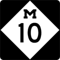
| Length: |
22.850 miles |
| Map: |
Route Map of M-10 |
| Notes: |
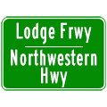
The freeway portion of M-10 in Detroit and Southfield is officially known as the John C. Lodge Freeway, however several of the route's former names are still used by some. The actual "John C. Lodge Expwy" originally only ran from Downtown Detroit out to the "Linwood Curve," halfway between the Davison and Wyoming Ave. A surface roadway—Northwestern Hwy—traditionally ran from Wyoming Ave northwesterly out of the city and into Oakland Co. When the freeway was extended in the early 1960s, the portion from the "Linwood Curve" west through the "Wyoming Curve," then northwesterly along the path of Northwestern Hwy to 8 Mile Rd was named "James Couzens Expwy." As the freeway was extended from 8 Mile Rd to Telegraph along Northwestern Hwy, the new freeway retained the name "Northwestern Hwy." It wasn't until the 1980s that MDOT decided to—officially or unofficially—rename the entire freeway the "John C. Lodge Frwy" from downtown Detroit to Telegraph Rd. Ironically, though, the service drives along M-10/John C. Lodge Frwy still retain their original names (as service drives, anyway). From downtown to Wyoming Ave, the service drives are named "John C. Lodge," from Wyoming to 8 Mile, the service drives as" James Couzens," and from 8 Mile to Telegraph, they're known as "Northwestern Hwy." John Christian Lodge (August 12, 1862—February 6, 1950), the freeway's namesake, was mayor of Detroit from 1922–1923, in 1924, and 1927–1929, and was on the Detroit City Council for over three decades. Lodge was also an uncle to Charles A. Lindbergh, the first person to fly solo across the Atlantic. |
| |
As much as the freeway portion of today's M-10 has changed names over the years, the non-freeway divided highway portion has always been named "Northwestern Hwy." In addition, a Northwestern Hwy extension was proposed to connect the current end of Northwestern at Orchard Lake Rd in West Bloomfield Twp with the proposed "Fenton-Clio Expressway" at Fenton. (The "F.C.E." is today's US-23 in Genesee Co.). The dashed line showing the proposed Northwestern Extension appeared on maps for many years, disappearing in the early 1970s. When I-275 was proposed as a complete bypass of Metropolitan Detroit, the Northwestern Hwy extension was resurrected as a full-freeway connection between Orchard Lake Rd and the I-275 freeway between 15 Mile (Maple) Rd and Pontiac Tr near Walled Lake. With the tabling and abandonment of the plans to complete I-275, the Northwestern Extension has been on and off for many years. In the late-1990s and early '00s, MDOT hired a consultant to study the possibilities for the "Northwestern Corridor," mostly at the behest of the Road Commission for Oakland County. (See below.) However, as the land in the path of the original "Northwestern Extension" has been sold off for development, the originally-proposed freeway connection has been relegated to the history books. |
| |
The "Northwestern Connector Study" in Oakland County was conducted in the 2000s by consultants DLZ Corp. The preferred alternative included widening Orchard Lake Rd from a five-lane road into a six-lane boulevard, widening Maple (15 Mile) Rd into a four-lane boulevard, widening 14 Mile Rd into three-lanes, and placing eleven roundabouts on each of the above roads to replace signalized intersections! While the widening portions of the plan may help reduce congestion some, it remains to be seen if the citizens of Oakland Co will be able to handle eleven roundabouts—especially ones on a six-lane boulevard! |
| |
According to The Detroit News' Tom Greenwood in his column on April 27, 2000, the portion of the M-10/Lodge Frwy in Southfield named the Adler Memorial Highway was named in honor of Rabbi Morris Adler who died after being shot by a deranged gunman in front of his congregation at Temple Shaarey Zedek on March 11, 1966. |
| |
The freeway portion of today's M-10 actually had no route designation when the first segment of the John C Lodge Expwy opened to traffic in the 1950s. Although it was constructed and maintained initially by the Wayne County Road Commission, it was a state trunkline highway, in that the state paid for a large portion of the overall cost to build the freeway. The first route number to be assigned to the Lodge was US-12 in 1956 when it was designated along the newly-completed Edsel Ford Frwy (now a portion of I-94). US-12 turned southerly along the Lodge from the Edsel Ford to end in downtown Detroit. In 1960, some Michigan State Highway Dept planning maps showed the US-10 designation being moved over to the I-75/Walter P Chrysler Frwy route (when completed), with Woodward Ave bearing a BUS US-10 designation and the John C Lodge Frwy not bearing any route number north of the Edsel Ford. The next route designation to grace the Lodge Frwy was BS I-696 (Business Spur I-696) in c.1964 when the I-696/Walter P Reuther Frwy was completed from the west, ending at Northwestern Hwy in Southfield. The BS I-696 designation began at the end of I-696 and continued southeasterly via today's John C Lodge Frwy into downtown Detroit. This was the first time a route designation had been applied to all of the Lodge. Then in 1970, the entire freeway was incorporated as part of US-10, which had been removed from parallel Woodward Ave, and the BS I-696 designation was removed. Finally, in the late-1980s (concurrent with a major reconstruction of the Lodge in Detroit), when the US-10 designation was truncated at Bay City, the Lodge was redesignated M-10, which it is today. |
| |
For the first time
in over fifty years, exit numbers began appearing on the John C Lodge Frwy
in Detroit in April 2005. In the 1970s and early-1980s, MDOT refrained
from posting exit numbers on the Lodge interchanges as the freeway was part
of the route of US-10, which itself was not constructed
as freeway from its "zero-point" at
Ludington. When US-10 was truncated back to Bay City in 1986, the M-10 designation
was assigned to the Lodge which meant both M-10's and the Lodge's "zero-point" were
now the same, at Jefferson Ave & Randolph St in downtown Detroit. However,
as part of their "Lodgability" reconstruction of the freeway in
the late-1980s, MDOT chose
not to erect exit numbers at that time. Assumedly as part of a freeway guide
sign replacement program, the department decided to finally include the exit
numbers during 2005. This leaves the M-8/Davison Frwy as the only freeway
in Detroit without numbered interchanges. |
| History: |
1920s – Prior to the creation of the US Highway system in the mid-1920s, the early version of M-10 begins at the Ohio state line south of Erie, runs northerly along Telegraph Rd to Dearborn, then easterly on Michigan Ave into downtown Detroit. From there, M-10 runs northwesterly through Flint, Saginaw and Bay City roughly along the later route of US-10. From Bay City, M-10 runs roughly along the later route of US-23 along the Lake Huron shore, ending in Mackinaw City. |
| |
1922 (July 24) – The portion of M-10/Telegraph Rd in southern Wayne Co from Flat Rock northerly to M-17/Michigan Ave at Dearborn is completed and opened to traffic. Future extensions of Telegraph Rd will continue the trunkline northerly through Redford and into Oakland Co to Pontiac for the express reason of offering through travellers a route through the Detroit area without needing to utilize busy Woodward Ave. |
| |
1926 – The new US Highway designations have been adopted by transportation officials and will be posted in the field the following spring. The following US Highways will be routed over portions of M-10 in Michigan:
- US-24 from the Ohio state line to Dearborn at Michigan Ave.
- US-112 along Michigan Ave from Dearborn into downtown Detroit.
- US-10 from downtown Detroit, through Pontiac and Flint to downtown Saginaw.
- US-23 from downtown Saginaw north to Mackinaw City.
|
| |
1927 (May 2) – Road crews erect temporary cardboard route markers over the existing state trunkline route markers for all new US Highways and changed state highways as a result of the new US Highways. This marks the end of the first iteration of M-10 after just 14 years. (The State Highway Dept plans to have permanent markers in place by midsummer.) |
| |
1927 (July 1) – The first 5.6 miles of the so-called "Dixie Cut-Off" also known as Dort Hwy, the eastern bypass of the City of Flint, is opened to traffic. Paving was completed June 6 on the segment beginning at US-10/Saginaw Rd northwest of Grand Blanc and continuing northerly to Davison Rd. This segment was officially assumed into the state trunkline system on Nov 1, 1926. Work on extending the bypass route around the remainder of Flint continue and it is assumed the route as it stands bears no designation or route markers at this time. The bypass was named for J. Dallas Dort, of the Dort Motor Car Co, an early pioneer in the automobile industry in Flint, parterning with William Durant, the founder of General Motors, at one time. |
| |
1928 – Just one year after the decommissioning of M-10 in Michigan, due to the coming of the US Highway system, the second iteration of the M-10 designation debuts. The remainder of the new "Dixie Cut-Off" or Dort Hwy eastern bypass of Flint is completed and opened to traffic from Davison Rd northerly back to the existing route of US-10 (formerly M-10 until 1927) north of Mount Morris. US-10 is then relocated to utilize the bypass route in its entirety, with the former route of US-10 through Flint being redesignated as M-10, ironically reviving the designation which existed along the route just one year prior! |
| |
1941-42 – In late 1941 or early 1942, the M-10 designation through the City of Flint is replaced by a brand-new BUS US-10 designation, resulting is the absence of the M-10 designation from Michigan for almost 50 years. |
| |
1986-87 – A third incarnation of M-10 debuts when the US-10 designation is scaled back from downtown Detroit to end in Bay City. The former US-10 from I-75/Fisher Fwy to the I-696 & US-24 interchange in Southfield is redesignated as M-10. Northwestern Hwy from this point northwest to Orchard Lake Rd in West Bloomfield Twp is redesignated from M-4 to M-10. During the summers of 1986 and 1987, the John C Lodge Frwy is completely reconstructed from downtown Detroit to Wyoming Ave in northwest Detroit, and the M-10 shields are erected upon completion of the project. |
| |
1987 – The southernmost portion of the John C Lodge Frwy from I-75/Fisher Frwy into downtown Detroit is officially redesignated from BS I-375 (Business Spur I-375) to M-10. It seems that no BBS I-375 markers were actually erected along this route, and the old US-10 route markers were swapped out for new M-10 markers at this time. |
| |
2005 (Apr) – For the first time in over fifty years, exit numbers begin appearing on the John C Lodge Frwy in Detroit. (See note above for details.) |
| Controlled-Access: |
Freeway: From Huntington Place (formerly TCF Center and Cobo Center) in downtown Detroit to the I-696/US-24 interchange
in Southfield (specifically at Beck Rd). |
| |
Expressway: None. |
| NHS: |
The entire length of M-10 is part of the National Highway System (NHS). |
| Memorial Highways: |
The following Memorial Highway designations have been officially assigned to parts of M-10 by the Michigan Legislature:
- Sergeant Collin Rose Memorial Highway – "The portion of highway M-10 in Wayne County between highway I-94 and Grand River Avenue.." From the Michigan Legislature: "On November 22, 2016, Sgt. Rose was in an area that had experienced numerous thefts from vehicles the previous day. He informed dispatchers that he was making contact with a suspicious person on a bike in front of 3650 Lincoln St. During the encounter, Sgt. Rose attempted to detain the man, but the subject suddenly pulled out a gun and shot him in the head. Sergeant Collin J. Rose died as a result of his injuries on November 23, 2016. He was 29 years old."
- Aretha L. Franklin Memorial Highway – "The portion of highway M-10 in the city of Detroit beginning at the intersection with Livernois Avenue and extending south to the intersection with highway I-94..." From the Michgian Legislature: "Born in Memphis, Tennessee in 1942, Aretha L. Franklin demonstrated natural talents for singing and playing the piano at a young age. During her youth, Franklin's family relocated to Detroit where she honed her skills and recorded some of her earliest tracks at her father's church. As her career accelerated, Franklin received her nickname the 'Queen of Soul.' After singing at the funeral of Dr. Martin Luther King Jr. in 1968, she also became a symbol for the Civil Rights Movement. Franklin highlighted her career by becoming the first female artist to be inducted into the Rock and Roll Hall of Fame in 1987 and winning 18 Grammy Awards throughout her career, the most recent in 2008. Franklin died on August 16, 2018, from complications with pancreatic cancer."
- Violet T. Lewis Memorial Highway – "The portion of highway M-10 located in the city of Detroit between the intersection with Meyers Road and the intersection with West Outer Drive..." From the Michigan Legislature: "Dr. Lewis opened the Lewis Business College in 1939 becoming Lewis College of Business in 1978, receiving accreditation from the North Central College of Business and Schools as a junior college. In 1987, the U.S. Secretary of Education designated Lewis College of Business as a Historical Black College and University (HBCU), and in 1992, Dr. Violet T. Lewis was inducted into the Michigan Women’s Hall of Fame. Dr. Lewis was also a co-founder of Gamma Phi Delta, a professional and business women’s sorority. As an educator, business, and community leader, Dr. Violet Temple Lewis’ initiative and accomplishments paved the way for greater opportunity for all women and minorities."
- Adler Memorial Highway – "The portion of highway M-10 located in Oakland County between the intersections of US-24 and M-102..." From MDOT: "Morris Adler, a Rabbi, of the Temple Shaarey Zedek in Southfield, was assassinated by a member of his congregation in 1966."
- Holocaust Memorial Highway – "The part of highway M-10 located in Oakland County, beginning at the intersection of M-10 and I-696 and continuing northwest to the intersection of M-10 and Orchard Lake Road..." From MDOT: "Society cannot afford to forget such a horrific time, during which more than 11.0 million people— approximately the population of Michigan—died. It is critical to ensure that people, especially those of younger generations, to whom more recent tragedies such as the attacks of September 11, 2001, are more salient, understand the significance of the Holocaust. A designated road would serve as an enduring reminder to help ensure that the terrible events of the Holocaust are not repeated in the future. This portion of M-10 is located near the Holocaust Memorial Center on Orchard Lake Road in Farmington Hills."
|
| Photographs: |
|
| Weblinks: |
|