

M-20/M-120/M-82 Maps (1969–1971)
In 1970, M-20 was extended due westerly from White Cloud in Newaygo Co to Hesperia, then supplanted the M-82 route between Hesperia and US-31 at New Era. Originally, M-120 was to have replaced the M-20 designation from Muskegon northerly to "Fremont Junction" west of Fremont where it met M-82, then it was to replace M-82 from there to the newly-rerouted M-20 in Hesperia. This was all to have taken place in July of 1970. However, the Dept of State Highways 1970 official highway map (middle image), released on February 3, 1970, showed these changes too soon, resulting in hastily-erected route markers by maintenance workers in that region, which also caused M-82 to be concurrently designated with M-120—not part of the original plan!—between "Fremont Junction" and Hesperia from 1970 through the end of the decade before the M-82 signs were removed and that route was truncated back to "Fremont Junction" as it is today.
The maps below from 1969 (top), 1970 (middle) and 1971 (bottom) show the progression of the route changes and how Dept of State Highways mapping staff not only jumped the gun with the 1970 edition, but failed to identify the rerouted M-20 on the 1970 edition between White Cloud and New Era at all!
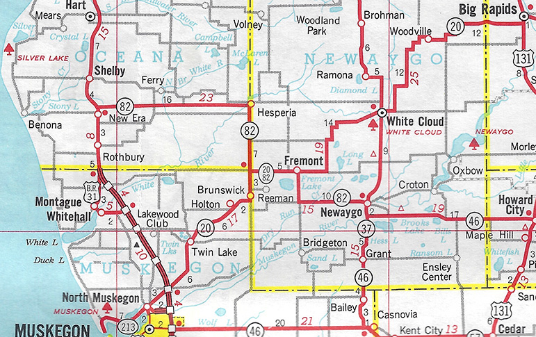
Above: 1969 Michigan Official Highway Map
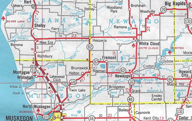
Above: 1970 Michigan Official Highway Map. Note lack of M-120 marker on M-82 between "Fremont Junction" (west of Fremont) and Hesperia as well as no M-20 markers between White Cloud and New Era.
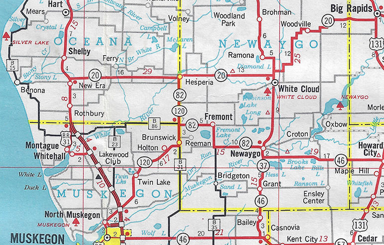
Above: 1971 Michigan Official Highway Map. Note addition of M-20 markers and M-120 marker to M-82 route south of Hesperia.
Back to: