

Lake Michigan Circle Tour
 After Lake Superior’s loosely-organized “circle route” which had been promoted by local tourist organizations since the 1960s became the first officially signed Great Lake circle tour route, the Lake Michigan Circle Tour (LMCT) was not far behind. The only single-nation Circle Tour (Lake Michigan being the only Great Lake completely within the US, of course), the LMCT also has the most mileage of any Circle Tour in the state of Michigan: 616 miles.
Working in conjunction with the Michigan Department of Transportation (MDOT), the West Michigan Tourist Association (WMTA) helped to make the first of the official Great Lakes Circle Tours a reality. On the MDOT side, Jack Morgan, assistant to the department’s deputy director, introduced the concept of a Circle Tour in 1987. Just 14 months later, agreement had been reached on a route and signs to be posted along the 1,100-mile tour completely circling Lake Michigan. The WMTA filled the need for a guidebook and when the Chicago Tribune and Milwaukee Journal ran articles in 1988 about the new Circle Tour, 150 callers from the Chicagoland area along deluged the WMTA staff the next Monday morning, requesting the guide. Two days later, 700 guidebook requests came in from Illinois and Wisconsin and the following day an additional 1,000 phone and mail requests poured in to their offices.
Present-Day Concerns and the Tri-Modal Corridor
In November 2012, the inaugural meeting of the Lake Michigan Trails Conference was convened in Saugatuck by Western Michigan University professor Dave Lembeck. Lembeck is championing both the completion of a Lake Michigan “water trail” for kayakers, canoeists and other paddlers around the lake’s entire shoreline as well as an interconnection between the water trail, the new U.S. Bicycle Route 35 (USBR-35) and the existing Lake Michigan Circle Tour. The envisioned “Tri-Modal Corridor” would accommodate non-motorized transportation and recreation via the “water trail” in the Lake and the bicycle route on land. The LMCT would help link the various bicycle trailheads and water access points together.
Unfortunately, actual signage along the Lake Michigan Circle Tour route has deteriorated over time. While Wisconsin has generally kept the Circle Tour reasonably well posted, signage in Michigan and Illinois is lacking and long segments of the LMCT in Indiana are now completely unsigned. Indeed, when the numbered highways that the Circle Tour ran along were rerouted in Northwest Indiana in recent years, the LMCT route markers were regrettably not relocated or replaced. Furthermore, highway signing standards may have changed to the point where including Circle Tour route markers alongside the other numbered highway markers on freeway signage is no longer allowed or encouraged. While hundreds of the standard Circle Tour markers are still found alongside the roadside in Michigan, some locations where the LMCT changes directions (e.g. transitions from one highway to another) are now under-signed or completely unsigned altogether. This was cited as a major concern by the attendees at the 2012 Lake Michigan Trails Conference.
Conference attendees vowed to support the ongoing efforts of the existing organizations assembling the resources necessary to complete the Lake Michigan Water Trail and the signed U.S. Bicycle Route network now underway around the periphery of the Lake. Additionally, attendees citied a need to renew coordination and oversight of the Great Lakes Circle Tour Program within the various state departments of transportation, the Ontario Ministry of Transportation and the de facto coordinating agency, the Great Lakes Commission. Several of those in attendance pledged resources and a commitment to both preserve the Circle Tour routes and look for ways to improve the coordination and signage into the future. Creating background documentation, documenting and recording the officially-adopted Circle Tour route, clarifying route signage standards and formalizing a route maintenance policy are just some of the concepts put forth in the revitalization of these important tourist routes.
Lack of Official Routing & Erroneous Information
Unfortunately, for many years, the Great Lakes Commission's own description of the LMCT was largely incorrect, both in terms of the actual route and because of numerous typos and incorrect community names. For example, for sixteen years (2001–17), the "Lake Michigan Circle Tour Road Route" section of the Commission's LMCT page (archived) gave the following highly-erroneous description of the route in Lower Peninsula:
ROUTE: Follow I-96E to Holland; US-31N to Manistee; MI-22 to Traverse City; US-31 to Petoskey; MI-119 to the town of Cross Bridge; C66 to US-31; cross the Mackinaw Bridge (toll) into the Upper Peninsula
The first major issue is to get to Holland from Indiana, one needs to first follow US-12 East (not listed) before transitioning onto I-94 East (not listed), then exit that route and follow BL I-94 and M-63 through St Joseph and Benton Harbor (not listed), transitioning then onto I-196/US-31 North (also not listed!) with a loop through downtown South Haven via BL I-196 (not listed), then back to I-196/US-31 North, before exiting onto US-31 North to reach Holland. On top of that, I-96 doesn't go to Holland at all!
From Holland to Petoskey the directions are somewhat better, although loops through downtown Muskegon, the downtowns of Whitehall and Motague, and through Pentwater via the respective BUS US-31 routings are omitted. However, from Petoskey, the LMCT has never run along M-119 and even if it did, the directions erroneously call the community of Cross Village, Cross Bridge, instead! (It's never been called Cross Bridge since its was founded in 1830!) But after omitting the connection from US-31 onto I-75 once US-31, the name of one of Michigan's most famous landmarks is misspelled: the Mackinac Bridge! If these directions are this bad—and have been since it was first reported to the Great Lakes Commission in the late 1990s (based on a previous incarnation of the erronous web page)—how could anyone trust the rest of the information?
Lake Michigan Circle Tour Route
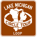
The route of the mainline LMCT in Michigan follows signed state trunkline routes in its entirety, although in some places the nearest state highway to the Lake Michigan may be several miles away. Along with the primary Circle Tour route, several marked "Lake Michigan Circle Tour Loops" have been posted using white-on-brown signs. These loops may follow state highways or utilize city streets and county roads running closer to the shoreline. These loop routes are detailed below the mainline route below:
- The LMCT enters Michigan from Indiana on US-12 south of New Buffalo and proceeds northerly through New Buffalo to I-94.
- The route leaves US-12 and continues northerly on I-94 from Exit 4 toward St Joseph.
- At Exit 23, the route exits I-94 and continues northerly into downtown St Joseph via BL I-94.
- In St Joseph, the LMCT continues northerly on M-63 into northern Berrien Co.
- At the nothern terminus of M-63, the circle tour proceeds northerly on I-196/US-31 toward South Haven.
- The route leaves I-196/US-31 at Exit 18 and loops through South Haven using BL I-196.
- On the east side of South Haven, where BL I-196 ends at I-196/US-31 Exit 20, the route continues north into Allegan Co on I-196/US-31.
- While the LMCT remains on I-196/US-31 at Saugatuck/Douglas, a locally-designated LMCT Harbor Tour loop route is signed concurrently with A-2/Blue Star Hwy between Exits 36 and 41.
- The circle tour continues northerly on US-31/BL I-196 toward Holland at Exit 44 when I-196 splits off to the east.
- After splitting from I-196 south of Holland, the route continues northerly following US-31 past Holland and through Grand Haven and toward Norton Shores.
- At the jct of US-31 & I-96, the LMCT leaves US-31 and follows BUS US-31 through downtown Muskegon.
- Northeast of downtown Muskegon, the route continues northerly via M-120 to North Muskegon and northeasterly back to US-31.
- Back on US-31, the circle tour continues northerly toward Ludington, leaving US-31 once to follow the route of BUS US-31 through the downtowns of Whitehall and Montague in northern Muskegon Co.
- At the end of the US-31 freeway near Ludington, the LMCT turns east following US-10/US-31 toward Scottville.
- At Ludington rather unique LMCT Loop Route begins, although it is currently unsigned: From US-31, the Loop route continues westerly along US-10 into downtown Ludington, then travels straight across the Lake Michigan via the S.S. Badger carferry!
- At Scottville, the circle tour turns northerly again to follow US-31 toward Manistee, although a locally-designated LMCT Loop Route formerly continued east on US-10 into downtown, then northerly via Old US-31 back to US-31 and the LMCT. (NOTE: The LMCT Loop route through Scottville was removed/decommissioned some time in late 2004 or early 2005 and no longer exists.)
- The route continues northerly from Scottville and through Manistee on US-31.
- Northeast of Manistee, the route turns northerly to follow M-22 through Onekama, Frankfort and Empire.
- Northeast of Empire, a LMCT Loop Route leaves M-22 to follow M-109 past Glen Haven, rejoining M-22 at Glen Arbor. (The mainline LMCT remains on M-22 between Empire and Glen Arbor.)
- From Glen Arbor, the circle tour continues northerly on M-22 through Leland to Northport. At Northport, M-22 and the LMCT turn nearly 180 degrees to head southerly into Traverse City.
- At Traverse City, the LMCT returns to US-31 and continues northerly via US-31 through Elk Rapids, Charlevoix and Petoskey and on toward the Mackinac Bridge.
- South of Mackinaw City, where US-31 ends, the route continues northerly on I-75 crossing the Mackinac Bridge and entering the Upper Peninsula at St Ignace. Between Mackinaw City and St Ignace, the LMCT is jointed by the Lake Huron Circle Tour.
- In St Ignace, the LMCT continues westerly along US-2 for more than 140 miles through Manistique and Gladstone to Escanaba.
- At Escanaba, the circle tour continues southwesterly via M-35 along the Green Bay shoreline to Menominee
- The route continues south on US-41 through Menominee and enters Wisconsin at Marinette.
- Continue on the Lake Michigan Circle Tour route into Wisconsin at the Wisconsin Highways website.
Note: The route included on this website has been personally
researched by the website author in the field.
Lake Michigan Circle Tour Loop Routes
 Lake
Michigan Circle Tour - Harbor Tour (Saugatuck/Douglas)
Lake
Michigan Circle Tour - Harbor Tour (Saugatuck/Douglas)
A locally-designated loop route which helps circle tour motorists navigate into and through the off-route communities of Saugatuck and Douglas in northwestern Allegan Co. While most local loops are designated as "Loop Routes" off the mainline circle tour, this particular route is actually designated as a "Harbor Tour," although it behaves like any other Loop Route. Also, as with all Loop Routes, this route is designated with white-on-brown circle tour signs, using the same LMCT "logo." The route is 7.7 miles long:
- The LMCT Harbor Tour begins at I-196/US-31/LMCT at Exit 34 near Ganges (south of Douglas).
- The Harbor Tour route proceeds easterly from the freeway along M-89/124th Ave to A-2/Blue Star Hwy.
- The route turns northerly on A-2/Blue Star Hwy into Douglas, passing just west of the downtown area.
- The loop route then crosses into Saugatuck, still via A-2/Blue Star Hwy, passing just east of the downtown.
- The route ends when it meets back up with I-196/US-31/LMCT at Exit 41 northeast of Saugatuck.
 Lake
Michigan Circle Tour - Loop Route (S.S. Badger carferry)
Lake
Michigan Circle Tour - Loop Route (S.S. Badger carferry)
While most Lake Michigan Circle Tour spur and loop routes simply involve an alternate highway routing diverging from the mainline route, this particular spur route is unique among them. On August 29, 1998, Lake Michigan Carferry's S.S. Badger which ferries automobiles, trucks and passengers between Manitowoc, Wisconsin and Ludington, Michigan was officially designated as a Lake Michigan Circle Tour spur route. The route traverses the following path:
- From the mainline Lake Michigan Circle Tour route at the western jct US-10 & US-31, the route heads westerly along US-10 into downtown Ludington, turning southerly via US-10/James St to the S.S. Badger carferry docks.
- The route then traverses Lake Michigan itself via the S.S. Badger carferry.
- From the carferry dock in Manitowoc, Wisconsin, the Loop route, following US-10, heads southerly via Lakeview Dr, westerly via Madison St and then northerly along 8th St (with eastbound US-10/LMCT Loop using 10th St) into downtown Manitowoc.
- The LMCT Loop Route ends at jct US-10 & US-151 in downtown Manitowoc.
 Former Lake
Michigan Circle Tour - Loop Route (Scottville)
Former Lake
Michigan Circle Tour - Loop Route (Scottville)
When MDOT completed a western bypass of Scottville, taking the high volume of US-31 traffic out of town, a locally-designated LMCT Loop Route was signed, acting as a de-facto Business Routing for US-31. Note, however, this LMCT Loop route was removed some time in late 2004 or early 2005 and no longer exists. The former route was 1.5 miles long:
- The LMCT Loop Route began at the jct of US-10 & US-31 on the west side of Scottville.
- The route continued easterly via US-10 into downtown Scottville.
- In downtown Scottville, the loop route turned northerly and followed Old US-31 out of Scottville.
- The LMCT Loop Route ended at US-31 north of Scottville.
Lake
Michigan Circle Tour - Loop Route (Sleeping Bear–Glen Haven)
While the Lake Michigan Circle Tour generally follows the closest posted state trunkline to its namesake body of water, the Sleeping Bear Dunes area is one exception. Instead of diverting the mainline LMCT off M-22 for only eight miles, it continues via M-22 through to Glen Arbor and on to Leland. However, as M-109 loops off M-22 to the west (lakeside) through the Sleeping Bear Dunes area, it has been designated as a LMCT Loop Route. The route is 6.8 miles long:
- The LMCT Loop Route begins at the southern jct of M-22 & M-109 just northeast of Empire and continues northerly along Dunes Hwy toward Glen Haven.
- At Glen Haven, the loop route turns east and continues on M-109/Harbor Hwy toward Glen Arbor.
- The LMCT Loop Route ends at the northern jct of M-22 & M-109 in Glen Arbor.
Back to: Great Lakes Circle Tour page.
Additional Information
- Great Lakes Circle Tour – new website from the author of MichiganHighways.org.
- Lake Michigan Circle Tour History (link broken) – from the West Michigan Tourist Association (WMTA). The WMTA helped to coordinate the first of the Great Lakes Circle Tours in the 1980s.
- Great Lakes Circle Tour – project archive from the Great Lakes Commission. It was the GLC who originally helped establishe the Great Lakes Circle Tours, however as of the early 2020s, the Commission has seemed to have abandoned the concept and no longer supports the Circle Tours in an active manner.
- Lake Michigan Circle Tour (archived) – from the Great Lakes Information Network (GLIN), which "is a partnership that provides one place online for people to find information relating to the binational Great Lakes-St. Lawrence region of North America." Please note that the "Circle Tour Road Route" description from the GLIN site was not only vague, but incorrect! (See description above.)
- Shoreline Charms (archived) – an article by Donna Marchetti about the Lake Michigan Circle Tour from the Michigan Living magazine published by AAA Michigan.