| WEST SEGMENT: |
| Western Entrance: |
Enters Michigan from Wisconsin at Ironwood along Cloverland Dr |
| Eastern Entrance: |
Enters from Wisconsin concurrently with US-141, 10.0 miles south of Crystal Falls |
| Length (Segment): |
109.147 miles |
| EAST SEGMENT: |
| Western Entrance: |
Enters from Wisconsin concurrently with US-141, 4.04 miles northwest of downtown Iron Mountain |
| Eastern Terminus: |
I-75 at Exit 344 in St. Ignace (at jct I-75 & BL I-75) |
| Length (Segment): |
195.995 miles |
| Length (Total): |
305.141 miles |
| Maps: |
Route Map of US-2 |
| |
 US-2/US-141 & M-45 Reroute Map (1931–33) US-2/US-141 & M-45 Reroute Map (1931–33) |
| Notes: |
US-2 exists in Michigan in two segments, dipping back into Wisconsin for approximately 15 miles between Crystal Falls and Iron Mountain. The western segment is nearly 100 miles long and runs from Ironwood to south of Crystal Falls, while the eastern portion is nearly twice as long at 196 miles and runs from near Iron Mountain to the route's eastern terminus at St Ignace. Interestingly, the overall national routing of US-2 also exists in two segments: From Everett, Washington to St Ignace and from Rouses Point, New York to Houlton, Maine. |
| |
Sometime in the early 1990s, MDOT began erecting milemarkers along this western segment of US-2. Smaller than the standard Interstate highway-type milemarkers, these new markers were posted on one side of the pavement between Ironwood and the US-41 junction at Powers. No other non-freeway milemarking was evident in any other portion of the Upper Peninsula. Then in c.2014–15, MDOT erected milemarkers along the eastern segment of US-2 westerly from St Ignace to the Mackinac/Schoolcraft Co line east of Blaney Park. However, unlike the milemarkers on the western segment which begin at the western entrance of US-2 from Wisconsin at Ironwood and increase as you travel easterly, the ones on the eastern segment begin at the eastern end of US-2 in St Ignace and increase as you head west, ending at Mile 62 near the Schoolcraft Co line! (The convention for milemarking in the U.S. is to begin at zero at the western and southern ends of routes and increase as you head easterly or northerly.) Reversing this decision in 2017, MDOT removed the Mackinac Co reverse milemarkers erected just a couple years prior and replaced them with new milemarkers using the cumulative distance along US-2 from Ironwood. Just east of what had been posted as Mile 1, one mile west of I-75 at St Ignace, is now posted as Mile 319, with the mileage from Ironwood including the approximately 15 miles that US-2 spends in Wisconsin between Crystal Falls and Iron Mountain. Similarly, during 2017, milemarkers were erected along M-28 parallel to US-2 to the north. |
| |
Starting in 1978 and then with increased earnestness starting in 1986 and throughout much of the 1990s, a bypass around the City of Iron Mountain and other alternatives for US-2 & US-141 was discussed and studied at length. See the Iron Mountain Bypass (1978-1999) article on the In Depth portion of this website for the story on how the bypass never came to be. |
| |
 In October 1982, the Reflective Systems Unit of MDOT began reviewing the state trunkline sytem and "discovered a substantial number of dual and some triple routing on both the free access and limited access system." The result of which was forwarded to "the Trunkline Numbering Committee in an attempt to reduce as much of this unnecessary routing as possible in an attempt to avoid driver confusion and save funds." (Although, at this point, US-2 and I-75 had been concurrent for 25 years with no known reports of "driver confusion.") That December, the MDOT Transportation Planning unit proposed to eliminate "US-2 Signing from St. Ignace to Sault Ste. Marie." In March 1983, the Supervising Engineer of the Reflective Safety Unit replied "The District Traffic and Safety Engineer, Paul Michelin, and we concur that US-2 could terminate at St. Ignace. We recommend that the department contact AASHTO and proceed to remove US-2 along I-75." The department then submitted its request to the AASHTO Route Number Subcommittee in May, stating: In October 1982, the Reflective Systems Unit of MDOT began reviewing the state trunkline sytem and "discovered a substantial number of dual and some triple routing on both the free access and limited access system." The result of which was forwarded to "the Trunkline Numbering Committee in an attempt to reduce as much of this unnecessary routing as possible in an attempt to avoid driver confusion and save funds." (Although, at this point, US-2 and I-75 had been concurrent for 25 years with no known reports of "driver confusion.") That December, the MDOT Transportation Planning unit proposed to eliminate "US-2 Signing from St. Ignace to Sault Ste. Marie." In March 1983, the Supervising Engineer of the Reflective Safety Unit replied "The District Traffic and Safety Engineer, Paul Michelin, and we concur that US-2 could terminate at St. Ignace. We recommend that the department contact AASHTO and proceed to remove US-2 along I-75." The department then submitted its request to the AASHTO Route Number Subcommittee in May, stating:
The US-2 markers dual with the I-75 designation along the 52 miles section between Sault Ste. Marie and St. Ignace. The dual signing makes it difficult to provide clear signing guidance to motorists and increases the cost of signing along this section of I-75. The I-75 signing is adequate as it provides for a continuous route between Florida and Canada at Sault Ste. Marie. The US-2 signing is interrupted at the international boundary for an extensive length (over 300 miles) making it impossible for motorists to follow the route through Canada. A more appropriate terminus point for US-2 is at I-75 near St. Ignace because of the extensive interruption in signing of US-2 through Canada and the dualling of US-2 with I-75 from St. Ignace to Sault Ste. Marie.
However, at their June 20, 1983 meeting in Fairfield Bay, Arkansas, the Route Numbering Subcommittee "withheld action" on the truncation of US-2 to St Ignace, "pending communication with the Ontario Ministry of Transportation and Communications to determine if this action will have any impact on their system." While the actual distance from Sault Ste Marie to the terminus of the eastern segment of US-2 in Rouses Point, New York is 656 miles, the "over 300 miles" may be referencing the AASHTO policy of eliminating existing US Highway Routes "less than three hundred miles in length... located wholly in one State," although this wouldn't seem to apply here as US-2 exists in 11 states and has never been signed through Ontario and Québec (either as provincial Highway 2 or with "TO US-2" signage). Additionally, the eastern segment of US-2 (New York to Maine) does not begin at the international boundary.
One could assume the AASHTO Route Numbering Subcommittee received assurance from Ontario that truncating US-2 would not cause any issues with their route numbering (which, at the time, would've been routes 17B, 17, A-40, A-640, A-20, and A-15) because MDOT's request was then approved at their October 1, 1983 annual meeting in Denver, Colorado. The US-2 route markers along I-75 from St Ignace to Sault Ste Marie were likely removed soon after. |
| |
Approximately 15½ miles of US-2 in Iron Co, from Iron River to Crystal Falls, were designated as a Historic Heritage Route in 2000 as the Iron County Heritage Route. While the officially-designated Historic Heritage Trail is the 16 miles of US-2 from Crystal Falls to Iron River, the "Iron County Heritage Trail" itself is "composed of a 36 mile loop connecting 14 premier sites that provide visitors the opportunity to discover the historic and recreation resources of Iron County." The loop continues south from the Heritage Route's western end in Iron River via M-189, then turns east via CR-424 through Caspian, Gaastra and Alpha, before returning to Crystal Falls via US-2/US-141. Thus, the Iron County Historic Heritage Route is only a portion of the overall Iron County Heritage Trail. |
| |
In "State Trunkline Needs, 1960–1980," a set of maps prepared by the State Highway Dept's Office of Planning, Programming Division in 1960 showing possible additions, upgrades and improvements to the state trunkline system over the ensuing twenty years, MSHD staff recommended several major upgrades to the route of US-2 during that timeframe. They included:
- Upgrading the existing route of US-2 from the eastern limits of Ironwood through Bessemer to jct M-28 in downtown Wakefield to a four-lane, divided highway. Only a portion of the segment was divided (between Ironwood and the west side of Bessemer), but that was converted to an undivided five-lane cross-section with a continuous left-turn lane decades later.
- Realigning US-2 onto new highway alignment from Gogebic Station to Watersmeet with the former route being turned back to local control. This realignment was completed soon after, in 1965.
- Upgrading the existing route of US-2 from the east side of Iron River to the western jct of US-2 & US-141 just west of Crystal Falls to a four-lane, divided highway. This project was never implemented.
- Upgrading the existing route of US-2 to a four-lane divided highway from the Wisconsin state line northwest of Iron Mountain to the northern limits of Iron Mountain; from the eastern limits of Iron Mountain through Quinnesec to the western limits of Norway; from the eastern limits of Norway past Loretto, Waucedah, and Hermansville to the north edge of Powers; from the eastern limits of Powers to the western limits of Escanaba. Only the portion between Iron Mountain and Norway was ever upgraded and this segment was later converted to a five-lane undivided cross-section with a continuous left-turn lane.
- Construction of a US-2/M-35 freeway beginning at the existing route of US-2/US-41 on the western limits of Escanaba and heading northerly and northeasterly past Gladstone to US-41 (which would've been redesignated as M-35 under the plans) about two miles north of Rapid River, approximately 1–2 miles west of the existing alignment. A proposed BUS US-2/BUS M-35 routing was proposed along the exisitng route from Escanaba north to Gladstone, then westerly along existing M-35 to an interchange with the proposed freeway on the west edge of Gladstone. The M-35 routing from Gladstone into Marquette Co was to have been redesignated as M-41 with M-35 continuing along the proposed US-2 freeway to Rapid River. Where M-35 was proposed to depart this proposed freeway at existing US-41 north of Rapid River, a new M-69 routing on all new alignment was also proposed to meet, running just north of due west from that location into northern Menominee Co. A somewhat scaled back version of this proposal was implemented, with a new alignment expressway segment (no private driveways, but access via at-grade intersections) being built from the south side of Gladstone to the north side of Gladstone in 1963 and from there northerly to Rapid River opening in 1971. The remainder of the Escanaba bypass was never realized, nor was the rerouting of M-35 designation and the designation of the new M-41 between Gladstone and Negaunee.
- Construction of a new alignment US-2 freeway heading east from north of Rapid RIver, running almost due east approximately 3–4 miles north of the existing route. The proposed US-2 freeway would have interchanged with M-149 just south of Indian Lake State Park before turning northeasterly to an interchange with M-94 (and a proposed BUS US-2 route) on the northwest corner of Manistique. The freeway would bypass Manistique to the north, meet the other end of the proposed BUS US-2 route at Co Rd 433, then take off almost due northeasterly before starting to curve back toward the east in the Blaney Park area, interchanging with M-77 immediately north of the existing US-2 junction. The proposed US-2 freeway would then have run due easterly within less than a mile of the existing route of US-2 past Engadine and Naubinway, gently curving to the southeast to remain roughly parallel to the existing route and the Lake Michigan shoreline. From Brevort, the freeway would have run due southeasterly into St Ignace, ending at an interchange with I-75 in the area of the existing Portage St exit (Exit 345). The entire route of the existing US-2 between Rapid River and St Ignace was to have been turned back to local control, with a short exception on the east side of Manistique (even though most of the proposed BUS US-2 at Manistique would have followed a route other than the existing US-2). Obviously, none of this proposal ever saw the light of day.
|
History
At-A-Glance
: |
A comprehensive and detailed history of US-2 appears after this section below. The major historical milestones of US-2 include:
- May 2, 1927 – US-2 officially debuts with the erection of temporary route markers over top of existing route markers. US-2 replaces the vast majority of M-12 across the Upper Peninsula. Permanent US-2 signs will be in place by midsummer.
- June 26, 1931 – Starting in 1928, a new route for US-2/US-41 between Escanaba and Gladstone is constructed in stages with the final portion opening June 26, 1931.
- October 1930 – US-2 is realigned closer to the Lake Michigan shoreline from Manistique easterly for nearly four miles.
- July 22, 1931 – US-2A/US-41A designated through Escanaba and Wells.
- August 31, 1931 – US-2/US-41 is realigned to the south side of the C&NW Ry tracks between Powers and Narenta.
- September 1931 – A bypass of Vulcan and West Vulcan east of Norway is completed.
- November 2, 1932 – US-2 is rerouted between Sault Ste Marie and the Straits area onto a more direct, 10 mile shorter alignment via Mackinac Trl through Kinross and Rudyard.
- July—August 1933 – The first two sections of realigned US-2 open southeast of Wakefield and west of Iron River. It will take over 30 years to complete the segments in between.
- October 1, mid-December 1933 – The approach leading to the new interstate bridge at Ironwood is completed (the bridge was finished in 1932) on October 1, with US-2 now bypasses downtown Ironwood. The former route becomes US-2A mid-December.
- January 7, 1935 – US-2A/US-41A are decomissioned at Escanaba and Wells.
- July 3, 1935 – The bridge spanning the Michigan Northern Power Co canal in Sault Ste Marie is dedicated.
- July 1936 – The new shoreline route for US-2 from Manistique through Thompson to Cooks is opened to traffic.
- October 11, 1936, June 1937 – Most of the Lake Michigan shoreline route from Brevort to St Ignace is opened to traffic in October 1936, except the Cut River Bridge portion and the last 4.7 miles into St Ignace. The final 4.7 miles at St Ignace are opened in June 1937.
- August 14, 1937 – Additional segments of relocated and modernized US-2 east and west of Marenisco are completed and opened to traffic.
- August 1, 1938 – The bypass of Hermansville is completed and opened to traffic.
- Fall 1938 – A major realignment is completed between Gulliver and Blaney Park.
- October 26, 1939 – The modernized route into Wakefield from the southeast is completed.
- May 3, 1940 – A stretch of US-2/US-141/M-95 in Iron Mountain collapses into the Chapin Mine pit.
- October 15, 1940 – A 26 mile stretch of new highway from Gould City through Naubinway to Epoufette is completed as another step in bringing US-2 closer to Lake Michigan.
- November 1940 – A major 17.8-mile realignment from west of Watermeet in Gogebic Co to Golden Lake in Iron Co is completed, as is a realignment from Crystal Falls south into Wisconsin at the Brule River bridge.
- August–Sept 1941 – A new Brule River bridge into Wisconsin opens south of Crystal Falls.
- April 19, 1941 – Construction on the Cut River Bridge in Mackinac Co begins.
- August 10–15, 1942 – M-54 through downtown Ironwood is redesignated as BUS US-2.
- August 15, 1948 – The magnificent Cut River Bridge is finally opened to traffic.
- October 1, 1949 – US-2 between Bessemer and Wakefield is realigned and modernized.
- March 16, 1956 – A bill to add US-2 to the Interstate highway system is introduced into the U.S. Congress, although it would not become law.
- November 13, 1957 – The first segment of the US-2 freeway is open from Castle Rock north of St Ignace to M-123.
- August 1957–Mid 1958 – During this time, the State Highway Dept plans to extend US-27 north of the Mackinac Bridge to replace US-2 between St Ignace and Sault Ste Marie. Those plans are reversed and it will be US-2 that is co-signed with I-75 on that stretch.
- November 12, 1960 – The I-75/US-2 freeway is opened between US-2 at the north end of the Mackinac Bridge approach, bypassing St Ignace to the Castle Rock interchange. Former US-2 through downtown St Ignace is redesignated as BL I-75.
- October 30, 1962 – A 2.2-mile long expressway bypass of downtown Gladstone opens.
- October 31, 1962 – The International Bridge at Sault Ste Marie is opened to traffic including a 3-mile segment of I-75/US-2 freeway leading to the new bridge. Former US-2 into downtown Sault Ste Marie is redesignated as BS I-75.
- December 5, 1962 – A 6-mile segment of I-75/US-2 freeway opens from Tone Rd at Kinross to existing US-2/Mackinac Trl near Dafter.
- July 23, 1963 – An additional 4-miles of I-75/US-2 freeway opens from M-48 at Rudyard northeasterly to Tone Rd at Kinross.
- November 1, 1963 – The last two segments of I-75/US-2 freeway in the U.P. opens from M-123 north of St Ignace to M-48 at Rudyard and from Mackinac Trl near Dafter to Three Mile Rd at Sault Ste Marie. The St Ignace-to-Soo freeway is now completely open.
- August 26, 1965 – The final section modernized and relocated highway between Bessemer and Iron River, the 16-mile portion from Gogebic Station to Watersmeet, opens.
- November 22, 1971 – The 6-mile US-2/US-41 expressway from Glastone to Rapid River opens to traffic.
- 1981 – A new US-2/US-141 interstate bridge spanning the Menominee River north of Iron Mountain is completed and opened to traffic, replacing the 1934 bridge.
- June 20–October 1, 1983 – After MDOT staffers propose removing the concurrent US-2 designation from I-75 between Sault Ste Marie and St Ignace, with US-2 then ending at St Ignace, AASHTO first withholds approval then later approves the request and, after being co-siged with I-75 for 25 years, the easternmost 51.7 miles of US-2 are lopped off.
- November 1, 1984 – A new US-2 Manistique River bridge at Manistique is completed and opened to traffic, bypassing the historic Siphon Bridge.
|
| History: |
Please Note: Prior to the debut of the U.S. Highway System in Michigan in 1927, the vast majority of the route of US-2 in the state superseded what had been designated M-12 from 1913–27. For the history of what became US-2 prior to 1927, please see the Former M-12 Route Listing. |
| |
1927 (May 2) – The fourteen year history of the route of M-12 comes to an end when crews begin replacing its route markers with US-2 signs along most of its length, with the exception of a section in Iron and Dickinson Cos. From the Wisconsin state line at Ironwood easterly through Gogebic Co and most of Iron Co to Crystal Falls, M-12 is supplanted by US-2. From Crystal Falls easterly to M-45 at Sagola in Dickinson Co, however, M-12 is redesignated as M-69 and from Sagola southerly to the Twin Falls Bridge north of Iron Mountain, it becomes a southerly extension of M-45. This is because US-2 is routed into Wisconsin for a short stretch through Florence and Spread Eagle before re-entering Michigan at the Twin Falls Bridge. (Interestingly, the M-69 designation which had run from Covington southerly through Crystal Falls to the Wisconsin state line becomes US-102 north of Crystal Falls and part of US-2 south of Crystal Falls, with the M-69 route markers simply re-used along the former M-12 between Crystal Falls and Sagola.) From the Twin Falls Bridge near Iron Mountain, the M-12 signs again yield to the new US-2 markers for the remainder of the route through Norway, Escanaba, Gladstone, Manistique, Engadine, Rexton, Moran, and Pickford, to its eastern terminus at the international ferry dock in downtown Sault Ste Marie. |
| |
1927 (June 30) – The first official trunkline route change along US-2 in Michigan actually deals with a roadway which was never built. A one-mile segment of what had been established as part of M-12 in eastern Schoolcraft Co yet never constructed is cancelled as a state trunkline route. The cancelled route starts at the southern 45° bend in Lang Rd and continues due northerly for ½ mile, makes a 90° turn to the east, running for another ½ mile to the northern 45° bend in Lang Rd, all southwest of Blaney Park. The existing 0.8-mile roadway (Land Rg) marked-and-maintained as US-2 between the two 45° bends is officially established as a state trunkline route. |
| |
1927 (July 27) – An additional 2.0 miles of US-2 is officially established as a state trunkline highway in Sault Ste Marie along Ashmun Ave from the present-day jct of BS I-75 & M-129 northerly into downtown at Water St, then easterly via Water St from Ashmun St for 2½ blocks to the international ferry terminal and the eastern terminus for US-2 [West Segment].
|
| |
1927 (Sept 21) – The 5.0-mile segment of US-2 in eastern Mackinac Co running along Three Mile Rd from St Ignace Rd northerly, then via Rockview Rd easterly to the hamlet of Rockview at Meridian Rd (present-day M-129) is cancelled as a state trunkline route. It's replacement, a 3.0-mile unbuilt route heading due easterly from the end of St Ignace Rd at Three Mile Rd to Meridian Rd where US-2 would turn north along Meridian Rd (established as a spur from M-12 in September 1925 then designated M-5 in May 1927) back to its former route at Rockview. However, since the three-mile east-west segment of roadway does not yet exist, the five-mile cancelled route via Three Mile and Rockview Rds remains a "marked-and-maintained" trunkline route as US-2. |
| |
1928 (Jan 4) – A new 3.5-mile alignment for US-2 in southeast Dickinson Co is established from Loretto at Hamilton Lake Rd–State St then east-southeasterly via present-day US-2 back to the former route approximately 900 ft west of Waucedah Rd near Waucedah. The 3.8-mile former route via Kellerman Rd from Loretto southeasterly then easterly (much of which has since been abandoned and/or obliterated as a public roads since) to Old US-2, then east-northeasterly along a present-day abandoned roadway to relocated US-2 near Waucedah is cancelled and turned back to local control. |
| |
1928 (Mar 8) – A new alignment for US-2/US-41 as it enters Escanaba from the west is established as a state trunkline along its present-day route from 13.75 Rd near the Ford River bridge then easterly along a new highway into the city, then continuing easterly on Ludington Ave to the existing route at Stephenson Ave, for a total of 5.9 miles. The former 6.8-mile route along 13.75 Rd from near the Ford River easterly into Escanaba, continuing via 8th Ave S, jogging north on S 19th St, then easterly again along 8th Ave St, turning northerly via S 14th St to Ludington St is cancelled as a trunkline and turned back to local control. The newly-constructed highway segment likely is completed and opens to traffic by the end of the construction season. |
| |
1928—1931 – From 1928 to mid-1931, a new route for US-2/US-41 between Escanaba and Gladstone in Delta Co is constructed in stages with trunkline establishment and cancellations taking place along the way as well:
- 1928 (May 2) – A new 3.1-mile trunkline route for US-2/US-41 is established along Lincoln Rd (N 23rd St) from the existing route at Ludington Ave northerly to 14th Ave N, although the new highway has not yet been completed. Simultaneously, the 0.7-mile portion of the route along Stephenson Ave from Ludington Ave north to Washington Ave at Sheridan Rd is cancelled as a trunkline route, but remains signed as a "marked-and-maintained" route.
- 1928 (Fall) – A new concrete highway is completed (and opened to local traffic) from existing US-2/US-41/Ludington Ave northerly along Lincoln Rd (N 23rd St) to approximately 14th Ave N by the Upper Peninusla State Fairgrounds. The state highways remain signed on their existing routes for now.
- 1929 (Aug 26) – The remaining 3.4 miles of the new alignment for US-2/US-41 between Escanaba and Gladstone is established from 14th Ave N in Escanaba northerly to the existing route (present-day Co Rd 517/P Rd). The 3.5-mile stretch of the existing route on Sheridan Rd from the Chicago & North Western Ry crossing (present-day 17th Ave N) in Escanaba northerly to the north city limit, then northerly along Co Rd 426/N 3rd St, northeasterly into Wells on Main St, northerly again along N 1st St, crossing the Escanaba River on the Bay Shore Road Bridge, continuing northerly Co Rd 517/P Rd to the new alignment of US-2/US-41 is cancelled as a state trunkline route as well. However, work on the new highway continues and the former route remains a "marked-and-maintained" route. A failure of the Bonney Falls Dam and the resulting flood damages a central pier in the not-yet-completed Escanaba River bridge on the new highway, necessitating removal and rebuilding of the pier, delaying completion of the new highway.
- 1931 (June 26) – With the completion of a storm drain to carry rainwater from the new highway under the C&NW Ry underpass in north Escanaba and the final concrete paving completed, the new US-2/US-41 route between Escanaba and Gladstone is finally opened to traffic. (It has been the established route for 10 months.) The former route, which had been cancelled and transferred to local control in 1928 and 1929 is re-established and signed as US-2A/US-41A with M-35 likely remaining concurrently designated along that route for now.
|
| |
1928 (June 13) – A new angling 1.0-mile alignment for US-2 in Chippewa Co's Bruce Twp (east of Dafter) is established along present-day M-129 from approximately ⅓ mile north of 10 Mile Rd to immediately north of 9 Mile Rd, removing two 90° turns from the route. The former 1.3-mile route along Meridian & 9 Mile Rds is cancelled and turned back to county control. |
| |
1928 (Jul 25) – The 0.73-mile segment of US-2 established in Ironwood a little more then two years prior via Lake St from Cloverland Dr south to McLeod Ave, then westerly along Douglas Ave to approximately Day St is cancelled as a trunkline route. Replacing it is a 0.4-mile route along Douglas Blvd fom Cloverland Dr south to Frederick St. (This would mean that the yet-to-be-established portion of Cloverland Dr from Lake St westerly to Douglas Blvd is apparently a "marked-and-maintained" route for US-2.) |
| |
1929 (July 13), 1930 (early Oct) – Although it won't be completed and opened to traffic for another 15 months, a new lakeshore routing for US-2 from downtown Manistique eastery for 3.92 miles is officially established as a state trunkline route on July 13, 1929. The new route begins at the cnr of Elk & Maple Sts in downtown Manistique and runs south on Maple St four blocks, then southeasterly along Arbutus Ave and continues along the Lake Michigan shoreline to a point on the existing route just east of the Soo Line Railroad (present-day Canadian National Ry) at Walters Rd. At the same time, the existing 2.7-mile portion of US-2 between the same two points is cancelled as a trunkline route, but remains as a "marked-and-maintained" route until the new roadway is finished. Then in early October 1930, the new roadway is opened to traffic and maintenance on the former route, along Maple & Elm Sts in the city and Co Rd 439/Tannery Rd outside the city, ceases. The total project cost is $130,000. |
| |
1929 (Sept 6) – A new alignment for US-2 in central Mackinac Co north of Rogers Park (about 6½ miles north of St Ignace) shaves ½ mile from its route. The new 2.9-mile route is established along present-day H-63/Mackinac Trl between Ackland and Gorman Rds, while the former 3.4-mile route via Ackland and Gorman Rds (plus a present-day abandoned stretch directly connecting between the two roads) is cancelled as a state trunkline route. The new roadway, however, is not likely completed and opened to traffic until sometime in 1930. |
| |
1929 (Dec 10)—1930 (Late) – The State Highway Dept begins the process of realigning US-2 between Sault Ste Marie and the Straits area onto a more direct, much shorter alignment via Kinross and Rudyard (saving more than ten miles from the existing route via Pickford). On December 10, 1929, the first 4.276-mile segment of the route in Chippewa Co from the so-called "Pine River Turn" on M-28 (at 6 Mile Rd near the Pine River Cemetery about six miles south of downtown Sault Ste Marie) then south-southwesterly via present-day H-63/Mackinac Trail to 10 Mile Rd east of Dafter is established as a state trunkline route. Nearly a year later in Late 1930, that segment of highway is completed and opened to local traffic, although US-2 remains signed on its existing route via Pickford until the remainder of the highway is completed. |
| |
1931 (Jan 12) – The first segment of the planned direct route for US-2 between St Ignace and Sault Ste Marie (via Rudyard and Kinross) is established as a state trunkline route in Mackinac Co, from present-day M-134 northeasterly to the Chippewa Co line. The new roadway, however, won't be completed and opened to traffic for nearly two years from this point, however, and US-2 remains signed along its existing route via Pickford. |
| |
1931 (mid-Jan) – While the officially established route for US-2/US-41/M-35 through Gladstone enters the city from the north via N 9th St, jogs west for one block along Wisconsin Ave, then turns southerly again along 10th St (Central Ave), the city commission requested the route be changed for the signed trunkline route to contine southerly along 9th St for two additional blocks before using Dakota Ave to lateral over to 10th St (Central Ave), then head southerly again from there. The State Highway Dept agrees to the proposal and route markers are changed to indicate the new route, even though the established route does not change. (Actual trunkline route mileage remains unchanged.) |
| |
1931 (May ___) – The 1.3-mile portion of Cloverland Dr in the City of Ironwood is officially established as a state trunkline route from Lake St westerly to Broadway–Superior Sts as part of US-2. Interestingly, this same section had been established as a trunkline in 1923, but was cancelled a year later, but is now re-established. |
| |
1931 (May 6) – The remainder of the new St Ignace-to-Sault Ste Marie route for US-2 (via Rudyard and Kinross) is established as a state trunkline route, even though contruction on the new alignment is not yet complete. The new 15.674 portion is in Chippewa Co in two segments: From the Mackinac Co line north for 2.989 miles to M-48 about 2½ miles south of Rudyard, where US-2 will then continue northerly along existing M-48 to Rudyard where the second 12.685-mile segment is established between Rudyard and 10 Mile Rd near Dafter via Kinross. With the new highway not yet complete, US-2 remains signed along its existing route via Pickford. |
| |
1931 (July 22) – While the new US-2/US-41 "bypass" of Escanaba and Wells in Delta Co opened to traffic on June 26, just 3½ weeks later, most of the former route of US-2 and US-41 which had been cancelled in 1928–29 is re-established as a trunkline route. Specifically, the 4.8-mile segment from Ludington St in Escanaba northerly along Stephenson Ave, then northeasterly and northerly via Sheridan Rd to the north city limit, continuing northerly via 3rd St, then Main St and 1st St through Wells, across the Escanaba River and northerly via present-day Co Rd 517/P Rd back to the relcoated US-2/US-41 route three miles south of Gladstone. (This route also still seems to be used by M-35 as well for now.) The newly re-established route is designated as US-2A and, possibly, as US-41A as well. The six block, 0.4-mile stretch of Ludington St from 23rd St (present-day Lincoln Rd) easterly to Stephenson St in downtown Escanaba was not re-established, however, and seems to be a "marked-and-maintained" route as part of the new US-2A/US-41A. |
| |
1931 (Aug 31) – Two changes are officially made to the route of US-2 in the central U.P. in Dickinson, Menominee and Delta Cos:
- Iron Mountain Area/New Menominee RIver Bridge: A planned replacement for the 1909 Twin Falls Bridge on the state line over the Menominee River between Iron Mountain and Spread Eagle, Wisconsin is paired with a new highway alignment for US-2/US-141 between the north side of Iron Mountain and the new bridge, in conjuction with a new highway alignment for M-45 (present-day M-95) from Iron Mountain northerly to Randville. The 12.3-mile new M-45 route north from Iron Mountain, the first 2.6 miles of which also includes US-2/US-141, is established, although not yet complete at this point. The 12.7-mile former route remains "marked-and-maintained" until the new highway is completed. Additionally, neither the new Menominee River span nor the ¾-mile US-2/US-141 approach roadway from M-45 to the new bridge is established as a state trunkline route yet. (See US-2/US-141 & M-45 Reroute (1931–33) map.)
- Menominee/Delta Co Reroute: The original route for T.L.12 and T.L.15 (later M-12 and M-15, now US-2 and US-41) between Powers/Spalding in northern Menominee Co easterly via Wilson into Delta Co, through Bark River to M-69 near Narenta follows the north side of the Chicago & North Western Ry where it then crossed to the south side from there into Escanaba. The majority of the route on the north side of the railroad, the 11.6-mile stretch from Co Rd 563 at Dougherty easterly into Delta Co, is cancelled with a new 11.4-mile route paralleling the south side of the C&NW tracks between those same two points officially established as a state trunkline route. Unlike the Dickinson Co changes (noted above), this project is completed and opened to traffic at the same time as the corresponding trunkline cancellation/establishment process.
|
| |
1931 (Sept) – A new 2¾ mile long bypass of the communities of Vulcan and West Vulcan in south-central Dickinson Co is completed and opened to traffic. The new route removes through traffic from the convoluted route through the center of Vulcan along Main St with several turns and running past a large school. Oddly, the new route is not officially established as a state trunkline route and the former route remains and unsigned trunkline route for now. The new bypass is part of a 3.3-mile concrete paving job from the east limits of Norway to Loretto and costs $124,000 to complete. |
| |
1932 (Oct 29) – Two more changes are officially made to the route of US-2 in the central U.P. in Menominee and Delta Cos:
- Powers/Spalding Reroute: The remainder of the "Menominee/Delta Co Reroute" noted above is made official in the communities of Spalding and Powers in north-central Menominee Co. The existing 2.1-mile route of US-2/US-41 is cancelled from Co Rd 563 westerly along present-day Old US-2&41, Ashland St (through Spalding where US-2 departs US-41) and Main St (into Powers) is cancelled and turned back to local control. A new 1.8-mile route is established from Co Rd 563 westerly on the south side of the Chicago & North Western Ry tracks bypassing Spalding to a new jct with US-2, then continuing southwesterly into Powers. Of the new 1.8-mile route, approximately 1½ miles belong to both US-2 and US-41, while the remainder is just US-41. All but 1,100 feet (0.208 mile) is completed and opened to traffic, with the remainding short segment left to settle over the winter before being paved and opened to traffic. US-2 traffic is routed through Spalding via a temporary route until a new C&NW Ry underpass is completed between Spalding and Powers.
- Eastern Delta Co Adjustment: When initially established as part of T.L. 12 in early January 1914, two sections of the route near Garden Corners and Cooks (in neighboring Schoolcraft Co) ran along either yet-to-be-constructed roadway or extremely primitive roads not suitable for trunkline use. The first section along the Correction Line from northwest of Garden Corners due easterly approximately two miles was cancelled as a trunkline route in 1928 and replaced by present-day US-2 between those points. Now, a shorter 0.7-mile segment at the Delta/Schoolcraft Co line is cancelled, replaced by a 0.9-mile route via the actual marked-and-maintained route (green line on the map below).

|
| |
1932 (Nov 1) – The new interstate bridge between Wisconsin and Michigan spanning the Montreal River in the northwest corner of Ironwood is completed and work is proceeding on the approach from the Wisconsin side of the river. Construction on the $10,653 bridge began in September with costs shared equally between the two states. Unfortunately, work on the extension of Cloverland Dr, the route of US-2 through Ironwood, westerly to the new bridge has not yet begun. |
| |
1932 (Nov 2) – A major realignment for US-2 between the Straits of Mackinac and Sault Ste Marie is completed and opened to trafffic, shaving 11 miles from the route of US-2. Formerly, US-2 headed northerly from Rogers Park (north of St Ignace), then easterly toward the Les Cheneaux Islands area along present-day M-134 and St Ignace, 3 Mile and Rockview Rds, then northerly via present-day M-129 to Sault Ste. Marie. The entrire former route of US-2 is redesignated as M-121. The new alignment (via present-day H-63/Mackinac Trl) through Rudyard and Kinross was established as a trunkline in three segments between December 1929 and May 1931. |
| |
1933 (Feb 15) – Exactly 0.5 mile of new alignment state trunkline highway is officially established as part of the planned US-2 connection between existing Cloverland Dr from Superior St westerly to the Montreal River bridge leading into Wisconsin. Construction on the short segment of new highway will not begin until later in the year. |
| |
1933 (Feb 15, July 12) – In the first project to modernize and relocate the majority of US-2 between Wakefield and Watersmeet in Gogebic Co—which would ultimately take thirty years to complete!—begins with two official actions during the year:
- February 15: A new 3.419-mile section of highway is officially established beginning at present-day Old US-2 approximately 4½ miles southeast of downtown Wakefield and continuing to an intersection with present-day Great Lakes Rd/Dunham Rd. While the new highway is established, it is likely not yet complete or open to traffic and the existing route remains on the trunkline system for now.
- July 12: The new route, noted above, is likely completed and opened to traffic, with the former 4.2-mile route along Great Lakes Rd/Old US-2 being cancelled as state trunkline and turned back to county control.
|
| |
1933 (Mar 14, July 12, Aug 12) – On March 14, a new, more direct 6.117-mile long alignment for US-2 between Beachwood and Gibbs City Rd just west of Iron Mountain in Iron Co is officially established as a state trunkline route, although work on the new route is not yet complete. Four months later on July 12, the former 7.3-mile route along Beechwood Store Rd from the new relocation easterly to Beechwood, then southeasterly via Amvets Hwy to Gibbs City Rd, then south on Gibbs City Rd to the relocated route is cancelled as a state trunkline route, but remains a "marked-and-maintained" route signed as US-2 for one more month. Then, on August 12, the new, shorter alignment of US-2 is completed and opened to traffic, with maintenance on the former (marked-and-maintained) route ceasing. |
| |
1933 (Mar 20, July 12)—1934 – The 0.781-mile long approach roadway leading from the new route of M-45 (present-day M-95) north of Iron Mountain westerly to the new interstate bridge spanning the Menominee River is officially established as a state trunkline route on March 20, although the new highway segment and the bridge are not yet complete and open to traffic. Then on July 12, the former 0.4-mile route of US-2/US-141 from the former M-45 route (which had been cancelled in August 1931) westerly to the Twin Falls Bridge over the Menominee is cancelled as a trunkline route and turned back to county control. The new bridge and approach roadway likely open to traffic at this point. (Some historical sources indicate the new US-2/US-141 Menominee River span leading into Wisconsin is completed and opened in 1934, however, although this may be when the Wisconsin approach roadway is fully completed.) The opening of the new bridge and the cancellation of the former route completes a multi-year project to completely realign US-2/US-141 and M-45 (present-day M-95) from Iron Mountain, northerly. (See US-2/US-141 & M-45 Reroute (1931–33) map.) |
| |
1933 (Oct 1, mid-Dec) – The ½ mile of new concrete joining the new interstate bridge spanning the Montreal River between Ironwood and Hurley, Wisconsin to the existing segment of Cloverland Dr in Ironwood is finally completed and the US-2 "bypass" of downtown Ironwood and Hurley is opened to traffic on October 1 nearly a year after the bridge itself was completed. This segment of highway had been established as a state trunkline route 6½ months earlier. Then in mid-December, the former route of US-2 through Ironwood—having been bypassed by the westerly extension of Cloverland Dr to the new bridge into Wisconsin 2½ months prior—is signed with a new trunkline designation: US-2A. |
| |
1935 (Jan 7) – A pair of changes to the route (or former route) of US-2:
- The 4.8-mile route of US-2A/US-41A from Escanaba northerly through Wells to US-2/US-41/M-35 south of Gladstone is cancelled as a state trunkline route and turned back to local control. US-2A/US-41A is the former route of US-2/US-41 through Escanaba and Wells.
- As part of a major effort to locate (or relocate) state highways closer to Great Lakes shorelines around the state, US-2 in Mackinac Co heading west from St Ignace is earmarked as one such route. The first 29.6-mile segment from the existing route at Hiawatha Trl northeast of Gould City then easterly through Naubinway and Epougette to Worth Rd just northwest of Brevort is officially established as a state trunkline route, atlhough it will be a half-decade before most of it is completed and opened to traffic. Meanwhile, the existing route of US-2 via Engadine, Garnet and Rexton remains the established and signed route.
|
| |
1935 (June) – The US-45 route designation debuts in Michigan, running just 60 miles to the west of the existing M-45, so state highway officials wisely decide to give M-45 a new designation to minimize confusion and M-95 takes over the route of the original M-45. The concurrent US-2/US-141/M-45 stretch from Iron Mountain northerly therefore becomes US-2/US-141/M-95.
|
| |
1935 (July 3) – The $160,000 US-2 bridge spanning the Michigan Northern Power Co canal in Sault Ste Marie is dedicated by State Highway Commissioner Murray D. Van Wagoner and opened to traffic after being under construction for 11 months. Several engineering challenges caused some difficulty in constructing the bridge, including hitting bedrock just 30 feet below the level of the water in the canal. |
| |
1935 (Oct 22) – The 2.9-mile stretch of US-2 from a point approximately 1½ mile east of downtown Rapid River, then southeasterly along Y Rd (present-day Co Rd 509) and southerly via W.5 Rd at a point 1¾ miles west of Ensign is cancelled as a state trunkline route, while the new relocation of US-2 between those same points is established as a trunkline and likely opens to traffic at this point. The relocation removes several sharp turns from the route as well as uses a grade separation over the Minneapolis, St. Paul & Sault Ste Marie Ry line which it formerly crossed at-grade. |
| |
1935 (Oct 28) – Two of the three segments of the relocated US-2 route between easternmost Delta Co southwest of Cooks and Manistique via the hamlet of Thompson are established as state trunkline routes: First, a 9.017-mile from exisitng US-2 southwest of Cooks (nearly a mile west of the Delta/Schoolcraft Co line) easterly to Thompson is established as a trunkline route. Second, a 2.567-mile segment from existing US-2/Deer St on the west side of Manistique southerly and southwesterly to the Stony Point area (at approximately present-day Stony Point Dr) is also established. Both segments are also likely completed and opened to local traffic at this time. However, neither segment is signed as part of US-2 until the middle portion is completed, which remains along its existing route (present-day Co Rd 442). |
| |
1936 (Feb 6) – Another section of the future Lake Michigan shoreline routing of US-2 in Mackinac Co, a 10.123-mile segment from the Brevoort River (between Brevort and Pointe Aux Chenes) southeasterly along the shore to Pointe la Barbe Rd in the West Moran Bay area west of St Ignace, is officially established. The segments immediately to the west and east of this one, however, have not yet been established. |
| |
1936 (Feb 20) – A pair of changes to US-2, one each in Iron and Dickinson Co:
- Iron Co: A 1.5-mile long winding loop to the north in central Iron Co from immediately west of Pentoga Tr then bending northwesterly before turning back southwesterly, passing Oss Rd to a point approximately 0.35 mile west of Oss Rd is bypassed by a new, straight 1.2-mile route between those same points which is officially established as a trunkline route. The former route is cancelled and largely abandoned as a public roadway.
- Dickinson Co: The former route of US-2 from a point 650 ft (0.12 mile) east of the Norway east city limit then easterly through West Vulcan and Vulcan along Main St to a point ⅓ mile west of the Sturgeon River bridge is cancelled as a state trunkline route. This section of the route was bypassed by a new US-2 alignment 4½ years earlier, but the new highway was not established as a state trunkline route (for some reason) nor was the former route through Vulcan and West Vulcan cancelled. While that cancellation has now taken place, the "new" bypass route still remains a "marked-and-maintained" route for reasons not yet apparent.
|
| |
1936 (early July, Dec 9) – The final 2.959-mile long stretch of the new US-2 relocation between Cooks and Manistique in Schoolcraft Co is completed and opened to traffic by Early July from Thompson northeasterly toward South Manistique. The relocated highway has opened in stages over the past two years, but mainline US-2 has continued to be signed over its existing "inland" route past Indian Lake and through the hamlet of Cooks until this final segment is completed. The final 2.959-mile segment from Thompson northeasterly along the Lake Michigan shoreline is finally officially established as a state trunkline route on December 9. Existing US-2 between eastern Delta Co just west of Cooks and Manistique remains a state trunkline highway route, however, and it's unclear when the US-2 route markers are moved to the newly-constructed route and how long the former route remains signed as US-2. In addition, the enterity of M-125 (connecting former US-2 with the Thompson State Fish Hatchery) is redesignated as part of M-149 while the 1.35-mile long county roadway from the southern end of M-125 at the fish hatchery southerly to a jct with relocated US-2 in "downtown" Thompson is now "marked-and-maintained" as part of M-149, although a formal establishment for that portion of the route has not yet happened. (M-149 was formerly just a spur route northerly from the former US-2 route to Palms Book State Park.) |
| |
1936 (Oct 11) – The section of the new shoreline route for US-2 in Mackinac Co from Brevort southeasterly to the West Moran Bay area (at the first intersection with Pointe La Barbe Rd) is opened to traffic, especially hunters streaming into the Upper Peninsula for the annual deer hunting season, even though the final 4.7 miles of the route into St Ignace it not yet completed. A temporary signed detour for US-2 traffic is signed along local roads for the next tear. The existing route of US-2 from Brevort easterly along Worth Rd then along Tahquamenon Trl has its route markers removed at this point, but officially remains a trunkline under state jurisdiction. |
| |
1937 (Aug 30) – The project to upgrade and modernize US-2 between Wakefield and Watersmeet advances with the following actions:
- A 5.53-mile segment of relocated US-2 is established from Old US-2/Great Lakes Rd-Dunham Rd (approximately 8 miles southeast of downtown Wakefield) then southeasterly and easterly back to Dunham Rd just northwest of Marenisco, while the existing 6.6-mile section of the route along Dunham Rd between those same points is cancelled as a trunkline route.
- Another 5.691-mile section is established from Dunham Rd just northwest of Marenisco then easterly and southeasterly to the cnr of CC Rd approximately 5.6 miles east of Marenisco on August 30 having opened to traffic two weeks prior on August 14. At the same time, the 2.5-mile portion of the former US-2/M-64 route from Fair Ave in Marenisco easterly and northeasterly to relocated US-2 northeast of town as well as a 2.6-mile segment along CC Rd from M-64 (4½ miles northeast of Marenisco) southeasterly to relocated US-2 about 5½ miles east of Marenisco are both cancelled as trunkline routes and turned back to county control.
- A third, shorter, 0.79-mile "bypass" of the locale of Gogebic Station ten miles east of Marenisco is established with the "loop" through locale being cancelled as a state trunkline route. Additionally, other shorter realignments, including at the Slate River bridge and approximately ¾ mile southeast of Slate River, help "smooth out" the route in the area.
|
| |
1937 (Aug 30) – A new curving street is constructed in Gladstone connecting Lake Shore Dr from its terminus at Central Ave (9th St) arcing northerly to the beginning of 10th St as it heads north into downtown. The new section of roadway plus the four blocks of 10th St (totaling 0.377 mile) is established as the new route for US-2/US-41/M-35, while the former 0.43-mile established route along Central Ave (9th St) from Lake Shore Dr to Wisconsin Ave, then east one block to 10th St is cancelled as a state trunkline route and turned back to city control. Since January 1931, the signed route for US-2/US-41/M-35 has jogged easterly from Central/9th via Dakota Ave then northerly on 10th to Wisconsin based on a request by the city council for better traffic management. The one block of Dakota Ave was only a marked-and-maintained route, and maintenance of that block also ceases at this point. |
| |
1937 (Aug 30) – The route of US-2 undergoes a improvement in alignment and modernization in three locations in eastern Delta Co:
- A new 2.193-mile section of highway is established from the Ogontz River easterly to approximately 800 ft east of EE.25 Rd at St Jacques (bypassing that hamlet), while the former 2.33-mile route between those same points along a new abandoned/obliterated roadway north of the relocated highway as well as along Main St through St Jacques is cancelled as a trunkline route.
- Approximately 4½ miles to the east, a second new alignment route for US-2 is established beginning at 24th Rd near Moss Lake and continuing northeasterly 2.13 miles to Co Rd 495/LL Rd at Isabella. The former 2.7-mile route along 24th Rd and LL Rd between those two points is cancelled and turned back to county control.
- Then one mile east of there, a third new alignment segment for US-2 is established beginning at OO.25 Rd (approximately 0.38 mile west of Fishdam River bridge) and continuing southeasterly along the shore of Big Bay de Noc for 2.6 miles to Garden Corners. The former 3.4-mile route along OO.25 Rd between those same points is cancelled and turned back to county control.
|
| |
1937 (Aug 30) – While the new, more southerly alignment of US-2 between the Cooks area and Manistique in southwest Schoolcraft Co has been open to traffic since early August 1936 (and was officially established as a trunkline route in segments over the previous two years), the former route of US-2 along present-day Co Rd 442 has remained a state trunkline route. Not only are 13.1 miles of that route now cancelled as a trunkline route (with the exception of the portion to be redesignated as part of M-149) and turned back to local control, but the 1.35-mile long county roadway from the southern end of the former M-125 at the Thompson State Fish Hatchery southerly to relocated US-2 in "downtown" Thompson is also officially established as a state trunkline highway and transferred from county to state jurisdiction. |
| |
1937 (June, Aug 30, Dec 29) – The final 4.7-mile segment in the shoreline realignment of US-2 between Brevort and St Ignace is completed and opened to traffic in June. The remaining 15½ miles of the new alignment had been opened to traffic on October 11, 1936 in time for the throngs of hunters heading into the U.P. for the annual deer hunting season, with traffic on the easternmost portion of the route detoured along local roads to make the connection with the newly-opened highway. This final segment runs from the westernmost Pointe la Barbe Rd into downtown St Ignace. With the entirety of the new US-2 lakeshore realignment now open to traffic, the former route from Brevort easterly via Worth Rd then southeasterly through Moran and Allenville via Tahquamenon Trl to Rogers Park is cancelled as a trunkline on August 30 and turned back to county control. Oddly, the westernmost and easternmost portions of this new lakeshore routing are not established as state trunkline routes until December 29. At that point, the 8.739-mile portion from Worth Rd at Brevort to the Brevort River bridge and the 4.663-mile section opened in June just west of St Ignace are officially assumed into the trunkline system. With the new route from the west bringing US-2 into St Ignace via Brevort and past Gros Cap, it then supplants the US-31 designation northward to Rogers Park where it meets its former route. While it could be assumed US-31 is removed from the U.P. and truncated back to the State Highway Ferry Docks in Mackinaw City at this point, official State Highway Dept maps will continue to show US-2 and US-31 running northerly from St Ignace concurrently to Rogers Park through 1939, where the US-31 designation appears to simply end while US-2 continues northerly toward Sault Ste Marie. One could speculate why the State Highway Dept didn't remove the US-31 symbol from the UP portion of the route until 1939, but it may have also been a cartographic error as well. (Also see June 3, 1940 historical entry below.) |
| |
1937 (Dec 29) – A 4.069-mile segment of the relocation for US-2 southeast from Wakefield in central Gogebic Co is officially established as a state trunkline route, although the remainder of the new highway through Wakefield is not yet established or complete and open to traffic. Until that time, the existing route of US-2 along Sunday Lake St and Charles St remains the signed and established route for US-2 leaving Wakefield to the southeast heading toward Marenisco and Watersmeet. |
| |
1937 (Dec 29) – A 6.4-mile section of US-2 in northwest Menominee Co is cancelled as a state trunkline route, being replaced by a new, more direct route. The cancelled segment begins at a point 0.4 mile northwest of the hamlet of Cunard then runs southerly into Cunard, then east via 43 Rd, south along Vega Rd, southeasterly via 3rd St through downtown Hermansville, then east on 41 Rd to the Meyer/Spalding Twp line (1.4 miles east of Hermansville). The new alignment between those same points is not yet officially established as a state trunkline and does not open to traffic at this point, "due to the abnormal fall of rain." The cancelled route remains a "marked-and-maintained" highway for the time being. |
| |
1937 (Dec 29) – The two segments of the new US-2 shoreline route between Brevort and St Ignace which were not yet established—it opened to traffic in late 1936 and June 1937—are officially assumed into the trunkline system. The first section is the 8.739-mile stretch from Worth Rd near Brevort southeasterly to the Brevort River bridge, while the second section is the 4.577-mile segment from the westernmost intersection with Pointe la Barbe Rd west of St Ignace easterly to State St on the south side of downtown St Ignace. (The middle section between the Brevort River bridge and Pointe la Barbe Rd was established in February 1936.) |
| |
1938 (Aug 1, Dec 6) – The new 5.563-mile long realignment for US-2 in northern Menominee Co between a point 0.4 mile northwest of the hamlet of Cunard then southeasterly bypassing Hermansville to the Meyer/Spalding Twp line (1.4 miles east of Hermansville) is completed and opened to traffic on August 1. The completion of the new highway segment had been delayed "due to the abnormal fall of rain" in 1937. This section of highway is officially established as a state trunkline about four months later on December 6 (the former route had been cancelled nearly a year earlier). |
| |
1938 (Dec 6) – As a step toward the eventual realignment of US-2 approaching Wakefield in central Gogebic Co from the southeast, the exisitng 4.5-mile segment of US-2 from Sunday Lake Rd easterly and southeasterly along Charles St and present-day Old US-2 to the relocation of US-2 at Jackson Creek is cancelled as a state trunkline route, even though the new alignment has not yet been established or completed and opened to traffic. The existing route remains a "marked-and-maintained" route for the time being. |
| |
1938 (Dec 6) – A new 8.504-mile realignment of US-2 in southeast Schoolcraft Co between White Dale (present-day Gulliver) and Blaney Corners, which removes three 90° corners and two 45° turns as well as shaves more than two miles from the route, is established as a state trunkline route and likely opened to traffic earlier in the fall. The 9.2-mile long former route (which excepts the 1.2-mile overlap of the former route with the new route between Van Atta and Lang Rds) along Co Rd 432, Co Rd 433, Van Atta Rd and Lang Rd is cancelled and turned back to county control. |
| |
1939 (July 13, Oct 26) – The final section of relocated US-2 heading southeasterly from downtown Wakefield is finally established as a state trunkline route on July 13 when Putnam St from Ascherman St easterly four blocks, then turning southeasterly for two additional blocks on a new alignment to Lahti St the western end of a segment established in late December 1937. The roadway itself is completed and opened to traffic at a ribbon-cutting ceremony (including bands, a parade and a banquet at the Community Center) more than three months later on October 26. At that point, the 4.5-mile former route along Charles St and present-day Old US-2 from Sunday Lake St southeasterly to the relocated route, which had been cancelled as a trunkline route the previous December and becomes a "marked-and-maintained" route, has its signs removed and maintenance ceases, reverting completley to local control. |
| |
1940 (May 3) – An 85-foot section of US-2/US-141/M-95 north of downtown Iron Mountain gives way and falls into an abandoned mine pit which had already collapsed once in history, in 1900. Four cars and one truck fall into the approximately 90-foot deep hole and all drivers are able to run to safety with no fatalities, although the truck driver is hoisted to the surface with the help of a rope. The State Highway Dept admits it has known about issues at the site for at least six months and has been "apprehensive" about the water level rising in the abandoned Chapin Mine pit. The water-filled pit, measuring 300 ft in length and 150 ft in width, also swallows the tracks of the parallel Chicago, Milwaukee & St. Paul and Chicago & Northwestern railroads, severely disrupting train schedules in the area. Both the highway and railroad lines reportedly "required constant maintenance" due to the subsidence in the pit area which was caused when the water pumps were switched off when the Chapin Mine was shut down in 1935.
Work on the highway in the mine area was first proposed in February 1940, but progress was complicated by the fact the 0.1-mile segment of US-2/US-141/M-95 from Fourth St southerly to north of Kent St had never been officially established as a state trunkline route and was, in fact, only an easement across land still owned by the Chapin Mine owners. (The portions of the highway north and south of the mine had been established in March 1921 as part of M-12.) As such, the City of Iron Mountain would first need to obtain title to the property over which the roadway runs, dedicate it as a city street, and then transfer jurisdiction of that street to the state to be established as a trunkline route. |
| |
1940 (June 3) – The U.S. Route Numbering Subcommittee of the American Association of State Highway Officials (AASHO) approves a request from the State Highway Dept to officially truncate the route of US-31 back to the State Highway Dept Ferry Docks in Mackinaw City, due to the realignment of US-2 in the Straits region in 1936–38. This may explain the reason why many publicly-issued State Highway Dept maps continued to show US-31 running concurrently with US-2 between St Ignace and Rogers Park for a few years after US-2 supposedly supplants that route in the U.P. |
| |
1940 (Oct 15, Nov 12) – Although the shoreline alignment for US-2 between Gould City and Epoufette by way of Naubinway in western Mackinac Co was officially established as a state trunkline route in January 1935, it takes the State Highway Dept almost six years to complete (most of) the project. A 26¼-mile stretch of the new highway from the existing route at Hiawatha Trl northeast of Gould City easterly through Naubinway back to Hiawatha Trl at Epoufette is completed and opened to traffic on October 15. (The 4¾-mile segment of proposed US-2 from Hiawatha Trl southeasterly across the Cut River, including a new high-level Cut River Bridge, is not yet complete, although construction on the new span will begin soon. Traffic remains routed along Cut River Rd through that stretch for the time being.) With the new US-2 route completed, the 17.3-mile former route along Hiawatha Trail from near Gould City through Engadine to M-48/Borgstrom Rd west of Garnet is turned cancelled as a state trunkline on November 12 and turned back to county control. The north-south portion of the former US-2 route along Hiawatha Trail from M-48 at Caffey Corner (east of Rexton) to Epoufette is given a new state trunkline designation as M-117. In between, the formerly concurrent US-2/M-48 segment along Hiawatha Trail between Garnet and Caffey Corner retains just the M-48 designation. The entirety of the new segment of US-2 is paved, with the paving portion of the project alone coming to $300,000, and the new alignment route saves nine miles over the former route. |
| |
1940 (Nov 1, Nov 12) – A new 17.815-mile section of new highway for US-2 is opened to traffic by November 1 from approximately 1½ miles west of downtown Watersmeet, bypassing that community to the south, and continuing directly into Iron Co where it ties back into the existing route at Golden Lake (at the present-day jct of US-2 & FFH-16). This major project not only shaves 4.7 miles from the distance between Watersmeet and Iron River, it removes several sharp turns, a winding alignment, and one at-grade railroad crossing from the route of US-2 but, most importantly, it completes the hard-surfacing of the entirety of US-2 across the entire Upper Peninsula. Less than two weeks later on November 12, the new route is officially established as a state trunkline, while 22.3 miles of the former route are cancelled as a state trunkline highway route—an approximately 1.2 mile section from the beginning of the Watersmeet bypass easterly along present-day Old US-2 to US-45 in Watersmeet and a 21.1-mile stretch of present day Old US-2 and Federal Forest Hwy 16 (FFH-16) from US-45/Crozier St Watersmeet easterly into Iron Co, then southerly to the Golden Lake area where it meets the new US-2 route. |
| |
1940 (Nov 2) – The route of US-2 in Schoolcraft Co east of Manistique is moderized and straightened in two segments between Manistique and Gulliver (White Dale), removing several 90° turns and winding stretches of roadway:
- Heading east from Manistique, the first newly-established section is the 2.135 miles from Duck Inn Rd (approximately five miles east of downtown Manistique) northeasterly to Gardapee Rd. The former 2.5-mile long section along Duck Inn Rd and Gardapee Rd is cancelled as a trunkline and turned back to county control.
- The second segment established is the 1.118-mile portion from Pawley Rd (8 miles east of downtown Manistique) then northeasterly to Howard Rd. The former 1.3-mile route along Pawley Rd and Howard Rd is cancelled and turned back to county control.
|
| |
1940 (Nov 12) – A newly-constructed alignment for US-2/US-141 south of Crystal Falls is established as a state trunkline route and likely opens to traffic about this same time. The new 7.017-mile route begins at present-day Co Rd 424 just east of Alpha and continues southeasterly and southerly directly to the former route at Stager Lake Rd just north of the Brule River and the Wisconsin state line. The former 8.0-mile route along Co Rd 424 from the relocated highway southwesterly, then southerly along Stager Lake Rd through Mastodon and Stager to the new US-2/US-141 route is cancelled as a trunkline and turned back to county control. The new Brule River bridge being constructed as part of the relocation project 40 feet upstream from the existing span, however, is not yet complete, forcing traffic to continue using the older, existing bridge for the time being. |
| |
1940 (Nov 12) – The 0.1-mile segment of US-2/US-141/M-95 in the center of Iron Mountain which had never been established as a state trunkline highway when the portions to the north and south were in 1921 (see May 3, 1940 note above) is officially assumed into the system, from Fourth St southerly to north of Kent St. While it has been signed as part of the routes which traversed it, it had always been an easement across the Chapin Mine property. Now, as an official trunkline route under state jurisdiction, permanent repairs can be completed. |
| |
1941 (Aug–Sept) – The new 165-foot long Brule River bridge on relocated US-2/US-141 south of Crystal Falls, which had not been completed the previous year when the rest of the realigned roadway was opened to traffic, is stated in media reports in August as being complete and open to traffic, but the Wisconsin approach to the new bridge is not yet complete. By September, however, news reports state the bridge is now "complete." The former bridge just downstream is then later removed. |
| |
1941 (Apr 19) – Construction begins on the steel superstructure of the Cut River Bridge, spanning the Cut River Gorge in central Mackinac Co east of Epoufette. The Cut River Bridge is the final link in the realignment of US-2 along the Lake Michigan shore from Gould City to St Ignace, begun in 1936 and will reportedly be the "highest highway bridge in Michigan" when complete. Further construction on the bridge and its approaches is halted by World War II. During the halt in construction during the war, US-2 traffic is maintained on Cut River Rd. |
| |
1941 (Nov 10) – Subsidence due to the collapse of mine shafts at the Penn (Vulcan) Mine in Vulcan has been causing the pavement on a ¼ mile section of the US-2 "Vulcan Bypass" to slowly sink since 1937, causing major maintenance issues fro State Highway Dept crews. The subsidence during 1941, however, is greater and ocurring at a faster rate, so the State Highway Dept chooses to close US-2 at Vulcan and route traffic back through the center of the community via the former route (Main St) which had been bypassed a decade earlier while a permanenet fix is being engineered. |
| |
1948 – The M-28 designation is extended northerly along US-2 from its eastern terminus to end in Sault Ste. Marie. |
| |
1942 (Jan 28, Aug) – A project to straighten the route of US-2 through the Fortune Lakes area and replace a hazardous narrow bridge on a reverse curve in Iron Co west of Crystal Falls results in the establishment on January 28 of a new 1.477-mile route from a point 3¼ miles west of downtown Crystal Falls then westerly through the Fortune Lakes to a point 0.35 mile east of Long Lake Rd. Simultaneously, the 1.5-mile former route is cancelled as a trunkline route, part of which is subsumed by the new alignment with much of the rest being turned back to county control as Resort Dr. Construction continues into the summer, however, and the new bridge and highway section is completed and opened to traffic in August. (The "hazardous narrow" bridge on the former US-2 alignment remains open to serve local residents until it was closed to vehicular traffic in c.2021–22.)
|
| |
1942 (Mid) – By mid 1942, M-28 is extended westerly along US-2 from Wakefield into Ironwood, bringing M-28 to the Wisconsin state line. |
| |
1942 (Aug 10–15, 17) – The route of M-54 in Ironwood, which begins at US-2/M-28/Cloverland Dr & Douglas Blvd and continues southerly 7½ blocks to Frederick St, southwesterly one block via Frederick to Suffolk St, southeasterly 2 blocks along Suffolk to Aurora St, then southwesterly 4 blocks to a point approximately 125 feet beyond Albany St where it terminates, is redesignated in its entirety as BUS US-2, with new route markers replacing the existing M-54 signs August 10–15. Additionally, the remaining 0.3 mile of Aurora St from the previous end of M-54 to Silver St and Silver St westerly the Montreal River on the Wisconsin state line is established as a state trunkline route on August 17 and added to the BUS US-2 route. The new bi-state business route is craeted after an agreement with Wisconsin highway officials results in a completion of the loop from US-2 into downtown Hurley, then northerly back to US-2 via US-51. The former US-2A had only been designated as M-54 for approximately three years! |
| |
1942 (Aug 17) – The 2.96-mile segment of US-2 through the Vulcan–West Vulcan area east of Norway in Dickinson Co is established as a state trunkline route, even though it has been signed and maintained as part of US-2 for years. The section runs from immediately west of the Chicago & North Western Ry crossing on the east side of Norway easterly via the "Vulcan–West Vulcan bypass" to ⅓ mile west of hte Sturgeon River bridge (west of Loretto). The reason for the establishment relates to the final repairs are made to the ½ mile stretch of US-2 which has been experiencing subsidence issues at the Penn Mine at Vulcan (east of Norway in Dickinson Co) since 1937. (The former route for US-2 which the "bypass" replaced had been cancelled and turned back to county control in February 1936, even though it later served as the temporary detour route when US-2 itself was closed due to the mine subsidence.) |
| |
1948 (Aug 15) – The magnificent Cut River Bridge finally opens to traffic with the completion of the bridge deck and approach roadways. The ribbon-cutting ceremony is incorporated into a three-day celebration in St Ignace commemorating the 25th anniversary of the State Highway Ferry service at the Straits of Mackinac. More than a million pounds of steel and 2,400 cubic yards of concrete used in building the bridge, which cost over $762,000 to construct. While construction on the span began in spring of 1941, wartime material and labor shortages necessitated a delay in its completion. Once structural steel and manpower became available at the conclusion of World War II, work on the bridge resumed and the structure was largely complete during the 1947 construction season, the approaches to the bridge weren't complete, so opening the route across the span needed to wait an additional 10–11 months. (Official Michigan State Highway Dept documents do not list an establishment date for the 4.802-mile segment of highway which includes the Cut River Bridge. While it could be assumed this stretch was part of the trunkline estabished between Hiawatha Trl near Gould City and Worth Rd near Brevort in January 1935, the temporary US-2 route along Cut River Rd will be cancelled late in 1949, implying that was the established routing from 1935... unless Cut River Rd was never established or if those records aren't currently available.)
Upon its opening, the former route of US-2 via Cut River Rd is retained as an unsigned trunkline route for now. The Cut River Rd route had been descirbed as "a crooked blacktop" where "several accidents have resulted from the bad alignment." Indeed, at least two fatalities were recored at the Cut River Rd bridge over its namesake waterway during the time the main span was being constructed.
|
| |
1949 (Sept 23) – Effective September 23, 1949, the vast majority of US-2 was designated as the "United Spanish War Veterans' Memorial Highway." Specifically, Act 104 of 1949 designated US-2 from Sault Ste Marie to Iron Mountain, M-95 from Iron Mountain to Sagola, M-69 from Sagola to Crystal Falls and US-2 again from Crystal Falls to Ironwood as a memorial to those who fought in the Spanish-American War. |
| |
1949 (Oct 1, Nov 7) – The new US-2/M-28 alignment between downtown Wakefield and a point two miles east of downtown Bessemer (½ mile east of the Bessemer east city limit) is completed and opened to traffic on October 1. Grading work on the new route began prior to World War II but, like many other non-critical highway projects, further progress was delayed by the war effort. The pavement on the former route through Ramsay is reportedly "the oldest piece of concrete pavement in the county." The new alignment also eliminates the several curves, turns, and hills of the old route as well as removes it from several residential and active iron mining areas. The 3.728-mile new highway, which includes four bridges and gentle curves, is established as a trunkline route a little more than a month later on November 7 and the western 1.6 miles of the former route—the portion from the Wakefield west city limit northwesterly through Ramsay to the relocated route—is cancelled and turned back to county control, while the segment of former US-2/M-28 in the City of Wakefield is retained as an unsigned trunkline for the time being. |
| |
1949 (Nov 7) – A short, new 0.996-mile alignment for US-2/US-41 on the north side of Gladstone is completed and opened to traffic, cutting across a small inlet on Little Bay de Noc via landfill shortening the route by 0.2 mile. The new alignment runs along present-day N 9th St from Court St northerly, continuing via Lake Shore Dr to Buckeye Ave. The former route along Buckeye Ave southwesterly to Bay Dr is turned back to local control. It is assumed the portion from Bay Dr southerly parallelling the Soo Line Railroad to 9th St at Court St is also turned back to local control and remains open, although this portion of roadway would be abandoned and partially obliterated by the construction of the US-2/US-41 expressway between Gladstone and Rapid City in a little over a decade. |
| |
1949 (Nov 10) – A pair of projects in Iron Co realign US-2 to remove sharp turns and modernize the route are established and likely open to traffic at this time:
- In Iron River, a new 1.174-mile alignment is established from Lalley Rd northeasterly to West Ice Lake Rd, while the former 1.2-mile route along Lalley Rd from relocated US-2 to West Ice Lake Rd then northerly along West Ice Lake Rd to the end of the relocated segment is cancelled and turned back to local control. The new alignment replaces three turns in the route to one long gradual curve.
- A second 1.247-mile long realignment approximately 4¼ miles east of downtown Iron River is established, beginning at Chicagon Mine Rd continuing due easterly to Thunander Rd removing four turns from the route. The former 1.3-mile route along Chicagon Mine Rd and present-day Old US-2 is cancelled and turned back to county control.
|
| |
1949 (Nov 10) – The former (temporary) route of US-2 around the Cut River Bridge area in western Mackinac Co between Epoufette and Brevort, which has been an unsigned trunkline route since the new span opened to traffic the previous August, is cancelled as a trunkline route and turned back to local cotrol. |
| |
1950 (Mar 19) – Act 144 of 1950, effective March 19, 1950, officially designates US-2/US-41/M-35 "from the north city limits of the city of Escanaba running north 1.1 miles to the junction of county road number 426, also known as the extension of Sheridan Avenue" as the "Amvets Memorial Drive". |
| |
1950 – After just two years co-signed with US-2 into downtown Sault Ste Marie, M-28 was scaled back to its pre-1948 terminus at US-2, removing the concurrent designation. |
| |
1952 – The concurrent M-28 designation from Wakefield to Ironwood is removed from US-2 when M-28 is extended south from Wakefield along a new route to the Wisconsin state line. |
| |
1952 (Sept 18) – Effective September 18, 1952, the portion of US-2 running from St Ignace to Sault Ste Marie was designated as part of the "Blue Star Memorial Highway," in addition to the entire route of US-31 in the Lower Peninsula from Niles to Mackinaw City. Act 71 of 1952 made the designation official. |
| |
1953 (June 5) – A 0.919-mile section of realigned US-2 is officially established at Norway, beginning at Railroad Ave on the east side of town and continuing easterly, bypassing the Hanbury Heights area to the former route at E Seventh St just east of the Norway east city limit. The former 0.94-mile route along Seventh Ave is cancelled as a trunkline and the portion within the City of Norway is turned back to city control, while the 275 ft outside of the city is no longer a publicly-maintained roadway (however, it remains utilized as the eastern end of Seventh St, even though no public road agnecy has jurisdiction over or maintains it). |
| |
1953 (June 16) – The 2.5-mile portion of the former route of US-2/M-28 within the City of Wakefield from the west city limit easterly to Sunday Lake Rd (now a new southerly extension of M-28) which was bypassed by the new section of US-2 westerly from Wakefield in 1949 is finally cancelled and turned back to city control. It had been an unsigned trunkline for 3½ years. The portion of the former US-2/M-28 route west of Wakefield through Ramsay had been cancelled and turned back to county control in November 1949. |
| |
1957–58 – A second grade separation is constructed to take the Chicago & North Western Ry over top of a short segment of divided highway along US-2 on the west side of Norway in Dickinson Co. The existing overpass over exisitng US-2 was widened and upgraded in 1954. The second overpass is constructed just to the east of the existing one to accommodate new westbound lanes for US-2, while the exisitng route and overpass (1954) are now for eastbound US-2 traffic. |
| |
1956 (Mar 16) – A bill to add US-2 to the Interstate highway system is introduced into the U.S. Congress, although it would not be destined to become law. |
| |
1957 (Nov 1) – The brand-new Mackinac Straits Bridge is opened to traffic along with its approach roadways and including an interchange with US-2 in St Ignace adjacent to Straits Stae Park. |
| |
1957 (Nov 13) – A 3.8-mile long segment of new freeway is completed and opened to traffic from existing US-2/Mackinac Tr from immediately north of Castle Rock in the St Ignace area to the existing route of M-123 at Rogers Park, all in Mackinac Co. While the new segment of highway does not feature any interchanges along its short alignment, it is built along the proposed route of the future I-75 running between St Ignace and Sault Ste Marie, but is signed as US-2 for now. Interestingly, this segment of highway and all of the future I-75 route through Mackinac Co will not be officially established as a state trunkline route for another five years! |
| |
1957 (Aug 21) – The Michigan State Highway Dept officially anounces the US-27 designation will be the one that graces the Mackinac Bridge between the Lower and Upper Peninsulas when it opens later in the year. Also announced are plans, already approved by state and federal transportation officials, to extend US-27 from St Ignace northerly along the new freeway being constructed in the US-2 corridor to a new terminus at Sault Ste Marie. Essentially, US-27 is to replace US-2 between the Straits and the Soo. |
| |
1958 (Mid) – By mid-1958, the State Highway Dept's plans to extend the US-27 designation from St Ignace northerly along the new freeway being constructed between there and Sault Ste Marie is abandoned. US-27 was to have replaced US-2 between the Straits and the Soo, but internal department maps show the new plan is to transfer US-2 onto the new freeway segments as they are completed with the I-75 designation joining it on the route as well. |
| |
1960 (Nov 12) – A 4.1-mile long segment of the I-75/US-2 freeway at St Ignace in Mackinac Co is completed and opened to traffic, beginning at the US-2 interchange at the northern end of the Mackinac Bridge approach (opened in 1957) and continuing northerly through a new interchange for BL I-75 north of St Ignace and merging into the existing segment of freeway that was completed and opened to traffic in November 1957. The project cost $4 million to complete. Most of the existing route of US-2 through downtown St Ignace is redesignated as BL I-75, while the portion of former US-2 along Mackinac Tr from BL I-75 northerly to the former connection to the 1957 freeway segment remains an unsigned state trunkline highway for four more days. |
| |
1961 (Nov 16) – The 4.6 miles of the former route of US-2 along Mackinac Tr from BL I-75 (formerly US-2) at Evergreen Shores north of Saint Ignace northerly to the intersection with the (slightly) relocated M-123 at Rogers Park in Mackinac Co is turned back to local control, four years after most of this segment had been bypassed by a new segment of US-2 freeway (later I-75/US-2, now just I-75). (One MDOT right-of-way map, however, shows that former US-2 along Mackinac Tr in the area of M-123 was turned back to county control on December 12, 1960, although that may be an error.) |
| |
1962 (Sept 10, Oct 20) – A 2.205-mile long limited-access expressway (no private driveway access, but featuring intersections at select crossroads) bypass of the downtown area of Gladstone for US-2/US-41/M-35 is officially established as a state trunkline route on September 10. The new route runs from Lake Shore Dr southwest of downtown Gladstone to a point just north of jct M-35/4th Ave to the north where it merges back with the former route at the intersection of present-day Rains Dr. The 2.405-mile former route of US-2/US-41/M-35 through downtown Gladstone via Lake Shore Dr and 9th St—as well as the one block (0.1 mile) of former M-35 along 4th Ave from 9th St to the new bypass—is cancelled as a trunkline route but remains a "marked-and-maintained" route for 40 days. At that point, the new $1.1 million bypass is opened to traffic on October 30 and maintenance on the former route through downtown ceases and returns to city control. The limited access expressway project was initially supposed to have continued on through from Gladstone to Rapid River, however protests from motel and other tourist-oriented business owners along the existing highway caused the State Highway Dept to shelve the plans for the project north of Gladstone initially, even though 40% of the right-of-way for the new expressway alignment have been acquired at this point, mostly on the southern end of the Gladstone-Rapid River segment. |
| |
1962 (Oct 31, Nov 5) – The new International Bridge linking the twin Sault Ste Maries of Michigan and Ontario and crossing the St Marys River/Soo Locks is completed and the three miles of I-75/US-2 freeway heading southerly away from the bridge to Three Mile Rd is also opened to traffic on October 31. The former route of US-2 into downtown Sault Ste Marie is redesignated as BS I-75, with ½ mile of Three Mile Rd between the new freeway interchange and existing US-2/Mackinac Trl now signed as a US-2 connector between the two routes. Official establishment of the northermost 2.931 miles of the I-75/US-2 freeway occurs on November 5, as does the establishment of the 0.506-mile section of Three Mile Rd between the freeway and Mackinac Trl. (State Highway Dept jurisdiction on the new International Bridge technically ends on the southern shoreline of the St Marys River, as the new bridge is under the jurisdiction of a separate authority, much like the Mackinac Bridge is. At this same time, the eastermnost 0.4 mile of US-2 along Ashmun St between Portage Ave and Water St and easterly 2½ blocks via Water St to the International Ferry Dock is cancelled as a state trunkline and tranferred to city control. (The new BS I-75 terminates where Ashmun St meets Portage Ave.) |
| |
1962 (Nov 15) – "Modernization" of the four miles of US-2 from Wemple St in Ironwood easterly to the Bessemer west city limit also results in the establishment of a new 0.65-mile long realignment for US-2 from Gheller Dr (east of Oak Ln) to an eastern intersection with Gheller Dr (just west of CR-511/Puritan Rd-Powderhorn Rd) as well as a new five-lane bridge over Powder Mill Creek at the Bessemer city limit. The total cost for the two projects is $1.05 million and the State Highway Dept announces mine waste will be used for fill material and embankments as it is readily available in the Ironwood area, it is cheaper and is better than dirt, according to highway engineers. The 0.7-mile long former route of US-2 along Gheller Dr is cancelled as a trunkline route and turned back to county control. |
| |
1962 (Dec 5) – A 6-mile segment of I-75/US-2 freeway is completed from Tone Rd (present day M-80 at Exit 378) near Kinross to Mackinaw Trail at Dafter in central Chippewa Co. Route markers are removed from the former route of US-2 along Mackinac Tr, which remains an unmarked state trunkline route for now. |
| |
1963 (July 23) – A four-mile segment of I-75/US-2 freeway in central Chippewa Co is completed and opened to traffic from M-48 at Rudyard (present-day Exit 373) northerly to Tone Rd (present-day M-80) at Kinross, where it connects with the six-mile segment of freeway opened to traffic the previous December. This segment of freeway cost $1.5 million to construct. US-2 is transferred from its Mackinaw Trail alignment onto the new freeway and the former route will remain an unsigned trunkline route until the end of the year. |
| |
1963 (Nov 1, 11:30am) – The remaining two uncompleted segments of the I-75/US-2 freeway in the Upper Peninsula are completed and opened to traffic at an 11:30 am dedication ceremony. The first segment runs from M-123 north of St Ignace to M-48 at Rudyard (present-day Exit 373) and the second stretch runs from Mackinac Trl near Dafter (approximately Mile 384) to BS I-75/Three Mile Rd at Sault Ste Marie. The entirety of the I-75/US-2 freeway in the Upper Peninsula from St Ignace to the International Bridge at Sault Ste Marie is now complete and open to traffic. |
| |
1963 (Dec 5) – Even though some portions of the I-75/US-2 freeway have been open to traffic for upwards of five years, the vast majority of the freeway in Mackinac and Chippewa Cos is now officially established as a state trunkline route. (It is unclear why the establishment comes so long after some of the segments were completed and opened to traffic.) Specifically, the 24.815-mile portion of I-75 in Mackinac Co (including US-2 from St Ignace northerly) from the northern end of the Mackinac Bridge to the Chippewa Co line and the 22.994-mile segment of the freeway in Chippewa Co from the Mackinac Co line northeasterly to the BS I-75/Three Mile Rd interchange on the southern city limit of Sault Ste Marie. At the same time, the remainder of the former route of US-2 (not signed as part of other trunkline routes) is cancelled as a state trunkline route and turned back to county control, namely: Mackinac Tr from M-123 in Mackinac Co northerly to the southern jct of M-48 three miles south of Rudyard and the former US-2 from the northern jct of M-48 at Rudyard northeasterly along Mackinac Tr to Three Mile Rd at the southern city limit of Sault Ste Marie. |
| |
1965 (July 16) – The Wakfield City Council approves the State Highway Dept request to split US-2 into a pair of one-way streets through the city, a popular remedy proposed by state highway engineers for dealing with increased traffic in cities across the state at this time. The proposed eastbound lanes would depart from the existing US-2 east of the Little Black River bridge, angle southeasterly to Harrison St, easterly along Harrison St to Olson Ave, then via a new alignment from Olson Ave merging back into the existing route between Aloha and Bedell Aves. Existing US-2 would be used for westbound traffic between those points. (This proposal was never ultimately acted upon, however.) |
| |
1965 (Aug 26, Sept 1) – The final major project in the long running effort to modernize and realign the route of US-2 between Bessemer on the west and Iron River on the east—a distance of 76 miles via modern-day highways—is completed and opened to traffic on August 26 between Gogebic Station and Watersmeet. This last section of highway cost $3.15 million to build and completes an effort begun in 1933 with short segments just southeast of Wakefield and just west of Iron River. The 16.067-mile long section of new highway is then officially established as a state trunkline route six days later on September 1, at the same time the 16.285-mile former route, which had been declared "inadequate" in 1960, is cancelled as a state trunkline route and turned back to county control, now known as "Old US-2." |
| |
1971 (Nov 15–22) – A new 6.077-mile long limited-access expressway routing of US-2/US-41 is completed and opens between Gladstone and Rapid River on November 22. The new highway has access only at key intersections, no driveways or intersections with lesser roads. In fact, this expressway had originally been intended to be a full freeway, according to State Highway Dept sources. This new segment of highway was officially established as a state trunkline route one week earlier on November 15, with the 5.712-mile forner route cancelled as a state trunkline route and turned back to county control (although it remained "marked-and-maintained" as US-2/US-41 for the week in between.) |
| |
1976 (Aug 6) – As the Dept of State Highways & Transportation continues planning for a new US-2 bridge spanning the Manistique River south of the existing US-2 "Siphon Bridge" in Manistique, the newly-appointed Manistique City Manager objects to departmental plans to turn back the eastern two-thirds of the existing route of US-2 through the city to municipal control (and routing M-94 along the Chippewa Ave leg of the route), which would place maintenance responsibility of both the former US-2 route and the Siphon Bridge in the city's hands. The department agrees to flip their proposed jurisdictional transfer so that Chippewa Ave from Deer St southerly to relocated US-2 would be turned back to the city while the remainder of existing US-2 and the Siphon Bridge would remain under state control as an extension of M-94. |
| |
1978–1999 – A bypass for US-2/US-141 around the City of Iron Mountain and other possible traffic congestion mitigation alternatives are studied. See the Iron Mountain Bypass (1978-1999) article on the In Depth portion of this website for details. |
| |
1979 (Aug 23) – The State Transportation Commission approves the reconstruction and partial relocation of US-2 in Mackinac Co. The project, estimated to cost $46 million, spans from I-75 at St Ignace westerly to M-117 at Engadine and calls for the construction of 42.6 miles of divided highway and 5.4 miles of five-lane, undivided highway as well as a new span over the Cut River. The improvements are part of a larger plan to provide a upgraded facility across the U.P. for "improved safety and handling peak summer traffic." |
| |
1981 – A new interstate bridge on US-2/US-141 spanning the Menominee River north of Iron Mountain is completed and opened to traffic, replacing the 1934 bridge, which is then removed. The new structure is just south of the older one and the approach roadways to the former bridge are obliterated in the process. |
| |
1982 (Oct)—1983 (Mar) – In October 1982, some MDOT staffers internally propose terminating US-2 at its jct with I-75 at Saint Ignace and removing the concurrent designation with I-75 between Saint Ignace and Sault Ste. Marie. By March 1983, others within the department concurred and the termation of US-2 at I-75 is forwarded to AASHTO for approval. (See Notes section above for details.) |
| |
1983 (June 20, Oct 1) – MDOT initially submits an application to truncate US-2 to its junction with I-75 at St Ignace to the U.S. Route Numbering Subcommittee of the American Association of State Highway & Transportation Officials (AASHTO) at their June 20 special meeting in Fairfield Bay, Arkansas. However, the committee withholds approval as they are concerned such a move would have an "impact on the Canadian numbering system." With no such impact indicated, the committee then approves the application at their October 1 annual meeting in Denver, Colorado. Thus, after running concurrently with I-75 for 25 years, the easternmost 51.7 miles of US-2 are lopped off and the route's new terminus is at I-75 Exit 344 at St Ignace. (See Notes section above for details.) |
| |
1984 (Nov 1) – A new US-2 Manistique River bridge at Manistique is completed and opened to traffic, bypassing the historic Siphon Bridge and shortening the route of US-2 by 1.4 miles. The portion of the route via Chippewa Ave on the west side of Manistique from relocated US-2 northerly to Deer St temporarily becomes an unsigned state route while the remainder of the former US-2 route through the city is designated as an extension of M-94. |
| |
1988 (Feb 15, Sept 21) – Approximately 3½ years after the completion of the new US-2 Manistique River bridge at Manistique, two trunkline cancellations occur in relation to that project. First, on February 15, the 0.9-mile long segment of OLD US-2 along Chippewa Ave from M-94/Deer St southerly to just north of the relocated US-2 is cancelled as a state trunkline route and turned back to city control. Then on September 21, the 0.140-mile segment of the newly-constructed Chippewa Ave "turned-in approach" (the connector from new US-2 to the former US-2 along Chippewa Ave) is also turned over to city control. |
| |
1998 (Sept) – US-2 through Iron River is realigned onto a more direct route east of downtown. Previously, US-2 headed easterly through Iron River via Adams St, then southerly one block on First Ave, easterly again via Genesee St across the Iron River before curving back northeasterly to leave the city. Now, US-2 continues due easterly along Adams St across the Iron River on a newly-constructed bridge. The former route is temporarily retained as an unmarked state trunkline. The new Iron River span was completed in 1997, but the new US-2 approach roadways weren't constructed until 1998. |
| |
2000 – The 15.58 miles of US-2 from Iron River to Crystal Falls in Iron Co is dedicated as the Iron County Heritage Route, part of the larger Iron County Heritage Tour. |
| |
2000 (Dec 19) – The 0.380-mile segment of OLD US-2 east of downtown Iron River along First Ave and Genesee St bypassed by the new alignment (and bridge spanning the Iron River) in 1998 is cancelled as a state trunkline route and turned back to city control. |
| |
2005 (Sept) – US-2 is realigned in central Iron Co near the Chicagon Location—approximately 7½ miles east of downtown Iron River and approximlately 7½ miles west of downtown Crystal Falls on the Crystal Falls/Bates Twp line—onto a new alignment north of the exisitng route, removing two sharper curves in the route and replacing them with one gentle bend. The 1.73-mile former route is completely obliterated as a public roadway and replaced by the new 1.6-mile realignment. |
| |
2007 – A portion of the U.P. Hidden Cost Recreational Heritage Route is designated on the segment of US-2/US-41 and US-2/US-41/M-35 in the Escanaba and Gladstone area, beginning at the southern jct of US-2/US-41 & M-35 in Escanaba and continuing notherly to the nothern Gladstone city limit along US-2/US-41 at Mather Ave. |
| |
2017 (Oct 6) – US-2 from Manistique to St Ignace in Schoolcraft and Mackinac Counties is officially designated as the Top-of-the-Lake Pure Michigan Byway and the official dedication ceremony for the byway is held at the Top of the Lake Snowmobile Museum in Naubinway. Representatives from the Michigan Department of Transportation, Eastern U.P. Regional Planning & Development Commission, Travel Michigan and other organizations are in attendance. |
| |
2020 (Apr–Nov) – Due to repeated issues with sinkholes and shoreline erosion, the 1.4-mile segment of US-2 from Prater Blvd in the Epoufette/Cut River area easterly to the west approach of the Cut River Bridge is relocated 350 feet inland. The $3.2 million project was originally scheduled for 2021 but moved up as US-2 and the slope leading down to the Lake Michigan shorline showed continued movement. The former route of US-2 is obliterated and returned to nature. |
| Controlled-Access: |
No portion of US-2 is freeway. |
| |
Expressway: From 0.3 mile north of Lake Bluff Rd just south of Gladstone to Brampton Rd-75 Rd intersection, just west of the the jct of US-2 & US-41 at Rapid River. |
| NHS: |
The entire length of US-2 in Michigan is part of the National Highway System (NHS). |
| Business Connection: |
BUS US-2 - Ironwood: From Wisconsin state line between downtown Hurley, Wisc. and Ironwood, Mich. to US-2 in Ironwood. |
| Circle Tours: |
 Lake Superior Circle Tour: Enters from Wisconsin at Ironwood easterly to jct M-28 in Wakefield. Lake Superior Circle Tour: Enters from Wisconsin at Ironwood easterly to jct M-28 in Wakefield. |
| |
 Lake Michigan Circle Tour: From southern jct of M-35 in Escanaba to eastern terminus at I-75 in St Ignace. Lake Michigan Circle Tour: From southern jct of M-35 in Escanaba to eastern terminus at I-75 in St Ignace. |
Pure Michigan
Byways: |
 Iron County Heritage Trail: From Iron River to Crystal Falls in Iron County. Iron County Heritage Trail: From Iron River to Crystal Falls in Iron County. |
| |
 Top-of-the-Lake Pure Michigan Byway: From Manistique to St Ignace. Top-of-the-Lake Pure Michigan Byway: From Manistique to St Ignace. |
| |
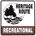 U.P. Hidden Coast Recreational Heritage Route: Fom jct US-2/US-41 & M-35 in Escanaba northerly to the northern city limit of Gladstone on US-2/US-41 at Mather Ave. U.P. Hidden Coast Recreational Heritage Route: Fom jct US-2/US-41 & M-35 in Escanaba northerly to the northern city limit of Gladstone on US-2/US-41 at Mather Ave. |
| Memorial Highways: |
The following Memorial Highway designations have been officially assigned to parts of US-2 by the Michigan Legislature:
- United Spanish War Veterans' Memorial Highway – "The portion of US-2 beginning in St. Ignace and extending west to [...] Iron Mountain, ... and the portion of US-2 beginning in Crystal Falls and extending west to Ironwood ..." From MDOT: "The United Spanish War Veterans was an American Veterans organization which consisted of veterans of the Spanish–American War, Philippine–American War and China Relief Expedition."
- Kenneth J. Moraska Memorial Highway – "The portion of Highway US-2 that is within the city limits of the City of Norway in Dickinson County..." From MDOT: "Patrolman Kenneth Moraska was shot and killed after responding to a domestic disturbance. When Patrolman Moraska arrived at the scene of the domestic dispute he reportedly found the front door locked and in an attempt to enter the building approached the rear door. As he approached the rear door of the house he was shot in the head with a hunting rifle. The suspect had been previously arrested by Patrolman Moraska for disorderly conduct. After shooting Patrolman Moraska, the suspect stole Patrolman Moraska's gun and lead other officers on a 6-hour chase before being apprehended. On December 1, 1971, the suspect was convicted of second degree murder and sentenced to life without the possibility of parole."
- Darryl M. Rantanen Memorial Highway – "The portion of highway US-2 and highway US-41 beginning at the eastern limit of Hyde and extending west to the western limit of Bark River..." From the Michigan Legislature: "Trooper Darryl M. Rantanen was killed in May 1974 while in pursuit of a stolen vehicle. Trooper Rantanen's partner, who was driving their patrol car, attempted to pull alongside the stolen car. Its driver swerved into the patrol car. Both vehicles left the roadway, with the patrol car turning onto its side and its top striking a tree. Trooper Rantanen’s partner was seriously injured. Trooper Darryl M. Rantanen died as a result of his injuries. He was the 29th Michigan State Police officer to die in the line of duty. He was 36 years old."
- AmVets Memorial Drive – "The portion of US-2 and US-41 and M-35 beginning at the northern city limit of Escanaba and extending north 1-1/10 miles to the junction of County Road 426, also known as the extension of Sheridan Avenue..." From MDOT: "AMVETS (American Veterans) is the nation’s most inclusive Congressionally-chartered veterans service organization, representing the interests of 20 million veterans. AMVETS is open to and fighting for all who honorably served in the United States military, including the Reserve and Guard, with more than 250,000 members nationwide."
- Senator Tom Casperson Memorial Bridge – "The bridge on highway US-2 over the Escanaba River in Delta County..." [said bridge also includes US-41 and M-35, but those designations were omitted from the legislation.] From the Michigan Legislature: "Senator Tom Casperson was born in Escanaba and worked for his family's log trucking business for 25 years before taking ownership of the company for 10 years. In 2002, he was elected as a State Representative for Michigan's 108th House District. He served in that capacity until he was elected to the Michigan Senate in 2011, serving in the 38th Senate District until 2018. On November 29, 2020, Senator Casperson died from lung cancer."
- Heath Michael Robinson Cut River Memorial Bridge – "The bridge on highway US-2 over the Cut River in Mackinac County..." From MDOT: "Chief Special Warfare Operator (SEAL) Heath M. Robinson, 34, of Detroit, Michigan was enlisted in January 1996. Robinson completed Basic Underwater Demolition/SEAL School in January, 2000. He served with two West Coast-based special warfare units from March 2000 to April 2004, and later served with four East Coast-based special warfare units beginning in April 2004. His decorations include four Bronze Star Medals, three with ‘V’ for valor; Joint Service Commendation Medal; three Navy and Marine Corps Commendation Medals, two with ‘V’ for valor; Joint Service Achievement Medal; three Navy and Marine Corps Achievement Medals; Combat Action Ribbon; two Presidential Unit Citations; Navy Meritorious Unit Commendation; five Navy Good Conduct Medals; Navy Fleet Marine Force Ribbon; National Defense Service Medal; Armed Forces Expeditionary Medal; two Afghanistan Campaign Medals; Iraq Campaign Medal; Global War on Terrorism Expeditionary Medal; Global War on Terrorism Service Medal; six Sea Service Deployment Ribbons; NATO Medal; Navy Expert Rifleman Medal and Navy Expert Pistol Shot Medal."
|
| Continue on: |
US-2 West into Wisconsin |
| Photographs: |
US-2 Is NOT A Freeway – set of three photos from September 4, 2006. |
| Weblinks: |
- US-2
@ Michigan Highway Ends – photos of the termini of US-2
at Dan Garnell's archived Michigan
Highway Ends site.
- Cut
River Bridge – One of only two cantilevered deck truss bridges in Michigan, it is 641 feet long and contains 888 tons
of structural steel.
- Mackinac Straits Historical Photos – a collection of photos from
the 1950s with scenes during and just after construction of the Mackinac Bridge.
- End of US highway 2 (western segment) – The US-2 (Western Segment) endpoints page from Dale Sanderson's excellent US Ends.com site.
- Iron Mountain Bypass (1978–1999) – article on the In Depth section of this website.
- Historic US-2 Bridges from Nathan Holth's excellent HistoricBridges.org site:
- Old US-2 Bridge – "This is skewed example of a concrete camelback bridge in good condition."
- Old US-2 Cisco Branch Ontonagon River Bridge – "Although it suffers from deteriorating railings, this bridge is an early and unaltered example of its type."
- Old US-2 Middle Branch Ontonagon River Bridge – "This is a large and unaltered example of a bridge design Michigan used for small-span crossings."
- Ramsay Bridge – "This is the longest striaght chord concrete through girder in Michigan, and is also especially impressive to view."
- Genesee Street Bridge – "This is an unaltered and fairly early example of a concrete arch bridge in Michigan, and it is a remnant of the former US-2 alignment."
- Twin Falls Bridge – "This impressive state border bridge is the only pin-connected highway camelback truss in Michigan and one of only two in Wisconsin."
- Bay Shore Road Bridge – "This is the remains of a mostly collapsed bridge that was once one of the longest t-beam bridges in Michigan."
- Old US-2 Little Fishdam River Bridge – "This is one of the smallest through girder bridges known to remain in Michigan."
- Cut River Bridge – "Among the largest bridges in Michigan, this is a very large deck cantilever bridge whose construction was interrupted by World War II."
- Mackinac Trail Bridge – "This attractive arch bridge has several unusual details."
- Historic US-2 Bridges from MDOT's archived Michigan's Historic Bridges site:
- Main St. / Black River – "Built in 1922-1923 from a design by the Michigan State Highway Department, the Ramsay Bridge is comprised of a 50-foot concrete through girder, flanked on both sides by similarly configured, 40-foot girders." (Main St in Ramsay is a former route of US-2.)
- US-2 / Iron River – "The bridge is a 55-foot, filled spandrel arch, with earth fill and an asphalt-surfaced roadway that is flanked on both sides by grassy strips."
- US-2 / Sturgeon River – built in 1929, "This bridge will be replaced in 2003."
- US-2 & M-94 / Manistique River – "This eight-span girder bridge is 296 feet long overall and is an unusual design in that the bridge is an integral part of a concrete raceway flume."
- US-2 / Cut River – "One of only two cantilevered deck truss bridges in Michigan, it is 641 feet long and contains 888 tons of structural steel."
- Mackinac Trail / Carp River – "Located some eleven miles north of St. Ignace, this graceful concrete arch bridge spans the Carp River on the Mackinac Trail."
|