| Southern Terminus: |
US-31 five miles northeast of Manistee |
| Northern Terminus: |
Jct US-31/M-37 & M-22/M-72 (cnr Grandview Pkwy & Division St) in Traverse City |
| Length: |
116.613 miles |
| Map: |
Route Map of M-22 |
| Notes: |
M-22 is one of several Michigan state highways which have a pronounced change in direction at some point along their route. In this route's case, the change in direction occurs at Northport, at the tip of the Leelanau Peninsula, Michigan's "Little Finger." M-22 approaches Northport from the Leland area on the south, comes to a ⊤-intersection at M-201's southern terminus, makes a hard right, and continues southerly toward Suttons Bay and Traverse City. Unlike some of Michigan's other "direction changing highways," M-22 does not have any signage indicating the change. In fact, in parts of Leelanau Co, cardinal direction plates are not used in M-22 assemblies, for obvious reason. |
| |
 According to Michigan State Highway Dept maps and sources from the 1930s, the department originally planned a "lakeshore alignment" for M-22 from CR-604/Glovers Lake Rd at Arcadia into CR-606/Grace Rd just south of Elberta. The shoreline route would have run between Lake Michigan and Lower Herring Lake as well, though several miles of sand dunes. Just over two miles of this shoreline route were graded out from Arcadia northerly to the Manistee/Benzie Co line before the plan was apparently halted for several years. By the mid-1940s, however, the plan for the shoreline route between Arcadia and Elberta was still in place, and an additional proposed shoreline route had been added from Point Betsie northeasterly along the Lake Michigan shore, merging back with the existing M-22 alignment at the Benzie/Leelanau Co line south of Empire. While a 3.1-mile relocation closer to the shoreline was completed in 1942 running northerly out of Arcadia, the remainder of the two shoreline realignments in Benzie Co were dropped by the mid-1950s and M-22 continues to run along its general 1930s alignment in Benzie Co. (Additional evidence the State Highway Dept was planning to relocate those two segments of M-22 can be found in the fact that they were two of the last three gravel-surfaced stretches of the route.) While many find great beauty and appreciation in segments of highway which run close to the Great Lakes shoreline, most would likely also agree that not punching M-22 through what is now the southernmost section of the Sleeping Bear Dunes National Lakeshore in northwest Benzie Co was also a good thing as well. According to Michigan State Highway Dept maps and sources from the 1930s, the department originally planned a "lakeshore alignment" for M-22 from CR-604/Glovers Lake Rd at Arcadia into CR-606/Grace Rd just south of Elberta. The shoreline route would have run between Lake Michigan and Lower Herring Lake as well, though several miles of sand dunes. Just over two miles of this shoreline route were graded out from Arcadia northerly to the Manistee/Benzie Co line before the plan was apparently halted for several years. By the mid-1940s, however, the plan for the shoreline route between Arcadia and Elberta was still in place, and an additional proposed shoreline route had been added from Point Betsie northeasterly along the Lake Michigan shore, merging back with the existing M-22 alignment at the Benzie/Leelanau Co line south of Empire. While a 3.1-mile relocation closer to the shoreline was completed in 1942 running northerly out of Arcadia, the remainder of the two shoreline realignments in Benzie Co were dropped by the mid-1950s and M-22 continues to run along its general 1930s alignment in Benzie Co. (Additional evidence the State Highway Dept was planning to relocate those two segments of M-22 can be found in the fact that they were two of the last three gravel-surfaced stretches of the route.) While many find great beauty and appreciation in segments of highway which run close to the Great Lakes shoreline, most would likely also agree that not punching M-22 through what is now the southernmost section of the Sleeping Bear Dunes National Lakeshore in northwest Benzie Co was also a good thing as well. |
| |
Approximately 58½ miles of M-22 in Leelanau Co, from Empire at M-72 northerly for 2.1 miles to M-109 and from Glen Arbor at M-109 for 56½ miles through Leland, Northport and Suttons Bay to M-72 at Traverse City, (along with M-109 and M-204) have been designated as a Scenic Heritage Route and is now officially designated as the Leelanau Scenic Heritage Route. The Heritage Route Committee works to protect the natural and rural landscape with its many vistas and open spaces such as the orchards, vineyards, fields, hills, valleys, forests, waterways, and the historic and recreational attributes. The Committee members include representatives from the Grand Traverse Band of Ottawa and Chippewa Indians, Leelanau County, each township and village, MDOT, Sleeping Bear Dunes National Lakeshore, organizations, and local citizens. |
| |
Approximately 49½ miles of M-22 in Manistee and Benzie Counties, from the southern terminus of M-22 at US-31 northeast of Manistee to the Benzie/Leelanau Co line, have been designated as a Pure Michigan Byway as the M-22 Benzie Manistee Pure Michigan Byway. The M-22 Benzie-Manistee Pure Michigan Byway Nominating Team and Committee is comprised of representatives from local governing bodies and civic and non-profit groups, and works in cooperation with MDOT, and with assistance from other agencies and organizations. Networks Northwest supported the process of the plan’s development. |
| |
In 2012, the M-22 route marker became the center of a legal and financial debate over whether a business can trademark a specific state highway route marker and prevent others from selling merchandise with the depiction of any other state highway route on it, not just the original one trademarked. In 2003, Matt and Keegan Myers began making and selling t-shirts and stickers featuring a close approximation of the M-22 route marker (they don't utilize the actual FHWA typeface for the numerals "22") and started using the slogan, "M-22 is not just a road; it is a way of life." They claimed it is "marked by the simplicity and appreciation for natural wonders such as bays, beaches and bonfires, dunes and vineyards, cottages, friends and family everywhere."
Soon after Keegan was featured on the cover of Traverse: Northern Michigan magazine wearing one of the brothers' M-22 t-shirts in 2006, sales of the shirts and stickers bearing the M-22 route marker started taking off. Soon, the pair began working with other retailers in Leelanau Co to produce additional apparel and accessory lines, including coffee and an M-22 brand of wine. An M-22 "company store" was opened in November 2007 in downtown Traverse City as well and the brothers filed for trademark protection for their M-22 logo in 2010 to further support the branding effort. Meanwhile, Heidi Marshall and Mary Roberts of Route Scouts, LLC in Harbor Springs started making souvenirs using the M-119 route marker and even tried to trademark it. Their effort failed when the U.S. Patent and Trademark Office denied the application when it responded that it was 'too similar to the M22 registered trademark."
State Representative Frank Foster of Petoskey then requested State Attorney General Bill Schuette "whether a private entity can claim exclusive control over a state highway route marker design" for merchandise use. The Attorney General issued Opinion No.7265 on May 29, 2012, stating, "No entity can lawfully claim exclusive control over use of the State’s highway route marker design because the design is in the public domain and is otherwise not subject to protection under trademark law." In his opinion the Attorney General even referenced the Michigan Highways website, noting in the footnotes: "Michigan organized its highway system by number in 1919, using the design of a white diamond containing a black letter “M” at the top with the assigned highway number below. For additional in-depth historical analysis, see Michigan Highways: The Great Routes of the Great Lakes State <http://www.michiganhighways.org>." While the Myers brothers vowed to "fight on" in their trademark battle, additional state highway route marker-themed merchandise has since popped up, including M-185 ("No Cars Allowed"), M-77, M-37, M-168, and others.
A new salvo in the M-22 trademark war appeared in September 2016 when the State of Michigan brought suit against M22 LLC, the Meyers brothers firm making and selling the M-22-themed merchandise from their shop in Glen Arbor. The State claims M22 LLC is violating state and federal law by trademarking a route marker, which it claims isn't allowed, as well as making the markers "non-compliant" with the Manual on Uniform Traffic Control Devices. Although M22 LLC's version of the M-22 marker doesn't use the correct FHWA typeface for the "2" digits, it's unclear if that makes a difference in either sides' case. |
| |
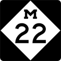
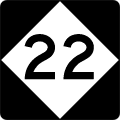
A direct comparison of the three representations of the M-22 route marker:

Left: The "M-22" product logo trademarked by M22 LLC (used here under fair use provisions).
Center: The acutal M-22 route marker used along the highway since the early 1970s.
Right: The "M-less" 22 route marker which MDOT began installing in August 2016. |
| |
Starting in 2016, MDOT introduced a "tweaked" version of the M-22 route marker and began posting them in certain areas along the route. In the first decade after the Myers' "M-22" logo merchandise became popular, the number of M-22 route markers being stolen from the side of the highway began to increase. In a three-year period, according to MDOT spokesman James Lake, the department had to replace approximately 90 signs which had been swiped. With each marker costing $325 to manufacture and install—a total of more than $29,000 over that period—the department felt it necessary to modify the signs, by removing the iconic "M", hoping it would deter theives from taking the signs. Lake, the MDOT spokesman, noted, "We are not changing the design of the M-22 route marker overall, nor replacing all of the route marker signs, but have been placing the modified '22' signs in locations where theft has been a problem and the original sign was stolen." |
| |
On October 2, 2015, USA Today announced M-22 had topped its Reader's Choice Award listing of top Best Scenic Autumn Drives. "The M-22 route along Lake Michigan is one of America's most beautiful tours, and it gets even better in the fall," USA Today noted. "This 116-mile road brings visitors through the peaceful countryside and along the shore, past small businesses, wineries, galleries and, of course, countless colorful trees. Visitors can stop and visit points of interest along the way and meet some locals, making this fall leaves trip a little bit wildlife and a little bit small town, all in one." Nineteen other roadways were in the running, including the Blue Ridge Parkway in North Carolina and Virginia, Kancamagus Scenic Byway in New Hampshire, Virginia's Skyline Drive, the Historic Columbia River Highway in Oregon, and Going-to-the-Sun Road in Montana. (Links to several news stories are available below in the "Weblinks" section.) |
| |
In "State Trunkline Needs, 1960–1980," a set of maps prepared by the State Highway Dept's Office of Planning, Programming Division in 1960 showing possible additions, upgrades and improvements to the state trunkline system over the ensuing twenty years, MSHD staff recommended one somewhat major change to the route of M-22 during that timeframe. The maps denoted, among many other things, segments of state trunkline routes identified as candidates to be possibly turned back to local control. The only change of any kind recommended for M-22 on these maps was the jurisdictional transfer of the potion of M-22 between the two junctions with M-109 (northeast of Empire and in Glen Arbor). The assumption is that all of M-109 would then be redesignated as the route of M-22. Of course, this change was never implemented in the five-plus decades since the maps were issued. |
| History: |
1913 (Sept 12)  – A new state trunkline route in Manistee Co roughly parallel to the Lake Michigan shoreline is officially established beginning at Trunk Line 11 (present-day US-31) approximately five miles northeast of Manistee, then northerly for 6.5 miles roughly along its present-day route to the Onekama south village limit, then for an additional 11.5 miles from the Onekama west village limit northerly to the Benzie Co line and is desiganted as Trunk Line 22 (T.L. 22). – A new state trunkline route in Manistee Co roughly parallel to the Lake Michigan shoreline is officially established beginning at Trunk Line 11 (present-day US-31) approximately five miles northeast of Manistee, then northerly for 6.5 miles roughly along its present-day route to the Onekama south village limit, then for an additional 11.5 miles from the Onekama west village limit northerly to the Benzie Co line and is desiganted as Trunk Line 22 (T.L. 22). |
| |
1913 (Oct 1) – A total of 9.8 miles of new state trunkline route are established in Benzie Co and designated Trunk Line 22 (T.L. 22). From the Manistee Co line northerly for 7.6 miles to the Elberta south village limit and from the Frankfort north village limit northerly to the Crystal Lake/Lake Twp line just south of the Point Betsie lighthouse. |
| |
1913 (Dec 5) – Leelanau Co sees 34 miles of new state trunkline route on Trunk Line 22 (T.L. 22) established in three segments:
- A 1.1-mile segment from the Empire north village limit, northeasterly to a point approx 0.2 mile southwest of the present-day jct of M-22 & M-109,
- A 27.4-mile segment from Glen Arbor northeasterly through Leland to the Northport west village limit, and
- A 5.5-mile segment from the Northport village south limit southerly to the Leelanau Twp/Suttons Bay Twp line between Omena and Peshawbestown.
|
| |
1914 (Feb 23) – Leelanau Co sees an additional 9.1 miles of new state trunkline route on Trunk Line 22 (T.L. 22) established in two segments:
- A 2.2-mile segment from the Benzie Co line south of Empire northerly along the present-day route then Wilco Rd to the Empire south village limit, and
- A 6.9-mile segment from approx 0.2 mile southwest of the present-day jct of M-22 & M-109 northerly along the present-day route of M-109 to the Glen Haven area, then easterly along present-day M-109 to Glen Arbor, meeting a previously-established segment there.
|
| |
1915 (Nov 8) – An additional 4.0-mile segment of Trunk Line 22 in Benzie Co is officially established as a state trunkline highway route from the Crystal Lake/Lake Twp line near Point Betsie northery and east-southeasterly around the western end of Crystal Lake to Crystal Dr. |
| |
1917 (June 6) – A 20.0-mile segment of Trunk Line 22 is officially established completing the route in Leelanau Co, from the Leelanau/Suttons Bay Twp line between Omena and Peshawbestown, southerly along its present-day route into Suttons Bay, then westerly along Broadway St and southerly again along Center Hwy into Greilickville, then along the present-day alignment to the Grand Traverse Co line. |
| |
1919 (June 23) – A 12.0-mile segment of Trunk Line 22 is officially established completing the route in Benzie Co, from the north end of the established trunkline route at Crystal Dr on the north shore of Crystal Lake, then northerly, easterly and northerly again past Platte Lake to the Benzie Co line. |
| |
1919 (July 1) – T.L. 22 is signed in the field as M-22 as all state trunkline highways in Michigan are signed with route markers. Any gaps in the trunkline within the communities along the route, including Onekama, Elberta, Frankfort, Empire and into Traverse City, are signed as M-22 but is not officially under state jurisdiction at this point. |
| |
1919 (Nov 20) – The exisitng 4.7-mile long segment of M-22 in southwest Leelanau Co from the Empire/Glen Arbor Twp line along present-day M-109 then northerly along today's M-109 to the Glen Haven area, then easterly into Glen Arbor is cancelled as a state trunkline route, while simultaneously a new 4.7-mile route—basically along the ame alignment that was just cancelled—is re-established along present-day M-109 via the Glen Haven area. |
| |
1919 (Dec 3) – The 1.1-mile segment of M-22 in northwestern Traverse City from the Leelanau Co line southeasterly via Bay St, then southerly along Elmwood Ave to Front St, then easterly on Front St to Division St is officially established as a state trunkline route. The remainder of M-22 into downtown Traverse City, via Front St from Division St five blocks to its northern terminus at jct M-11 at Union St is signed as part of M-22, but is still technically under city jurisdiction. |
| |
1921 (Feb 10) – A somewhat minor rerouting for M-22 in northwest Manistee Co takes the route from two sides of a "rectangle" and puts it onto the other two sides. The 1.5-mile segment of M-22 from Steffins Rd & Saint Pierre Rd northerly one mile along Saint Pierre to Bischoff Rd, then westerly ½ mile along Bischoff Rd where it turns northerly toward Arcadia is cancelled as a state trunkline route and turned back to county control. Simultaneously, the 1.5-mile segment of Steffens Rd from Saint Pierre Rd westerly ½ mile to Gear Rd, then northerly one mile to Bischoff Rd is established as the new route for M-22. |
| |
1921 (Aug 3) – Due to a provision in Public Act 210 of 1921 which defines the general course of "state trunkline reward roads" and breaks them into numbered "Divisions"—which are not used for route numbering purposes or posted in any way in the field—the general route of M-11 (present-day US-31) is given, along with "a branch from Manistee through Arcadia, Frankfort, Empire, Glen Arbor by way of the Glen Lake Narrows bridge, Leland, Northport, Omena, Sutton's Bay [sic] to Traverse City... with a spur through Northport to the north line of the corporation." As the new state statute specifies the trunkline needs to run "by way of the Glen Lake Narrows bridge" between Empire and Glen Arbor, the existing 6.7-mile long portion of M-22 around the west and north sides of Glen Lake by way of the Glen Haven area (via present-day M-109) is officially cancelled as a state trunkline route and turned back to county control. In its place, a new 6.0-mile route is established running northeasterly from the modern-day jct of M-22 & M-109 to the Glen Lake Narrows, across the bridge, then northerly into Glen Arbor. Local interests along with the Leelanau Co Board of Supervisors applaud the rerouting as it now brings M-22 "...through the most thickly populated resort property along Glen Lake, thence over the Glen lake narrows bridge..." |
| |
1921 (Aug 8, Sept 21) – The route of M-22 through the villages of Frankfort and Elberta is officially established in two parts. First, on August 8, the 2.3-mile segment of M-22 from the Frankfort/Elberta boundary northerly along Lake St, then westerly via Main St for six blocks, then northerly again along Seventh St and Crystal Ave to the northern Frankfort village limit is officially established and transferred to state control, but was likely already signed as part of M-22. Then, on September 21, the 1.0-mle portion of M-22 within the village of Elberta along Frankfort Ave and Lake St is similarly established and transferred to state control. |
| |
1921 (Nov 30) – All 1.4 miles M-22 through the village of Onekama in Manistee Co is officially established as a state trunkline route and transferred to state control, although it has likely been signed as M-22 for the past two years. |
| |
1924 (Oct 15) – The 2.1-mile segment of M-22 from the sothern Northport village limit northerly along Shabwasung St, easterly 1 block on Main St, northerly 1 block via Waukazoo St, easterly ½ block along Nagonaba St, then northerly via Mill St to the north village limit is officially established as a state trunkline route and transferred to city control. |
| |
1927 (June 29) – The existing 0.8-mile route of M-22 approaching the village of Empire from the south along Wilco Rd is cancelled as a state trunkline route and turned back to county control. At the same time, 2.4 miles of trunkline route is established from modern-day M-22 & Wilco Rd northerly into Empire along its present-day route to the north village limit, meaning the entirety of M-22 in Empire has now been officially established as a state trunkline route. |
| |
1928–30 – The Glen Lake Narrows bridge is deemed unsafe for travel in early April 1928 and closed to all use. M-22 traffic is detoured around the south and east sides of Glen Lake via Macfarlane and Dunn's Farm Rds. On May 21, 1928, the County Board of Supervisors approves plans for a new concrete and steel bridge over the Narrows. Initial work on the $51,700 span begins in October 1928 with the bridge substantially complete by the end of the 1929 construction season. However, footings for the concrete work on the bridge were deemed to be faulty and required reinforcement which delays completion into the next summer. The reinforcements and approach work is completed and the bridge is opened to traffic on August 15, 1930. |
| |
1931 (June 14) – Act 131 of 1931—the Dykstra Act—is passed allowing the State Highway Dept to take over control of state highways running into and through incorporated cities, thereby officially incorporating them as state trunkline highways. For M-26, this consists of the 0.5-mile segment of the route along Front St in Traverse City from Division St easterly to US-31 at Union St. |
| |
1936 (mid-Oct) – Construction on the first segment of the realignment of M-22 to run closer to the shoreline of Grand Traverse Bay in southeast Leelanau Co is complete and (mostly) open to traffic. The newly-complete segment runs from existing M-22 at the modern-day intersection of West Bayshore Dr & Cherry Bend Rd in Greilickville northerly for 4.653 mile to a point approx ¼ mile south of Lakeview Hills Rd. While this new segment of highway is shown on official state highway maps, the existing route along Cherry Bend Rd and Center Hwy is still signed as the primary route for M-22 for the time being. |
| |
1937 (Dec 29) – M-22 is rerouted through downtown Frankfort to avoid the main business district along Main St. The 0.62-mile segment of M-22 along Main St from Lake St westerly to Seventh St, then northerly along Seventh St to Forest Ave is officially cancelled as a state trunkline route and turned back to city control. At the same time, the 0.62-mile rerouting is officially established as a state trunkline route, continuing northerly from Main St along Lake St, then turning westerly along Forest Ave back to the existing route at Seventh St. |
| |
1937 (Dec 29) – Several official changes occur with regard to the M-22 relocation along the bayshore route in southeast Leelanau Co, including:
- The 4.653-mile segment of relocated M-22 along West Bayshore Dr from Cherry Bend Rd in Greilickville northerly to approx ¼ mile south of Lakeview Hills Rd is officially established as a state trunkline highway route, although only the 3.2-mile portion from Cherry Bend Rd north to Crain Hill Rd is signed as M-22. The 1.45-mile segment of highway completed in 1936 north of Crain Hill Rd remains an unsigned state trunkline route for now.
- The entire 0.6-mile length of Crain Hill Rd (0.7 mile in reality) from the M-22 relocation along West Bayshore Dr to the exisitng M-22 route along Center Hwy is also officially established as a state trunkline to carry the route of M-22 between the new and old locations. With this, M-22 now continues northerly from Greilickville along the bayshore relocation to Crain Hill Rd, then laterals over to the existing route on Center Hwy via Crain Hill.
- The bypassed portion of M-22 along Cherry Bend Rd from Greilickville and Center Hwy and Center Hwy from Cherry Bend Rd northerly to Crain Hill Rd (4.3 miles total) is cancelled as a state trunkline route and turned back to county control.
|
| |
1938 (Dec 4) – Whether it was an oversight from decades prior or something else, the 0.5-mile segment of M-22 in Northport from the three-way jct of M-22 (present-day jct of M-22 & M-201) westerly and southwesterly to Johnson Rd at the (then-) village limit was never officially established as a state trunkline route. It is now officially established 25 years after the adjacent segments outside the village limit had been initially assumed into the state trunkline highway system and turned over to state control. It has been signed as part of M-22 since nearly twenty years. |
| |
1941 (May 5)–1942 (early) – As the first part of the "shoreline relocation" project noted in the "Notes" section of this listing, a 1.8-mile segment of highway is graded from Arcadia northerly to the Manistee/Benzie Co line as part of a Works Progress Administration in 1939, but work is temporarily halted. Then, on May 5, 1941, a 3.046-mile segment of new state trunkline highway route, including the 1.8-mile segment north from Arcadia, is officially established as a state trunkline highway route for an M-22 relocation closer to the lakeshore. The newly-established route runs northerly from Glovers Lake Rd at Arcadia to the Manistee/Benzie Co line, then bends easterly away from the lakeshore to merge back into the existng M-22 route north of Matzinger Rd. At the same time, the existing 3.5-mile route of M-22 along Glovers Lake Rd from Arcadia easterly to Saint Pierre Rd, then northerly along Saint Pierre Rd into Benzie Co the point where the relocation merges back into it is cancelled as a state trunkline route and turned back to county control. A year later in early 1942, the new alignment is completed and opened to traffic, including a new scenic overlook just north of the county line offering a popular stop for tourists to view the breathtaking Lake Michigan shoreline. |
| |
1946 – The final gravel segment of M-22, between Leland and Northport, is paved. |
| |
1948 – The "Northport Leg" of M-22 first appears with M-201 route markers on internal State Highway Dept maps. While it won't be signed in the field as M-201 until the following spring, as it is shown on State Highway Dept maps, albeit internal ones, 1948 will be considered the date the M-22 "third leg" at Northport is re-commissioned as M-201. |
| |
1949 (Apr 1) – The State Highway Dept replaces all M-22 signs on the route through Northport with M-201 route markers to alleviate confusion amongst tourists and visitors unfamiliar with the area. This mitigates the complexity of having one state state route leading southerly, northerly and southwesterly away from the same intersection. M-201 also makes its marked debut on the April 15, 1949 edition of the Official Michigan Highway map. |
| |
1949 (Sept 9, Nov 10) – The remainder of the shoreline realignment of M-22 along the West Arm of Grand Traverse Bay in eastern Leelanau Co is completed and opens to traffic on September 9 at ceremonies presided over by State Hghway Commissioner Charles Ziegler. The segment begins at the northern end of the 1.45-mile long "spur" completed in 1936 to just south of Lakeview Hills Rd and continues northerly for 8.99 miles, first along the West Bay shoreline, then turns inland to run directly to Suttons Bay where it meets the route's former alignment. Then on November 10, the 8.99 miles of new highway alignment is officially established as a trunkline route and the 9.5 miles of the former route along Center Hwy and 0.6 (0.7) miles of Crain Hill Rd are cancelled as a state trunkline route and transferred to county control while the 0.7 miles of Elm and Broadway Sts in Suttons Bay are similarly cancelled and transferred to village control. |
| |
1952 (Nov 11) – In a project designed to remove through traffic and trucks from the heart of Traverse City's downtown core, a new shoreline boulevard named Grandview Parkway is constructed along the shoreline of the West Arm of Grand Traverse Bay and opened to traffic. From the M-22 & M-72 jct on the Leelanau/Grand Traverse Co line south of Greilickville, M-22 (along with M-72) are rerouted to use the new Grandview Parkway route along the bayshore southeasterly to Division Ave where it meets with US-31 and M-37 coming up from the south. At that point, M-22 has its new northern terminus, while M-72 continues along the shore via Grandview Parkway concurrently with US-31 and M-37 to bypass downtown. The former route of M-22/M-72 along Bay St southeasterly to Elmwood Ave, then southerly via Elmwood to Front St and easterly along Front St into downtown becomes an unsigned trukline for the time being. |
| |
1953 (Nov 6) – Almost exactly a year after it opened to traffic, Traverse City's Grandview Parkway—part of M-22/M-72 west of Division St and US-31/M-37/M-72 east of Division—is officially established as a state trunkline highway route. At the same time, the former route of M-22 (and M-72) into the central part of the city from the northwest via Bay St, Elmwood Ave and Front St is officially cancelled as a state trunkline highway route and transferred to city control. |
| |
1964 (Oct 22) – The entire length of M-22 in Manistee Co from US-31 to the Benzie Co line, excluding the portion within the village limits of Onekama, as well as the southern segment of M-22 in Benzie Co from the Manistee Co line northerly to the southern Elberta village limit is cancelled as a state trunkline highway route and immediately re-established along roughly the same route as part of a $1.072-million highway modernization project. A total of 26.52 miles of trunkline route are cancelled, while the replacement route is 25.90 miles in length, mostly due to replacing sharper curves with more gradual ones, ironing out some of the windier segments and improving the horizonal alignment of the route by lowering hills and adding fills where necessary. Much of the "new" highway route lies directly atop of the "old" alignment in most places where changes are not made. The Benzie Co portion is closed for reconstruction between June 25, 1963 and October 15, 1963 when it reopens to traffic, while the Manistee Co portion is closed from September 19, 1963 to October 15, 1964 with the cancellation/re-establishment occuring one week after the Manistee Co portion is completed. |
| |
2002 – The Leelanau Scenic Heritage Route is officially designated a Michigan Scenic Heritage Route by the state legislature. |
| |
2015 (Oct 2) – As noted in the "Notes" section above, M-22 tops a USA Today Reader's Choice Award poll as the No.1 Best Scenic Autumn Drive in the United States. |
| |
 2016 (Summer) – A "tweaked" version of the M-22 route marker—without the iconic "M" which has been part of the state trunkline route marker since 1918—is unveiled by MDOT to be used in areas where the normal M-22 markers are seeing higher rates of theft. This is due to the popularity of M-22-themed merchandise for sale in the region. 2016 (Summer) – A "tweaked" version of the M-22 route marker—without the iconic "M" which has been part of the state trunkline route marker since 1918—is unveiled by MDOT to be used in areas where the normal M-22 markers are seeing higher rates of theft. This is due to the popularity of M-22-themed merchandise for sale in the region. |
| |
2016 (Oct 5) – M-22 in Manistee and Benzie Counties is officially designated as the M-22 Benzie Manistee Pure Michigan Byway and the official designation ceremony for the byway is held at the Camp Arcadia Ampitheater in Arcadia. Representatives from the Michigan Department of Transportation, Alliance for Economic Success, Travel Michigan and other organizations are in attendance. |
| |
2016–17 – When new Pure Michigan Byway signs are erected along M-22 in Leelanau Co replacing the former Scenic Heritage Route markers, the route of the Byway itself is apparently extended southerly to begin at the Benzie/Leelanau Co line south of Empire as opposed to commencing at the M-72 jct in Empire, as all materials on the route had previously shown. Whether this is a signing error or an official extension of the Byway portion of M-22 is not clear. |
| Controlled-Access: |
No portion of M-22 is freeway or expressway. |
| NHS: |
No portion of M-22 is on the National Highway System (NHS). |
| Circle Tour: |
 Lake Michigan Circle Tour: Entire length of M-22. Lake Michigan Circle Tour: Entire length of M-22. |
Pure Michigan
Byways:
|
 Leelanau Scenic Heritage Route: Two segments of M-22 comprise part of the byway route: Leelanau Scenic Heritage Route: Two segments of M-22 comprise part of the byway route:
- From the Benzie/Leelanau Co line south of Empire to the southern jct of M-109 northeast of Empire. (4.80 miles)
- From the northern jct of M-109 in downtown Glen Arbor to M-72 at the northwestern edge of Traverse City, south of Greilickville. (56.34 miles)
- Additionally, the entirety of M-109 and M-204 are a part of the route.
|
| |
Benzie Manistee Pure Michigan Byway: The entirety of M-22 in Manistee and Benzie Counties, from the route's southern terminus at US-31 northerly through Onekama, Arcadia, Elberta and Frankfort to the Benzie/Leelanau Co line. (49.45 miles) |
| Memorial Highway: |
The following Memorial Highway designation has been officially assigned to part of M-22 by the Michigan Legislature:
- Carl Oleson, Jr. Bridge – "The bridge on highway M-22 in Leelanau county between Big Glen Lake and Little Glen Lake..." From MDOT: "Carl Oleson, Jr owned a tackle/bait shop for many decades in Glen Arbor, alongside his wife Ruth and son Carl III."
|
| Photographs: |
|
| Weblinks: |
|