What began as an endeavor to get workers in Detroit to the war
munitions plants in Ypsilanti quicker and more efficiently eventually grew
into a freeway extending first to, then through Detroit on the east and
bypassing Ann Arbor on the west. Of course, today this corridor is but
a segment in the I-94 freeway as it travels 275 miles across the Lower
Peninsula from New Buffalo on Lake Michigan to Port Huron at the southernmost
point of Lake Huron.
Since so much work was completed on the I-94 corridor even before I-94
itself existed as a route designation, this page was originally conceived of as a companion piece to the year-by-year history in the I-94
route listing in the Route Listings section
of this website. However, during a major overhaul in 2016, the information below was tacked onto the beginning of the year-by-year history section of the I-94
route listing so the story of the development of that route could be presented all in one place. This page will be being retained indefinitely for historical purposes.
| History: |
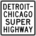 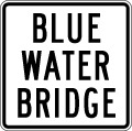 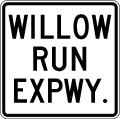 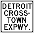 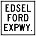 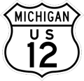 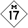 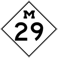 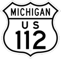 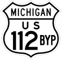 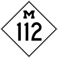 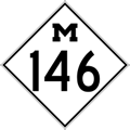
NOTE: This history includes the history of any earlier route segments which were eventually incorporated into the route of I-94, including portions of US-12, M-17, M-29, US-112, BYP US-112, M-112, and M-146. Look for the route marker symbols denoting the original designation being referred to at the beginning of each history entry. For the history of I-94 beginning only when that designation was officially signed in 1959, jump to that portion of the detailed history of I-94 on that route's page. |
| 1927 (June 13) |
 1927 (June 13) – A local delegation led by Washtenaw Co Road Commission chairman George W. McCalla and engineer A.R. Bailey travel to Lansing to request a three-mile long "cut-off" for the former M-23, now newly designated and signed as US-112 (and potentially also for M-17) around the south side of Ypsilanti. The cut-off route had been previously surveyed by the State Highway Dept, but "not carried out, owing to local conditions," as reported. The local represetatives note to the State Administrative Board such a cut-off would relieve oongestion along Michigan Ave as it leaves Wayne Co and heads into Ypsilanti. The Ad Board referred the suggestion to the road committee for consideration (although it would take the coming of yet another World War to cause such a southern bypass of Ypsilanti to finally come to fruition in a decade-and-a-half). 1927 (June 13) – A local delegation led by Washtenaw Co Road Commission chairman George W. McCalla and engineer A.R. Bailey travel to Lansing to request a three-mile long "cut-off" for the former M-23, now newly designated and signed as US-112 (and potentially also for M-17) around the south side of Ypsilanti. The cut-off route had been previously surveyed by the State Highway Dept, but "not carried out, owing to local conditions," as reported. The local represetatives note to the State Administrative Board such a cut-off would relieve oongestion along Michigan Ave as it leaves Wayne Co and heads into Ypsilanti. The Ad Board referred the suggestion to the road committee for consideration (although it would take the coming of yet another World War to cause such a southern bypass of Ypsilanti to finally come to fruition in a decade-and-a-half). |
1930
(Aug 26) |
  A meeting between state highway officials and representatives of each county and the major cities from Detroit to Kalamazoo is held to discuss the concept of a "Detroit-Chicago Superhighway" to run from Detroit westerly past Ann Arbor, Jackson, Albion, Marshall, Battle Creek and Kalamazoo en rotue, eventually, to Chicago. Near unanimous support was given for the new "superhighway," although the Battle Creek officials strongly desired the route to pass to the north of their central business district while state highway officials championed a route to the south that would also bypass Camp Custer (today's Fort Custer) and connect with a new trunkline already proposed to enter downtown Kalamazoo from the east. This improved highway is a direct precedessor, in may ways, to the present-day I-94. A meeting between state highway officials and representatives of each county and the major cities from Detroit to Kalamazoo is held to discuss the concept of a "Detroit-Chicago Superhighway" to run from Detroit westerly past Ann Arbor, Jackson, Albion, Marshall, Battle Creek and Kalamazoo en rotue, eventually, to Chicago. Near unanimous support was given for the new "superhighway," although the Battle Creek officials strongly desired the route to pass to the north of their central business district while state highway officials championed a route to the south that would also bypass Camp Custer (today's Fort Custer) and connect with a new trunkline already proposed to enter downtown Kalamazoo from the east. This improved highway is a direct precedessor, in may ways, to the present-day I-94. |
1930
(Dec 2) |
  A 47.4-mile long state trunkline highway route is officially determined as part of the proposed "Detroit-Chicago Superhighway" eventually linking the two cities with a re-engineered "super" highway largely on new alignment. The concept of freeways, as they came to be known later in the 20th Century, had not yet fully coalesced and this proposed route was planned as a 40-foot wide (or wider, in places) concrete highway, engineered to the highest existing standards. The new route "will eventually provide a new route across the State, keeping away from the centers of the larger cities." (Detroit Free Press, Jan 14, 1934, Part 2, pg. 4) A 47.4-mile long state trunkline highway route is officially determined as part of the proposed "Detroit-Chicago Superhighway" eventually linking the two cities with a re-engineered "super" highway largely on new alignment. The concept of freeways, as they came to be known later in the 20th Century, had not yet fully coalesced and this proposed route was planned as a 40-foot wide (or wider, in places) concrete highway, engineered to the highest existing standards. The new route "will eventually provide a new route across the State, keeping away from the centers of the larger cities." (Detroit Free Press, Jan 14, 1934, Part 2, pg. 4)
The first segment of the "Detroit-Chicago Superhighway", as officially determined on this date, begins at US-112/Michigan Ave & Wyoming Ave between Detroit and Dearborn and continues westerly along Ford Rd to Canton Center Rd, then continues due westerly along an unconstructed alignment into Washtenaw Co to US-12/Plymouth Rd just northeast of Dixboro. The route then continued due westerly for an additional four miles before curving southwesterly as it crossed the Ann Arbor RR (present-day Great Lakes Central RR) north of Ann Arbor, continuing to US-12/Jackson Rd at Zeeb Rd west of Ann Arbor. The "superhighway" route continues westerly for ¾ mile along US-12/Jackson Rd for nearly 14 miles to just southwest of Sylvan. There, the route curved west-northwesterly for two miles, crossing existing US-12 and the Michigan Central RR before turning due westerly for an additional mile to the Washtenaw/Jackson Co line. From there, the "superhighway" route continues west on a gently curving alignment passing north of Riley Lake, between Grass and Tims Lakes and south of Goose Lake to the present-day intersection of Sargent Rd & Ann Arbor Rd northeast of Jackson. The highway route then turns southwesterly along present-day BL I-94/Ann Arbor Rd to Michigan Ave and then via Michigan Ave to the eastern Jackson city limit.
From the outset, the portion of the "Detroit-Chicago Superhighway" along Ford Rd from US-12/Michigan Ave westerly to Canton Center Rd in Canton Twp and on to US-12 at Dixboro northeast of Ann Arbor is designated M-153, but state highway officials hoped to have Ford Rd designated as a "federal route," likely meaning transferring the US-12 designation from Plymouth Rd to the north onto Ford Rd. West of Ann Arbor, the highway officials planned to move the US-12 designation to the new route as it was completed and opened to traffic. |
1935
(Jan 7)
|
 While the Ford Rd portion of the "Detroit-Chicago Superhighway," signed as M-153, was completed westerly from Canton Center Rd in Wayne Co to Napier Rd on the Washtenaw Co line in 1933 and then on to US-12/Plymouth Rd near Dixboro in Washtenaw Co in 1934, the remaining mileage of the "superhighway" route in Washtenaw Co is cancelled and removed from the state trunkline highway system. The northern bypass of Ann Arbor would return in coming years as the M-14 "North Belt" and the remaining portion of the route determined in 1930 would re-emerge on a slightly different alignment as part of US-12 as well. While the Ford Rd portion of the "Detroit-Chicago Superhighway," signed as M-153, was completed westerly from Canton Center Rd in Wayne Co to Napier Rd on the Washtenaw Co line in 1933 and then on to US-12/Plymouth Rd near Dixboro in Washtenaw Co in 1934, the remaining mileage of the "superhighway" route in Washtenaw Co is cancelled and removed from the state trunkline highway system. The northern bypass of Ann Arbor would return in coming years as the M-14 "North Belt" and the remaining portion of the route determined in 1930 would re-emerge on a slightly different alignment as part of US-12 as well. |
1936
(Feb 6–20)
|
 As the originally-proposed route for the "Detroit–Chicago Superhighway" is gradually being abandoned between Ann Arbor and Jackson, a new alignment for US-12 in eastern Jackson Co is officially determined as a state trunkline highway route. Beginning at the same location where the "Detroit–Chicago Superhighway" route departed from existing US-12 (at the present-day cnr of E Michigan Ave & Ann Arbor Rd), the newly-determined route follows the proposed "Detroit–Chicago Superhighway" route for the first 3½ miles to the Brill Lake area where the new route swings north of Goose Lake then continues easterly to the Washtenaw Co line. This new US-12 routing is determined on Feb 6 while the former "Detroit–Chicago Superhighway" alignment is officially cancelled two weeks later on Feb 20. (This results in two weeks where the former "superhighway" alignment and the new US-12 northern alignment co-exist, although neither in physically constructed form.) The new route for US-12 in eastern Jackson Co is likely completed and opened to traffic by the end of 1937, as the former route of US-12 through Grass Lake along Michigan Ave is cancelled on Dec 29, 1937. As the originally-proposed route for the "Detroit–Chicago Superhighway" is gradually being abandoned between Ann Arbor and Jackson, a new alignment for US-12 in eastern Jackson Co is officially determined as a state trunkline highway route. Beginning at the same location where the "Detroit–Chicago Superhighway" route departed from existing US-12 (at the present-day cnr of E Michigan Ave & Ann Arbor Rd), the newly-determined route follows the proposed "Detroit–Chicago Superhighway" route for the first 3½ miles to the Brill Lake area where the new route swings north of Goose Lake then continues easterly to the Washtenaw Co line. This new US-12 routing is determined on Feb 6 while the former "Detroit–Chicago Superhighway" alignment is officially cancelled two weeks later on Feb 20. (This results in two weeks where the former "superhighway" alignment and the new US-12 northern alignment co-exist, although neither in physically constructed form.) The new route for US-12 in eastern Jackson Co is likely completed and opened to traffic by the end of 1937, as the former route of US-12 through Grass Lake along Michigan Ave is cancelled on Dec 29, 1937. |
1939
(July 13)
|
 In preparation for the opening of the Blue Water Bridge spanning the St Clair River between Port Huron, Michigan and Point Edward, Ontario, the six-tenths of a mile of the bridge approach from M-51/Pine Grove Ave (present-day BL I-69/BL I-94) easterly to the shoreline of the St Clair River is officially determined as a state trunkline highway route. No route designation is assigned to the approach roadway which was constructed in 1938 and would be incorporated into the route of I-94 a quarter of a century later. In preparation for the opening of the Blue Water Bridge spanning the St Clair River between Port Huron, Michigan and Point Edward, Ontario, the six-tenths of a mile of the bridge approach from M-51/Pine Grove Ave (present-day BL I-69/BL I-94) easterly to the shoreline of the St Clair River is officially determined as a state trunkline highway route. No route designation is assigned to the approach roadway which was constructed in 1938 and would be incorporated into the route of I-94 a quarter of a century later. |
1939
(Oct 9) |
 The Blue Water Bridge linking Port Huron and Point Edward, Ontario is officially dedicated and opened to traffic. The Blue Water Bridge linking Port Huron and Point Edward, Ontario is officially dedicated and opened to traffic. |
1941
(Oct 1)
|
 Even though the U.S. was not officially at war—the Attack on Pearl Harbor wouldn't occur for more than two months—a massive bomber plant is constructed at Willow Run, straddling the Washtenaw/Wayne Co line east of Ypsilanti. With the primary supply of labor for the bomber plant living 15–20 miles to the east in the Detroit area, getting workers to the new plant quickly becomes a major headache. (Many workers were unwilling or unable to live in temporary housing constructed at Willow Run during the week, commuting home to Detroit on the weekends. Worker turnover became a problem early on.) Roads and highways connecting Detroit with Willow Run were narrow and not built to handle the amount of traffic they received almost overnight. To get the bomber plant workers to their jobs and allow them to return home each night, the Michigan State Highway Dept, the U.S. War Department and Ford Motor Company—the company that constructed and operated the plant on behalf of the federal government—decide to construct a system of ultra-modern access highways encircling the Willow Run facility and reaching toward Detroit. Work begins on the Willow Run Expressway System on Oct 1. A ceremonial kick-off to start the work on the Willow Run Expressway was held on Sept 10. Even though the U.S. was not officially at war—the Attack on Pearl Harbor wouldn't occur for more than two months—a massive bomber plant is constructed at Willow Run, straddling the Washtenaw/Wayne Co line east of Ypsilanti. With the primary supply of labor for the bomber plant living 15–20 miles to the east in the Detroit area, getting workers to the new plant quickly becomes a major headache. (Many workers were unwilling or unable to live in temporary housing constructed at Willow Run during the week, commuting home to Detroit on the weekends. Worker turnover became a problem early on.) Roads and highways connecting Detroit with Willow Run were narrow and not built to handle the amount of traffic they received almost overnight. To get the bomber plant workers to their jobs and allow them to return home each night, the Michigan State Highway Dept, the U.S. War Department and Ford Motor Company—the company that constructed and operated the plant on behalf of the federal government—decide to construct a system of ultra-modern access highways encircling the Willow Run facility and reaching toward Detroit. Work begins on the Willow Run Expressway System on Oct 1. A ceremonial kick-off to start the work on the Willow Run Expressway was held on Sept 10. |
1941
(Oct 17) |
  As work on the Willow Run Expressway System gets underway, the State Highway Dept also begins planning on a new superhighway to connect the Willow Run area with Detroit via what is called the "Detroit Industrial Area," to the south of US-112/Michigan Ave. The first 5.5 mile segment of the planned Detroit Industrial Expressway from US-112/Michigan Ave at Wyoming Ave on the Detroit/Dearborn boundary westerly to Southfield Rd is determined as a state trunkline highway route and will feature the designation M-112. As work on the Willow Run Expressway System gets underway, the State Highway Dept also begins planning on a new superhighway to connect the Willow Run area with Detroit via what is called the "Detroit Industrial Area," to the south of US-112/Michigan Ave. The first 5.5 mile segment of the planned Detroit Industrial Expressway from US-112/Michigan Ave at Wyoming Ave on the Detroit/Dearborn boundary westerly to Southfield Rd is determined as a state trunkline highway route and will feature the designation M-112. |
1942
(Jan 28) |
Three segments of highway which will eventually become part of I-94, two of which are directly contiguous to each other, are officially assumed into the state trunkline highway system:
  A portion of the Willow Run Expressway System from a point along M-17/Ecorse Rd 1¾ miles south and east of US-112/Michigan Ave at Ypsilanti (at the present-day jct of US-12 & M-17) then continuing east-northeasterly just to the north of the existing alignment of M-17/Ecorse Rd for 1.86 miles to the Wayne Co line, including both "triple-decker" freeway-to-freeway interchanges. When opened to traffic, this becomes the new alignment for M-17/Ecorse Rd and will also become part of BYP US-112 when the southern bypass of Ypslianti is completed. (The former route of M-17 is turned back to local control with portions obliterated by the new highway construction.) A portion of the Willow Run Expressway System from a point along M-17/Ecorse Rd 1¾ miles south and east of US-112/Michigan Ave at Ypsilanti (at the present-day jct of US-12 & M-17) then continuing east-northeasterly just to the north of the existing alignment of M-17/Ecorse Rd for 1.86 miles to the Wayne Co line, including both "triple-decker" freeway-to-freeway interchanges. When opened to traffic, this becomes the new alignment for M-17/Ecorse Rd and will also become part of BYP US-112 when the southern bypass of Ypslianti is completed. (The former route of M-17 is turned back to local control with portions obliterated by the new highway construction.) A 3.7-mile long segment of the Willow Run Expwy in Van Buren and Romulus Twps in Wayne Co from M-56/Belleville Rd just north of Belleville easterly along the Chase Rd corridor to Hannan Rd, then southeasterly to M-56/Northline Rd 1/3-mile east of Huron River Dr. A 3.7-mile long segment of the Willow Run Expwy in Van Buren and Romulus Twps in Wayne Co from M-56/Belleville Rd just north of Belleville easterly along the Chase Rd corridor to Hannan Rd, then southeasterly to M-56/Northline Rd 1/3-mile east of Huron River Dr. A 10.5-mile segment of the Detroit Industrial Expwy is also determined beginning at the Willow Run Expwy at Hannan Rd on the Van Buren/Romulus Twp line in Wayne Co and continuing northeasterly to the north of the Wabash RR line to Southfield Rd, linking the Willow Run Expwy with the 5.5 mile segment of the Detroit Industrial Expwy determined the previous October. Segments of this stretch of highway will open later in the year and in the early portion of 1942. A 10.5-mile segment of the Detroit Industrial Expwy is also determined beginning at the Willow Run Expwy at Hannan Rd on the Van Buren/Romulus Twp line in Wayne Co and continuing northeasterly to the north of the Wabash RR line to Southfield Rd, linking the Willow Run Expwy with the 5.5 mile segment of the Detroit Industrial Expwy determined the previous October. Segments of this stretch of highway will open later in the year and in the early portion of 1942. |
1942
(June 17) |
 The U.S. War Department officially authorizes construction of the Detroit Industrial Expwy under the provisions of the Defense Highway Act of 1941. Part of the freeway is already constructed, which illustrates the speed at which improvements were being implemented during wartime. The U.S. War Department officially authorizes construction of the Detroit Industrial Expwy under the provisions of the Defense Highway Act of 1941. Part of the freeway is already constructed, which illustrates the speed at which improvements were being implemented during wartime. |
1942
(July 1) |
 The first mile of the Willow Run Expwy is completed and opened to traffic. (The exact limits of this segment are not clear, as information relating to military production efforts is considered sensitive and is often generalized, if not censored altogether. As construction of the Willow Run and Detroit Industrial Expwys are directly related to the Willow Run bomber plant, detailed information on those highways is sometimes difficult to come by.) As the portion of the Willow Run Expwy along Chase Rd through Van Buren Twp in Wayne Co was likely some of the easiest and quickest to construct, it may have been in that area the first mile opened to traffic. The first mile of the Willow Run Expwy is completed and opened to traffic. (The exact limits of this segment are not clear, as information relating to military production efforts is considered sensitive and is often generalized, if not censored altogether. As construction of the Willow Run and Detroit Industrial Expwys are directly related to the Willow Run bomber plant, detailed information on those highways is sometimes difficult to come by.) As the portion of the Willow Run Expwy along Chase Rd through Van Buren Twp in Wayne Co was likely some of the easiest and quickest to construct, it may have been in that area the first mile opened to traffic. |
1942
(Aug 17) |
 A 6.1-mile long westerly extension of the Willow Run Expressway System from M-17/Ecorse Rd (at the west end of the expressway complex being constructed around the Wilow Run bomber plant) past the south side of Ypsilanti to a jct with US-112/Michigan Ave southwest of Ypsilanti and then further to a ⊤-intersection with US-23/Carpenter Rd southeast of Ann Arbor is officially established as a state trunkline highway route, to be designated as a realigned M-17 and BYP US-112, a new route designation, when opened to traffic. A 6.1-mile long westerly extension of the Willow Run Expressway System from M-17/Ecorse Rd (at the west end of the expressway complex being constructed around the Wilow Run bomber plant) past the south side of Ypsilanti to a jct with US-112/Michigan Ave southwest of Ypsilanti and then further to a ⊤-intersection with US-23/Carpenter Rd southeast of Ann Arbor is officially established as a state trunkline highway route, to be designated as a realigned M-17 and BYP US-112, a new route designation, when opened to traffic. |
1942
(Sept 12–22) |
   On Sept 12, the east tri-level ("triple decker") interchange on the Willow Run Expwy is dedicated and opened to traffic. This interchange allows traffic from the new BYP US-112 (later US-112, now US-12) section of the Willow Run Expwy to directly access the Willow Run bomber plant from the north. Then on Sept 22, news accounts report the entire Willow Run Expressway System is "put into service," implying the entire expressway along Chase Rd from Hannan Rd westerly to Wiard Rd, northerly along Wiard Rd from Chase Rd to M-17/Ecorse Rd, then easterly along M-17/Ecorse Rd to M-56/Belleville Rd, with extensions to the northeast connecting with US-112/Michigan Ave and to the west connecting with M-17/Ecorse Rd heading into Ypsilanti. The new expressway features interchanges at (from east-to-west) at: On Sept 12, the east tri-level ("triple decker") interchange on the Willow Run Expwy is dedicated and opened to traffic. This interchange allows traffic from the new BYP US-112 (later US-112, now US-12) section of the Willow Run Expwy to directly access the Willow Run bomber plant from the north. Then on Sept 22, news accounts report the entire Willow Run Expressway System is "put into service," implying the entire expressway along Chase Rd from Hannan Rd westerly to Wiard Rd, northerly along Wiard Rd from Chase Rd to M-17/Ecorse Rd, then easterly along M-17/Ecorse Rd to M-56/Belleville Rd, with extensions to the northeast connecting with US-112/Michigan Ave and to the west connecting with M-17/Ecorse Rd heading into Ypsilanti. The new expressway features interchanges at (from east-to-west) at:
- Tyler Rd (entrance only from wbd Tyler Rd to nbd and sbd M-112/Willow Run Expwy)
- Airport Rd (exit only from nbd and sbd M-112/Willow Run Expwy to ebd Airport Rd)
- West tri-level interchange (jct M-112 & M-17)
- East tri-level interchange (north entrance into Willow Run bomber plant)
- Jct M-17/Ecorse Rd & Future US-112 BYP (present-day US-12)
At-grade intersections along M-112 portion:
- Hannan Rd
- M-56 SOUTH/Haggerty Hwy SOUTH
- Haggerty Hwy NORTH
- Morton–Taylor Rd
- M-56 NORTH/Belleville Rd
- Quirk Rd
- Beck Rd
- Beckly Rd
- Denton Rd NORTH
- Rawsonville Rd
- various residential roads south off Chase Rd between Rawsonville and Wiard Rds
- Chase Rd WEST
- Wiard Rd SOUTH
At-grade intersections along M-17 portion:
- Denton Rd NORTH
- Beck Rd
- M-56/Belleville Rd
|
1942
(Nov 23) |
  The first segment of the M-112/Detroit Industrial Expressway is completed and opened to traffic from the eastern end of the Willow Run Expwy at Hannan Rd west of Romulus then east-northeasterly to Middle Belt Rd. The Detroit Industrial Expwy, unlike the Willow Run Expwy to the west, is being constructed to full freeway standards with no intersecting crossroads and interchanges at Wayne Rd (wbd exit, ebd entry) and Middle Belt Rd. An interchange with ramps leading to M-56 at North Line Rd and Huron River Dr west of Romulus is still under construction. The first segment of the M-112/Detroit Industrial Expressway is completed and opened to traffic from the eastern end of the Willow Run Expwy at Hannan Rd west of Romulus then east-northeasterly to Middle Belt Rd. The Detroit Industrial Expwy, unlike the Willow Run Expwy to the west, is being constructed to full freeway standards with no intersecting crossroads and interchanges at Wayne Rd (wbd exit, ebd entry) and Middle Belt Rd. An interchange with ramps leading to M-56 at North Line Rd and Huron River Dr west of Romulus is still under construction. |
1943
(Feb 2) |
  The next segment of the M-112/Detroit Industrial Expwy is opened to traffic from Middle Belt Rd easterly to Southfield Rd, although with two-way traffic using the wbd lanes of the freeway from Inkster Rd eaterly as completion of the ebd lanes is delayed due to winter weather shutting down concrete pouring operations. Access is only via interchanges at M-17/Ecorse Rd (wbd exit to and entry from wbd Ecorse, ebd exit to and entry from ebd Ecorse only), US-24/Telegraph Rd (wbd exit to and entry from sbd Telegraph, ebd exit to and entry from nbd Telegraph only), and at Southfield Rd. The next segment of the M-112/Detroit Industrial Expwy is opened to traffic from Middle Belt Rd easterly to Southfield Rd, although with two-way traffic using the wbd lanes of the freeway from Inkster Rd eaterly as completion of the ebd lanes is delayed due to winter weather shutting down concrete pouring operations. Access is only via interchanges at M-17/Ecorse Rd (wbd exit to and entry from wbd Ecorse, ebd exit to and entry from ebd Ecorse only), US-24/Telegraph Rd (wbd exit to and entry from sbd Telegraph, ebd exit to and entry from nbd Telegraph only), and at Southfield Rd. |
1943
(Feb 26) |
  The first 5.8 miles of the M-112/Willow Run Expwy from the west tri-level interchange southerly along Wiard Rd then easterly along Chase Rd to M-56/Belleville Rd are officially determined as state trunkline highway mileage, approximately five months after opening to traffic. The first 5.8 miles of the M-112/Willow Run Expwy from the west tri-level interchange southerly along Wiard Rd then easterly along Chase Rd to M-56/Belleville Rd are officially determined as state trunkline highway mileage, approximately five months after opening to traffic. |
1943
(Spring) |
  The ebd lanes of the M-112/Detroit Industrial Expwy from Inkster Rd easterly to Southfield Rd are completed and opened to traffic. Two lanes of ebd traffic are now using their own lanes while wbd traffic can now utilize both lanes on the other side of the freeway. The ebd lanes of the M-112/Detroit Industrial Expwy from Inkster Rd easterly to Southfield Rd are completed and opened to traffic. Two lanes of ebd traffic are now using their own lanes while wbd traffic can now utilize both lanes on the other side of the freeway. |
1944
(July 1) |
  The last 5½ miles of the M-112/Detroit Industrial Expwy are completed and opened to traffic from Southfield Rd in Allen Park northeasterly to US-112/Michigan Ave at Wyoming Ave on the Dearborn/Detroit city limit. Not only does this mark the completion of the Detroit Industrial Expwy, but also represents the maximum extent of M-112 as well. The last 5½ miles of the M-112/Detroit Industrial Expwy are completed and opened to traffic from Southfield Rd in Allen Park northeasterly to US-112/Michigan Ave at Wyoming Ave on the Dearborn/Detroit city limit. Not only does this mark the completion of the Detroit Industrial Expwy, but also represents the maximum extent of M-112 as well. |
1944
(Aug 23) |
  The 6.1-mile long westerly extension of the Willow Run Expressway System from M-17/Ecorse Rd past the south side of Ypsilanti to a ⊤-intersection with US-23/Carpenter Rd southeast of Ann Arbor officially etermined as a state trunkline highway route in August 1942 is completed and opened to traffic. The new highway is esignated as M-17 throughout, with M-17 traffic directed notherly along US-23/Carpenter Rd back to its former alignment at Washtenaw Ave, while the former route of M-17 through downtown Ypsilanti is designated as BUS M-17. In addition, a new BYP US-112 designation is created, departing from US-112/Michigan Ave just east of the Washtenaw/Wayne Co line and continuing southwesterly along the Willow Run Expwy System, joining with M-17 at Ecorse Rd and continuing westerly along the new bypass back to US-112/Michigan Ave southwest of downtown Ypsilanti, while M-17 continues westerly on its own to US-23. The 6.1-mile long westerly extension of the Willow Run Expressway System from M-17/Ecorse Rd past the south side of Ypsilanti to a ⊤-intersection with US-23/Carpenter Rd southeast of Ann Arbor officially etermined as a state trunkline highway route in August 1942 is completed and opened to traffic. The new highway is esignated as M-17 throughout, with M-17 traffic directed notherly along US-23/Carpenter Rd back to its former alignment at Washtenaw Ave, while the former route of M-17 through downtown Ypsilanti is designated as BUS M-17. In addition, a new BYP US-112 designation is created, departing from US-112/Michigan Ave just east of the Washtenaw/Wayne Co line and continuing southwesterly along the Willow Run Expwy System, joining with M-17 at Ecorse Rd and continuing westerly along the new bypass back to US-112/Michigan Ave southwest of downtown Ypsilanti, while M-17 continues westerly on its own to US-23. |
1945
(Mar 9) |
   A "formal opening" ceremony is held for the $26-million Willow Run/Detroit Industrial Expressway system at the US-112/Michigan Ave & Wyoming Ave interchange on the Detroit/Dearborn boundary, attended by Governor Frank Kelly, State Highway Commissioner Charles M Ziegler and Henry Ford II, Executive Vice President of Ford Motor Co. Ford Motor Co had donated quite a bit of the right-of-way for the overall project, both in the area around the Willow Run bomber plant near Ypsilanti as well as in Dearborn past the Ford Rouge Assembly Plant and other company offices. A "formal opening" ceremony is held for the $26-million Willow Run/Detroit Industrial Expressway system at the US-112/Michigan Ave & Wyoming Ave interchange on the Detroit/Dearborn boundary, attended by Governor Frank Kelly, State Highway Commissioner Charles M Ziegler and Henry Ford II, Executive Vice President of Ford Motor Co. Ford Motor Co had donated quite a bit of the right-of-way for the overall project, both in the area around the Willow Run bomber plant near Ypsilanti as well as in Dearborn past the Ford Rouge Assembly Plant and other company offices. |
1945
(Oct) |
 The first right-of-way is acquired for the proposed Detroit Crosstown Expressway (also referred to previously as the McGraw–Harper Expressway, the Harper–McGraw Expressway, and the Crosstown Motorway) in the City of Detroit, easterly from the eastern terminus of the M-112/Detroit Industrial Expwy at Wyoming Ave. The first right-of-way is acquired for the proposed Detroit Crosstown Expressway (also referred to previously as the McGraw–Harper Expressway, the Harper–McGraw Expressway, and the Crosstown Motorway) in the City of Detroit, easterly from the eastern terminus of the M-112/Detroit Industrial Expwy at Wyoming Ave. |
1946
(January) |
A route for the Detroit–Chicago Expressway is "chosen" by the Michigan Automobile Club (present-day AAA Michigan) and the Chicago Automobile Club running westerly from Detroit via the Detroit Industrial and Willow Run Expwys to Ypsilanti, then following the US-12 (present-day I-94) corridor past Ann Arbor, Jackson, Albion, Marshall and Battle Creek to Kalamazoo. There is some disagreement, however, as to the preferred alignment of the proposed expressway between Kalamazoo and Michigan City, Indiana. The three possible routings include continuing the freeway along the US-12 (present-day I-94) corridor past Benton Harbor/Saint Joseph, following US-131 from Kalamazoo to Three Rivers then angling southwesterly to Elkhart, Indiana and continuing westerly to Michigan City via South Bend, or a more direct angling alignment from Kalamazoo to South Bent via Decatur, Dowagiac and Niles. While the two auto clubs have little actual say in both the alignment of such a route or its construction schedule, club leaders publicly claim the freeway "could be completed by 1950"—just four short years in the future! (In reality, Michigan would complete its portion in 1963 while it would take Indiana until 1972 to finally complete their segment.) |
1946
(Apr 16–23) |
  On Apr 16, Detroit City Councilman Charles E Dorais introduces an ordinance naming the proposed Crosstown Expressway as the Edsel Ford Expressway, in honor of Edsel Ford, Henry Ford's only child and president of Ford Motor Co from 1919–1943. Edsel Ford had died of cancer three years earlier at the age of 49. One week later on Apr 23, the Detroit Common Council unanimously approves renaming the Crosstown after Edsel Ford. On Apr 16, Detroit City Councilman Charles E Dorais introduces an ordinance naming the proposed Crosstown Expressway as the Edsel Ford Expressway, in honor of Edsel Ford, Henry Ford's only child and president of Ford Motor Co from 1919–1943. Edsel Ford had died of cancer three years earlier at the age of 49. One week later on Apr 23, the Detroit Common Council unanimously approves renaming the Crosstown after Edsel Ford. |
1946
(Dec 4–6) |
News reports on Dec 4 confirm the South Bend and Elkhart areas in northern Indiana are campaigning for the proposed Detroit–Chicago Expressway to be routed from Kalamazoo southwesterly through their region, then westerly toward Chicago. Two days later on Dec 6, State Highway Commission Charles Ziegler denies the Detroit–Chicago Expressway is being officially considered by the department and believes the Indiana Highway Dept has similarly not considered it as well. He states the major issue holding back construction of such a facility is funding. It will likely cost $100–200 million and take many years to complete. Upgrades to the existing routes of US-12, US-112 and M-60 are being planned at this time, according to Ziegler. |
1949
(Dec 1) |
 The first 4½ miles of the two-lane "Jackson North Belt" bypass is completed from the existing alignment of US-12 (at present-day jct of I-94 & BL I-94 northeast of Jackson near former Exit 144) then westerly to M-106/Cooper St north of downtown Jackson. While it isn't clear if US-12 is officially routed over this segment then temporarily to the south along M-106/Cooper St at this point, only automobile traffic is allowed at first with trucks being banned from the route which cost $519,000 to construct. The first 4½ miles of the two-lane "Jackson North Belt" bypass is completed from the existing alignment of US-12 (at present-day jct of I-94 & BL I-94 northeast of Jackson near former Exit 144) then westerly to M-106/Cooper St north of downtown Jackson. While it isn't clear if US-12 is officially routed over this segment then temporarily to the south along M-106/Cooper St at this point, only automobile traffic is allowed at first with trucks being banned from the route which cost $519,000 to construct. |
1949
(Nov 10) |
 A 4.22-mile long segment of new state trunkline highway route is assumed into the system bypassing Mount Clemens to the east along Snover Rd beginning at US-25/Gratiot Ave just north of M-59/Hall Rd and continuing southerly to Crocker Blvd southeast of downtown Mount Clemens. The segment of two-lane highway may have opened to traffic as early as 1947, however, and as is signed as a relocation of M-29. (It would be assumed into the routing of future I-94 in the early 1960s.) A 4.22-mile long segment of new state trunkline highway route is assumed into the system bypassing Mount Clemens to the east along Snover Rd beginning at US-25/Gratiot Ave just north of M-59/Hall Rd and continuing southerly to Crocker Blvd southeast of downtown Mount Clemens. The segment of two-lane highway may have opened to traffic as early as 1947, however, and as is signed as a relocation of M-29. (It would be assumed into the routing of future I-94 in the early 1960s.) |
1950
(Apr 18) |
 The 4.401-mile long "Jackson North Belt" from US-12/Ann Arbor Rd northeast of Jackson westerly to M-106/Cooper St north of downtown is officially assumed into the state trunkline highway system. It was opened to traffic 4½ months earlier. The 4.401-mile long "Jackson North Belt" from US-12/Ann Arbor Rd northeast of Jackson westerly to M-106/Cooper St north of downtown is officially assumed into the state trunkline highway system. It was opened to traffic 4½ months earlier. |
1951
(June 22) |
 A 3.86-mile long segment of the relocated US-12 is completed south of Galesburg in Kalamazoo Co. As this new segment of highway does not directly connect back to US-12 west of Galesburg, it is reported that it is not signed as part of the US-12 route at this time. (This segment would be assumed into the route of I-94 later in the decade.) A 3.86-mile long segment of the relocated US-12 is completed south of Galesburg in Kalamazoo Co. As this new segment of highway does not directly connect back to US-12 west of Galesburg, it is reported that it is not signed as part of the US-12 route at this time. (This segment would be assumed into the route of I-94 later in the decade.) |
1951
(July 9,
12:30 pm) |
 Eleanor Clay Ford, widow of late Ford Motor Co executive Edsel Ford (and niece of department store owner J. L. Hudson), cuts the ribbon at a ceremony at Wyoming Ave on the Dearborn/Detroit city limit to dedicate and open the first 1.9 miles of the Edsel Ford Expwy in Detroit. Construction on the $12-million segment began in January 1947 and opens to traffic from the eastern end of the M-112/Detroit Industrial Expwy easterly to a temporary terminus at Livernois Ave (present-day Exit 212A). Construction east of Livernois continues toward a link-up with the new John C Lodge Expwy. The Edsel Ford is not assigned a route designation upon opening and is not "officially" determined as a state trunkline highway even though it is being planned and constructed by the State Highway Dept. Eleanor Clay Ford, widow of late Ford Motor Co executive Edsel Ford (and niece of department store owner J. L. Hudson), cuts the ribbon at a ceremony at Wyoming Ave on the Dearborn/Detroit city limit to dedicate and open the first 1.9 miles of the Edsel Ford Expwy in Detroit. Construction on the $12-million segment began in January 1947 and opens to traffic from the eastern end of the M-112/Detroit Industrial Expwy easterly to a temporary terminus at Livernois Ave (present-day Exit 212A). Construction east of Livernois continues toward a link-up with the new John C Lodge Expwy. The Edsel Ford is not assigned a route designation upon opening and is not "officially" determined as a state trunkline highway even though it is being planned and constructed by the State Highway Dept. |
1951
(Dec) |
 An additional 1¼ mile of the "Jackson North Belt" bypass is completed and opened to traffic from M-106/Cooper St north of downtown westerly to M-50 northwest of the city. When this segment opens, the entire Jackson North Belt is officially signed as US-12, which then travels southerly along M-50 and US-127 along N East St into Jackson to rejoin the existing route of US-12 along W Michigan Ave. The former route of US-12 along Michigan Ave and Ann Arbor Rd from M-50/East St easterly to the beginning of the Jackson North Belt is redesignated as BUS US-12. The truck prohibition on the Jackson North Belt is also lifted as it is now open to all vehicle traffic. An additional 1¼ mile of the "Jackson North Belt" bypass is completed and opened to traffic from M-106/Cooper St north of downtown westerly to M-50 northwest of the city. When this segment opens, the entire Jackson North Belt is officially signed as US-12, which then travels southerly along M-50 and US-127 along N East St into Jackson to rejoin the existing route of US-12 along W Michigan Ave. The former route of US-12 along Michigan Ave and Ann Arbor Rd from M-50/East St easterly to the beginning of the Jackson North Belt is redesignated as BUS US-12. The truck prohibition on the Jackson North Belt is also lifted as it is now open to all vehicle traffic. |
1952
(Oct 23) |
 The next ½ mile of the Edsel Ford Expwy in Detroit is completed and opened to traffic from Livernois Rd easterly W Warren Ave, with ebd traffic forced off the new freeway (and wbd traffic allowed to enter) at ramps at 30th St (present-day Exit 212B). The next ½ mile of the Edsel Ford Expwy in Detroit is completed and opened to traffic from Livernois Rd easterly W Warren Ave, with ebd traffic forced off the new freeway (and wbd traffic allowed to enter) at ramps at 30th St (present-day Exit 212B). |
1953
(Fall) |
 A 4¾-mile long segment of relocated US-12 from 35th St south of Galesburg (at the western end of the segment completed and opened to local traffic in 1951) westerly to Miller Rd southeast of Kalamazoo is opened to traffic as a two-lane expressway to local traffic only. Through US-12 traffic is maintained on its existing route via Michigan Ave through Galesburg and then into Kalamazoo via King Hwy (present-day M-96). This roadway would be incorporated into the I-94 freeway over the next several years, becoming the westbound lanes of the new facility. A 4¾-mile long segment of relocated US-12 from 35th St south of Galesburg (at the western end of the segment completed and opened to local traffic in 1951) westerly to Miller Rd southeast of Kalamazoo is opened to traffic as a two-lane expressway to local traffic only. Through US-12 traffic is maintained on its existing route via Michigan Ave through Galesburg and then into Kalamazoo via King Hwy (present-day M-96). This roadway would be incorporated into the I-94 freeway over the next several years, becoming the westbound lanes of the new facility. |
1953
(Nov 5) |
 A 10-mile westerly extension of the US-12 "Jackson North Belt" bypass is completed and opened to traffic from M-50 northwest of downtown Jackson westerly to the existing route of US-12 along Michigan Ave west of Parma (at present-day Exit 128). The two-lane limited access expressway utilizes what would become the ebd lanes of I-94 in less than a decade. Interestingly, this segment of highway would not be officially determined as a state trunkline route for more than three years while the former route of US-12 along Michigan Ave from Jackson westerly through Parma officially remains as an unsigned state trunkline highway route. A 10-mile westerly extension of the US-12 "Jackson North Belt" bypass is completed and opened to traffic from M-50 northwest of downtown Jackson westerly to the existing route of US-12 along Michigan Ave west of Parma (at present-day Exit 128). The two-lane limited access expressway utilizes what would become the ebd lanes of I-94 in less than a decade. Interestingly, this segment of highway would not be officially determined as a state trunkline route for more than three years while the former route of US-12 along Michigan Ave from Jackson westerly through Parma officially remains as an unsigned state trunkline highway route. |
1953
(Nov 10) |
 Almost two full years after opening to traffic, the 1.21-mile long segment of the US-12 "Jackson North Belt" between M-106/Cooper St and M-50 on the north side of Jackson is officially determined as a state trunkline highway. Almost two full years after opening to traffic, the 1.21-mile long segment of the US-12 "Jackson North Belt" between M-106/Cooper St and M-50 on the north side of Jackson is officially determined as a state trunkline highway. |
1954
(July 1–
Aug 15) |
 On July 1, the ebd lanes of a one-mile easterly extension of the Edsel Ford Expwy are opened to traffic from West Grand Blvd to US-16/Grand River Ave in Detroit. Six week later on Aug 15, the wbd lanes of the Edsel Ford from US-16/Grand River Ave to West Grand Blvd are then opened to traffic. The Edsel Ford Expwy is now completed and fully open to traffic for 3½ miles. On July 1, the ebd lanes of a one-mile easterly extension of the Edsel Ford Expwy are opened to traffic from West Grand Blvd to US-16/Grand River Ave in Detroit. Six week later on Aug 15, the wbd lanes of the Edsel Ford from US-16/Grand River Ave to West Grand Blvd are then opened to traffic. The Edsel Ford Expwy is now completed and fully open to traffic for 3½ miles. |
1954
(Sept 7) |
The 0.6-mile long "Northline Connector" linking the eastern end of the Willow Run Expwy to Northline Rd southwest of Romulus is turned back to county control. The Northline Connector was completed in 1943 soon after the first segment of the Detroit Industrial Expwy opened from the end of the Willow Run Expwy. |
1954
(Dec 8) |
 A 2.67-mile long segment of the M-146/Port Huron Bypass is completed and opened to traffic, beginning at US-25/Pine Grove Ave one-tenth of a mile north of Garfield St and continuing southerly through intersections at Garfield and Hancock Sts to ramps leading to and from the Blue Water Bridge, then bending southwesterly to cross the Black River and through an interchange with Water St before turning southerly again to a terminus at M-21/Lapeer Rd. The M-146 designation then runs easterly along Lapeer Rd with M-21 to 24th St where it continues southerly along 24th on its existing alignment. This is the first segment of a proposed westerly US-25 freeway bypass of Port Huron. A 2.67-mile long segment of the M-146/Port Huron Bypass is completed and opened to traffic, beginning at US-25/Pine Grove Ave one-tenth of a mile north of Garfield St and continuing southerly through intersections at Garfield and Hancock Sts to ramps leading to and from the Blue Water Bridge, then bending southwesterly to cross the Black River and through an interchange with Water St before turning southerly again to a terminus at M-21/Lapeer Rd. The M-146 designation then runs easterly along Lapeer Rd with M-21 to 24th St where it continues southerly along 24th on its existing alignment. This is the first segment of a proposed westerly US-25 freeway bypass of Port Huron. |
1955
(Jan 18,
3:00 pm) |
 The next segment of the Edsel Ford Expwy is completed and opened to traffic in Detroit from US-16/Grand River Ave easterly to an interchange with the John C Lodge Expwy in the New Center Area. At the 40-acre, $15.3-million Lodge interchange, ramps are only open for ebd Edsel Ford Expwy traffic to the sbd Lodge Expwy and from both nbd and sbd Lodge Expwy traffic accessing the wbd Edsel Ford Expwy. The next segment of the Edsel Ford Expwy is completed and opened to traffic in Detroit from US-16/Grand River Ave easterly to an interchange with the John C Lodge Expwy in the New Center Area. At the 40-acre, $15.3-million Lodge interchange, ramps are only open for ebd Edsel Ford Expwy traffic to the sbd Lodge Expwy and from both nbd and sbd Lodge Expwy traffic accessing the wbd Edsel Ford Expwy. |
1955
(Jan 26,
8:00 am) |
 A 2.7-mile long connecting highway linking the recently completed relocation of US-12 southeast of Kalamazoo with the existing route of US-12 along King Hwy east of downtown is completed and opened to traffic as a two-lane controlled-access expressway. (A second set of lanes to make this new connector into a four-lane divided expressway is planned.) With this connection between the relocated and existing US-12 now open, US-12 traffic is finally routed along the Galesburg–Comstock "bypass" running south of Morrow Lake, portions of which were opened to local trffic in 1951 and 1953. The former route of US-12 from the eastern end of the "bypass" (at present-day Exit 88) northwesterly along E Michigan Ave into Galesburg is retained as an unsigned state trunkline for time being, while the segment of E Michigan Ave and King Hwy from Galesburg westerly through Comstock to the western end of the new connector highway is redesignated as a westerly extension of M-96. What had been designated as US-12A along E Michigan Ave between Comstock and Kalamazoo is decommissioned, but remains an unsigned state trunkline highway route for the time being as well. A 2.7-mile long connecting highway linking the recently completed relocation of US-12 southeast of Kalamazoo with the existing route of US-12 along King Hwy east of downtown is completed and opened to traffic as a two-lane controlled-access expressway. (A second set of lanes to make this new connector into a four-lane divided expressway is planned.) With this connection between the relocated and existing US-12 now open, US-12 traffic is finally routed along the Galesburg–Comstock "bypass" running south of Morrow Lake, portions of which were opened to local trffic in 1951 and 1953. The former route of US-12 from the eastern end of the "bypass" (at present-day Exit 88) northwesterly along E Michigan Ave into Galesburg is retained as an unsigned state trunkline for time being, while the segment of E Michigan Ave and King Hwy from Galesburg westerly through Comstock to the western end of the new connector highway is redesignated as a westerly extension of M-96. What had been designated as US-12A along E Michigan Ave between Comstock and Kalamazoo is decommissioned, but remains an unsigned state trunkline highway route for the time being as well. |
1955
(July 9) |
 The two-lane, undivided segment of the M-17 bypass of Ypsilanti from US-112/Michigan Ave southwest of downtown westerly to US-23/Carpenter Rd is converted to a four-lane divided facility. An interchange is completed and opened to traffic on the site of the former ⊤-intersection at the western end of the M-17 bypass at US-23/Carpenter Rd in preparation for a westerly extension of the highway as the "Ann Arbor South Belt" freeway bypass. The two-lane, undivided segment of the M-17 bypass of Ypsilanti from US-112/Michigan Ave southwest of downtown westerly to US-23/Carpenter Rd is converted to a four-lane divided facility. An interchange is completed and opened to traffic on the site of the former ⊤-intersection at the western end of the M-17 bypass at US-23/Carpenter Rd in preparation for a westerly extension of the highway as the "Ann Arbor South Belt" freeway bypass. |
| 1955 (Sept 14, Noon) |
 The Edsel Ford Expwy is extended east from its temporary terminus at the John C Lodge Expwy in Detroit for one mile to a new temporary ending at Russell St, opening to traffic at Noon. The Edsel Ford Expwy is extended east from its temporary terminus at the John C Lodge Expwy in Detroit for one mile to a new temporary ending at Russell St, opening to traffic at Noon. |
1956
(Mar 26) |
 The 7.61-miles of the new US-12 southerly bypass of the Galesburg–Comstock area in Kalamazoo Co, beginning at existing US-12/Michigan Ave (present-day Exit 88) southeast of Galesburg and continuing westerly to Miller Rd southeast of Kalamazoo, is officially determined as a state trunkline highway route. This segment was opened as a two-lane highway for local traffic only from US-12/Michigan Ave to 35th St south of Galesburg in 1951 and from 35th St westerly to Miller Rd in 1953, while the US-12 designation was finally applied to this segment in early 1955. The segment of the former route of US-12 along E Michigan Ave from the beginning of the Galesburg–Comstock bypass northwesterly into downtown Galesburg at M-96 is turned back to county and municipal control, as is the former US-12A alignment along E Michigan Ave from M-96 in Comstock westerly to M-43/Riverview Dr in Kalamazoo. The 7.61-miles of the new US-12 southerly bypass of the Galesburg–Comstock area in Kalamazoo Co, beginning at existing US-12/Michigan Ave (present-day Exit 88) southeast of Galesburg and continuing westerly to Miller Rd southeast of Kalamazoo, is officially determined as a state trunkline highway route. This segment was opened as a two-lane highway for local traffic only from US-12/Michigan Ave to 35th St south of Galesburg in 1951 and from 35th St westerly to Miller Rd in 1953, while the US-12 designation was finally applied to this segment in early 1955. The segment of the former route of US-12 along E Michigan Ave from the beginning of the Galesburg–Comstock bypass northwesterly into downtown Galesburg at M-96 is turned back to county and municipal control, as is the former US-12A alignment along E Michigan Ave from M-96 in Comstock westerly to M-43/Riverview Dr in Kalamazoo. |
1956
(Apr 18) |
Plans for a proposed Detroit–Chicago Tollroad are officially abandoned. The Michigan Turnpike Authority had been contemplating constructing two facilities in the state: a north-south tollroad from Toledo through Metro Detroit to Saginaw (and, possibly, to the Mackinac Straits) and an east-west tollroad connecting Detroit and Chicago via the US-12 corridor. State Highway Commissioner Charles M. Zeigler, however, is a staunch opponent of tollroads and begins construction of toll-free routes within both corridors, severely limiting the ability of the Authority to construct its own facilities. While the idea of the Authority taking over the segments of freeway already constructed by the State Highway Dept—repaying the state for the money expended on building them—completing the gaps and operating the entire facility as a tollroad, support begins to dwindle and eventually the Detroit–Chicago Tollroad is officially dropped by the Authority in the hopes it will allow their Toledo–Detroit–Saginaw route to come to fruition. |
1956
(Sept 29,
Oct 6) |
 The US-12 "Ann Arbor Southbelt" freeway is completed and opened to traffic... twice. First, the freeway, which still has a few final details yet to be completed, is opened on Sept 29 between US-23/Carpenter Rd southeast of Ann Arbor westerly to Ann Arbor-Saline Rd to help with traffic for the Univ of Michigan–UCLA football game at Michigan Stadium. Then, after closing later that day, the entire "Ann Arbor Southbelt" from US-23 west to the existing route of US-12 along Jackson Rd (at present-day Exit 172) west of Ann Arbor is officially opened to traffic on Oct 6 in time for the Michigan–Michigan State football game. The "Ann Arbor Southbelt" was initially planned as a westerly extension of M-17 prior to the major route designation swap to be made official one month later. The US-12 "Ann Arbor Southbelt" freeway is completed and opened to traffic... twice. First, the freeway, which still has a few final details yet to be completed, is opened on Sept 29 between US-23/Carpenter Rd southeast of Ann Arbor westerly to Ann Arbor-Saline Rd to help with traffic for the Univ of Michigan–UCLA football game at Michigan Stadium. Then, after closing later that day, the entire "Ann Arbor Southbelt" from US-23 west to the existing route of US-12 along Jackson Rd (at present-day Exit 172) west of Ann Arbor is officially opened to traffic on Oct 6 in time for the Michigan–Michigan State football game. The "Ann Arbor Southbelt" was initially planned as a westerly extension of M-17 prior to the major route designation swap to be made official one month later. |
1956
(Oct 15) |
 New westbound lanes are completed and opened to traffic on the 9-mile portion of the US-12 "Jackson North Belt" bypass from US-127/M-50 northwest of downtown Jackson (present-day Exit 138) westerly to the end of the completed expressway at Michigan Ave west of Parma (present-day Exit 128). The eastbound lanes were completed in 1949. This portion of the bypass route is now a full, four-lane freeway. New westbound lanes are completed and opened to traffic on the 9-mile portion of the US-12 "Jackson North Belt" bypass from US-127/M-50 northwest of downtown Jackson (present-day Exit 138) westerly to the end of the completed expressway at Michigan Ave west of Parma (present-day Exit 128). The eastbound lanes were completed in 1949. This portion of the bypass route is now a full, four-lane freeway. |
1956
(Oct 22) |
 One day shy of exactly four years after the completion and opening of the first segment of the Edsel Ford Expressway on the west side of Detroit, the first 7.65 miles of the freeway are officially assumed into the state trunkline highway system from Wyoming Ave on the west to Mount Elliot Ave on the east. (The Edsel Ford is only open as far as Russell St at this time, however.) The reason for the four-year difference between first opening and being determined as a state trunkline route is unclear, especially as the State Highway Dept is the lead agency in the construction of the freeway, while the Wayne Co Road Commission is taking care of the building of the John C Lodge Expwy (even though the Lodge is also a state highway as well). One day shy of exactly four years after the completion and opening of the first segment of the Edsel Ford Expressway on the west side of Detroit, the first 7.65 miles of the freeway are officially assumed into the state trunkline highway system from Wyoming Ave on the west to Mount Elliot Ave on the east. (The Edsel Ford is only open as far as Russell St at this time, however.) The reason for the four-year difference between first opening and being determined as a state trunkline route is unclear, especially as the State Highway Dept is the lead agency in the construction of the freeway, while the Wayne Co Road Commission is taking care of the building of the John C Lodge Expwy (even though the Lodge is also a state highway as well). |
1956
(Nov 1) |
 The State Highway Dept makes several major route designation changes in the metropolitan Detroit/Ann Arbor area involving the Willow Run, Detroit Industrial and Edsel Ford Expressways. US-12, which had an eastern terminus at US-16 at the cnr of Plymouth Rd & Grand River Ave on Detroit's westside since it was first designated in 1926, then later concurrently designated with US-16 along Grand River from Plymouth Rd southeasterly into downtown Detroit, is relocated from the Plymouth Rd alignment between Ann Arbor and Detroit and transferred to a new southerly route. Beginning at the western end of the "Ann Arbor Southbelt," US-12 now runs southeasterly and easterly around Ann Arbor to US-23/Carpenter Rd, then continues easterly supplanting the M-17 designation along the Ypsilanti bypass to US-112/Michigan Ave. From there, the BYP US-112 designation on the Ypsilanti bypass is replaced by the mainline US-112 designation and concurrently designated with US-12. (M-17 is removed from the bypass routing and replaces the BUS M-17 route through downtown Ypsilanti while US-112 through the city is redesignated as BUS US-112.) US-12/US-112 continues easterly onto the Willow Run Expwy to the west tri-level interchange where US-112 continues northeasterly via the former BYP US-112 back to Michigan Ave east of Ypsilanti while US-12 turns southerly along the Wiard Rd alignment of the Willow Run Expwy supplanting the M-112 designation before turning easterly again along the Chase Rd alignment of the Willow Run, heading into Wayne Co. US-12 continues easterly replacing M-112 in its entirety along the Willow Run and Detroit Industrial Expwys to US-112/Michigan Ave on the western limits of Detroit. There, the US-12 designation now travels along the Edsel Ford Expwy from its beginning easterly to, according to news reports, a new terminus at US-10/Woodward Ave north of downtown Detroit, after passing under its former alignment along US-16/Grand River Ave along the way. The former route of US-12 from the west side of Ann Arbor through downtown then northeasterly through Dixboro and Plymouth then easterly into Detroit to US-16/Grand River Ave is redesignated as M-14, while the formerly concurrent US-12/US-16 along Grand River Ave in Detroit from Plymouth Rd southeasterly into downtown reverts back to just US-16. (As a result of these route changes, US-12 and its "child" route, US-112, now run concurrently for the first time.) The State Highway Dept makes several major route designation changes in the metropolitan Detroit/Ann Arbor area involving the Willow Run, Detroit Industrial and Edsel Ford Expressways. US-12, which had an eastern terminus at US-16 at the cnr of Plymouth Rd & Grand River Ave on Detroit's westside since it was first designated in 1926, then later concurrently designated with US-16 along Grand River from Plymouth Rd southeasterly into downtown Detroit, is relocated from the Plymouth Rd alignment between Ann Arbor and Detroit and transferred to a new southerly route. Beginning at the western end of the "Ann Arbor Southbelt," US-12 now runs southeasterly and easterly around Ann Arbor to US-23/Carpenter Rd, then continues easterly supplanting the M-17 designation along the Ypsilanti bypass to US-112/Michigan Ave. From there, the BYP US-112 designation on the Ypsilanti bypass is replaced by the mainline US-112 designation and concurrently designated with US-12. (M-17 is removed from the bypass routing and replaces the BUS M-17 route through downtown Ypsilanti while US-112 through the city is redesignated as BUS US-112.) US-12/US-112 continues easterly onto the Willow Run Expwy to the west tri-level interchange where US-112 continues northeasterly via the former BYP US-112 back to Michigan Ave east of Ypsilanti while US-12 turns southerly along the Wiard Rd alignment of the Willow Run Expwy supplanting the M-112 designation before turning easterly again along the Chase Rd alignment of the Willow Run, heading into Wayne Co. US-12 continues easterly replacing M-112 in its entirety along the Willow Run and Detroit Industrial Expwys to US-112/Michigan Ave on the western limits of Detroit. There, the US-12 designation now travels along the Edsel Ford Expwy from its beginning easterly to, according to news reports, a new terminus at US-10/Woodward Ave north of downtown Detroit, after passing under its former alignment along US-16/Grand River Ave along the way. The former route of US-12 from the west side of Ann Arbor through downtown then northeasterly through Dixboro and Plymouth then easterly into Detroit to US-16/Grand River Ave is redesignated as M-14, while the formerly concurrent US-12/US-16 along Grand River Ave in Detroit from Plymouth Rd southeasterly into downtown reverts back to just US-16. (As a result of these route changes, US-12 and its "child" route, US-112, now run concurrently for the first time.) |
1956
(Dec 28,
10:00 am) |
 While its original completion date was pegged at the end of October 1957, the 4¼-mile "Kalamazoo South Belt" is completed and opened to traffic from Miller Rd southeast of Kalamazoo then southwesterly to US-131/Westnedge Ave (present-day Exit 76) south of downtown ten months early. While the "Kalamazoo South Belt" is a part of the overall US-12 Detroit–Chicago Expressway, since the western end of the completed freeway does not tie directly back into US-12, the mainline US-12 designation for through traffic remains on its existing route following present-day BL I-94 into downtown Kalamazoo, then westerly out of the city. Interestingly, while an overpass is constructed along the freeway passing over the Pennsylvania RR (now Grand Elk) northeast of the Portage/Kilgore interchange, the Grand Trunk RR and New York Central RR both cross the bypass at-grade west of Sprinkle Rd and west of Lovers Ln, respectively. While its original completion date was pegged at the end of October 1957, the 4¼-mile "Kalamazoo South Belt" is completed and opened to traffic from Miller Rd southeast of Kalamazoo then southwesterly to US-131/Westnedge Ave (present-day Exit 76) south of downtown ten months early. While the "Kalamazoo South Belt" is a part of the overall US-12 Detroit–Chicago Expressway, since the western end of the completed freeway does not tie directly back into US-12, the mainline US-12 designation for through traffic remains on its existing route following present-day BL I-94 into downtown Kalamazoo, then westerly out of the city. Interestingly, while an overpass is constructed along the freeway passing over the Pennsylvania RR (now Grand Elk) northeast of the Portage/Kilgore interchange, the Grand Trunk RR and New York Central RR both cross the bypass at-grade west of Sprinkle Rd and west of Lovers Ln, respectively. |
1957
(Jan 21) |
 The 10-mile segment of the former route of US-12 from the western Jackson city limit westerly through Parma to the western end of the US-12 "Jackson North Belt" bypass is turned back to county control, even though it hasn't borne the US-12 designation since 1949 when the Jackson-to-Parma segment of the bypass was completed and opened to traffic. Simultaneously, the "Jackson North Belt" from Michigan Ave west of Parma easterly to US-127/M-50 on the north side of Jackson is (finally) officially determined as a state trunkline highway route, eight years after it first opened to traffic as a two-lane undivided expressway and more than three months after its conversion to a full freeway. The 10-mile segment of the former route of US-12 from the western Jackson city limit westerly through Parma to the western end of the US-12 "Jackson North Belt" bypass is turned back to county control, even though it hasn't borne the US-12 designation since 1949 when the Jackson-to-Parma segment of the bypass was completed and opened to traffic. Simultaneously, the "Jackson North Belt" from Michigan Ave west of Parma easterly to US-127/M-50 on the north side of Jackson is (finally) officially determined as a state trunkline highway route, eight years after it first opened to traffic as a two-lane undivided expressway and more than three months after its conversion to a full freeway. |
| 1957 |
 The eastbound lanes of the 7.6-mile long segment of US-12 along the "Galesburg–Comstock bypass" from E Michigan Ave southeast of Galesburg (present-day Exit 88) westerly to Miller Rd south of Comstock are completed and opened to traffic, officially converting this segment of highway to a full four-lane freeway along this stretch. Construction on a freeway extension to the east toward Battle Creek is underway. The eastbound lanes of the 7.6-mile long segment of US-12 along the "Galesburg–Comstock bypass" from E Michigan Ave southeast of Galesburg (present-day Exit 88) westerly to Miller Rd south of Comstock are completed and opened to traffic, officially converting this segment of highway to a full four-lane freeway along this stretch. Construction on a freeway extension to the east toward Battle Creek is underway. |
1957
(June 1) |
 A 1.42-mile long eastern extension of the Edsel Ford Expwy in Detroit is completed and opened to traffic from Russell St to Mount Elliot St northeast of downtown. This segment was included in the official state trunkline determination of the Edsel Ford from the previous October. A 1.42-mile long eastern extension of the Edsel Ford Expwy in Detroit is completed and opened to traffic from Russell St to Mount Elliot St northeast of downtown. This segment was included in the official state trunkline determination of the Edsel Ford from the previous October. |
1957
(June 24) |
Two segments of the future I-94 are officially determined as state trunkline highway routes on opposite sides of the state today:
 The 4.23-mile long "Kalamazoo South Belt" from Miller Rd southeast of the city to US-131/Westnedge Ave south of Kalamazoo is assumed into the system, although it opened to traffic at the end of December 1956. The 4.23-mile long "Kalamazoo South Belt" from Miller Rd southeast of the city to US-131/Westnedge Ave south of Kalamazoo is assumed into the system, although it opened to traffic at the end of December 1956. The 2.67-mile long completed portion of the M-146 "Port Huron bypass," opened to traffic in late 1954, is also officially assumed as a state trunkline highway route. The 2.67-mile long completed portion of the M-146 "Port Huron bypass," opened to traffic in late 1954, is also officially assumed as a state trunkline highway route. |
1957
(Aug 14) |
AASHO, the American Association of State Highway Officials (today's AASHTO) adopts the "Official Route Numbering for the National System of Interstate and Defence Highways" map which specifies three route designations for the present-day I-94 corridor. From Indiana northeasterly to the Benton Harbor/St Joseph area, the Interstate is proposed to be designated as part of I-94 which is shown running along its present-day routing from Billings, Montana to this point. Here, I-94 continues northerly to Grand Rapids, then southeasterly along present-day I-96 to Detroit. From Benton Harbor/St Joseph, the modern-day I-94 route is given the designation of I-92 past Kalamazoo, Battle Creek, Jackson and Ann Arbor to Detroit, where it terminates. From Detroit, today's I-94 is proposed as I-77 running northeasterly to a terminus at Port Huron. Much back-and-forth on the numbering scheme will take place over the next couple years, however. |
1957
(Nov 4) |
 The US-12 "Ann Arbor South Belt" freeway bypass, opened to traffic in 13 months prior, is officially determined as a state trunkline highway route from US-23/Carpenter Rd southeast of Ann Arbor to the existing route of US-12 along Jackson Rd west of the city. The US-12 "Ann Arbor South Belt" freeway bypass, opened to traffic in 13 months prior, is officially determined as a state trunkline highway route from US-23/Carpenter Rd southeast of Ann Arbor to the existing route of US-12 along Jackson Rd west of the city. |
1958
(June) |
 Construction on a new interchange and underpass at Belleville Rd along the US-12/Wilow Run Expwy in western Wayne Co is completed, removing the last complete intersection and traffic signal on the original segment of the Willow Run Expwy. Construction on a new interchange and underpass at Belleville Rd along the US-12/Wilow Run Expwy in western Wayne Co is completed, removing the last complete intersection and traffic signal on the original segment of the Willow Run Expwy. |
1958
(July 29) |
A 1.8-mile long segment of Michigan Ave west of Jackson between the western city limit and the new M-60 freeway bypass is re-assumed into the state trunkline highway system after having been turned back to county control a year an a half earlier. This is done as part of a rerouting of the BUS US-12 designation at Jackson, which now continues due westerly from the city along Michigan Ave (instead of turning northerly with US-127/M-50 and terminating at US-12 at present-day Exit 138) to the new M-60 freeway bypass of Jackson, then turns northerly along M-60 to a new terminus at the US-12 & M-60 jct (present-day Exit 136). |
1958
(Oct 3–8) |
 A 4.6-mile long segment of four-lane divided US-12 freeway is completed and opened to traffic on Oct 3 from the eastern end of the "Galesburg–Comstock bypass"(at present-day Exit 88) southeast of Galesburg in Kalamazoo Co running easterly immediately to the north of the existing alignment of US-12 along E Michigan Ave to an interchange at Mercury Dr-Climax Rd on the Kalamazoo/Calhoun Co line. US-12 is transferred to this new segment of freeway which is then officially determined as a state trunkline route five days later on Oct 8. At the same time, the 4.05-mile former route of US-12 along E Michigan Ave is turned back to county control, also on Oct 8. A 4.6-mile long segment of four-lane divided US-12 freeway is completed and opened to traffic on Oct 3 from the eastern end of the "Galesburg–Comstock bypass"(at present-day Exit 88) southeast of Galesburg in Kalamazoo Co running easterly immediately to the north of the existing alignment of US-12 along E Michigan Ave to an interchange at Mercury Dr-Climax Rd on the Kalamazoo/Calhoun Co line. US-12 is transferred to this new segment of freeway which is then officially determined as a state trunkline route five days later on Oct 8. At the same time, the 4.05-mile former route of US-12 along E Michigan Ave is turned back to county control, also on Oct 8. |
1958
(Oct 8) |
 Also on Oct 8, the 1.96-mile long "Willow Run Bypass" is officially assumed into the state trunkline system and likely opens to traffic around this same time as well. The so-called "Willow Run Bypass" cuts the corner between the US-12/Willow Run Expwy at the 90º turn from the Chase Rd alignment onto the Wiard Rd alignment southwest of Willow Run Airport (present-day Exit 186) and the US-12/US-112 bypass of Ypsilanti (at present-day Exit 185). The new alignment cuts in half the distance US-12 through traffic requires to pass through the Willow Run area. The former route is left over from the original development of the Willow Run Expressway System during World War II when the purpose of the highways in the area was to bring traffic to the Willow Run bomber plant rather than as a through route for traffic between Detroit and Ann Arbor and points west. The former north-south segment of US-12 between present-day Exit 186 and the west tri-level interchange is retained as an unsigned trunkline for the next nine months. Also on Oct 8, the 1.96-mile long "Willow Run Bypass" is officially assumed into the state trunkline system and likely opens to traffic around this same time as well. The so-called "Willow Run Bypass" cuts the corner between the US-12/Willow Run Expwy at the 90º turn from the Chase Rd alignment onto the Wiard Rd alignment southwest of Willow Run Airport (present-day Exit 186) and the US-12/US-112 bypass of Ypsilanti (at present-day Exit 185). The new alignment cuts in half the distance US-12 through traffic requires to pass through the Willow Run area. The former route is left over from the original development of the Willow Run Expressway System during World War II when the purpose of the highways in the area was to bring traffic to the Willow Run bomber plant rather than as a through route for traffic between Detroit and Ann Arbor and points west. The former north-south segment of US-12 between present-day Exit 186 and the west tri-level interchange is retained as an unsigned trunkline for the next nine months. |
1958
(Dec 16–29) |
 An additional 3.3 miles of the Edsel Ford Expwy opens to traffic in Detroit on Dec 16 from the previous eastern terminus at Mount Elliot St northeast of downtown easterly to Norcross St, inclduing a temporary connector from the end of the freeway up onto Harper Ave, which runs along the north side of the freeway at this point. The temporary connector is put in place to relieve congestion at the Conner St interchange, instead of forcing all ebd traffic to exit the freeway at that one location. The $22.6-million extension is officially assumed into the state highway system two weeks later on Dec 29. An additional 3.3 miles of the Edsel Ford Expwy opens to traffic in Detroit on Dec 16 from the previous eastern terminus at Mount Elliot St northeast of downtown easterly to Norcross St, inclduing a temporary connector from the end of the freeway up onto Harper Ave, which runs along the north side of the freeway at this point. The temporary connector is put in place to relieve congestion at the Conner St interchange, instead of forcing all ebd traffic to exit the freeway at that one location. The $22.6-million extension is officially assumed into the state highway system two weeks later on Dec 29.
|
1959
(Apr 25,
June 27) |
On Apr 25, the Michigan State Highway Dept issues a map titled "Recommended Numbering, Interstate Highways in Michigan" in response to the AASHO-issued route numbering map from 1957. It substitutes the I-94 designation along the proposed I-92 route from Benton Harbor/St Joseph past Kalamazoo, Battle Creek, Jackson and Ann Arbor to a terminus in Detroit. What was proposed as I-94 via Grand Rapids and Lansing is suggested by the State Highway Dept to become I-67 from Benton Harbor/St Joseph to Grand Rapids and then part of an I-96 route from Muskegon to Detroit. The Detroit-to-Port Huron Interstate is still proposed to be designated as I-77. Two months later on June 27, however, AASHO approves a revised map, although the State Highway Dept's requests have gone unheeded, retaining the I-94/I-92/I-77 designations from its 1957 map along the I-94 corridor. |
1959
(July 28) |
 The original 2.2-mile long north-south segment of the Willow Run Expwy southeast of Ypsilanti near the Willow Run Airport—the "Wiard Rd segment" from present-day Exit 186 to the west tri-level interchange that was stripped of its US-12 designation when the "Willow Run Bypass" was opened in 1958—is transferred to county control. The original 2.2-mile long north-south segment of the Willow Run Expwy southeast of Ypsilanti near the Willow Run Airport—the "Wiard Rd segment" from present-day Exit 186 to the west tri-level interchange that was stripped of its US-12 designation when the "Willow Run Bypass" was opened in 1958—is transferred to county control. |
1959
(Sept 9) |
 The Van Buren Co Road Commission is granted permission by the State Highway Dept to begin erecting Red Arrow Highway route markers alongside the existing US-12 markers on its stretch of the highway through its county. It is reportedly the first ever instance of a county being allowed to "pre-sign" a state trunkline highway that is earmarked for transfer from the state to county control. The Van Buren Co Road Commission is granted permission by the State Highway Dept to begin erecting Red Arrow Highway route markers alongside the existing US-12 markers on its stretch of the highway through its county. It is reportedly the first ever instance of a county being allowed to "pre-sign" a state trunkline highway that is earmarked for transfer from the state to county control. |
1959
(Fall) |
  Originally planned for early spring, the State Highway Dept begins erecting I-94 route markers along the completed portions of the US-12 freeway between Kalamazoo and Detroit as well as along the Edsel Ford Expwy through the city of Detroit. State Highway officials note the route from Detroit westerly to the Indiana state line near New Buffalo will continue to be concurrently designated as both I-94 and US-12 until the freeway is complete, then the US-12 signs will be removed. Originally planned for early spring, the State Highway Dept begins erecting I-94 route markers along the completed portions of the US-12 freeway between Kalamazoo and Detroit as well as along the Edsel Ford Expwy through the city of Detroit. State Highway officials note the route from Detroit westerly to the Indiana state line near New Buffalo will continue to be concurrently designated as both I-94 and US-12 until the freeway is complete, then the US-12 signs will be removed. |
|
 The Michigan State Highway Department was well underway constructing a
system of freeways both in Southeast Michigan in and around greater Detroit,
but also connecting many of the state's larger cities as well as metro
areas outside the state, even before there were such things as "Interstate
Highways."
 The Van Buren Co Road Commission is granted permission by the State Highway Dept to begin erecting Red Arrow Highway route markers alongside the existing US-12 markers on its stretch of the highway through its county. It is reportedly the first ever instance of a county being allowed to "pre-sign" a state trunkline highway that is earmarked for transfer from the state to county control.
