

| Back to Previous Route: M-183 |
  |
On to Next Route: M-186 |
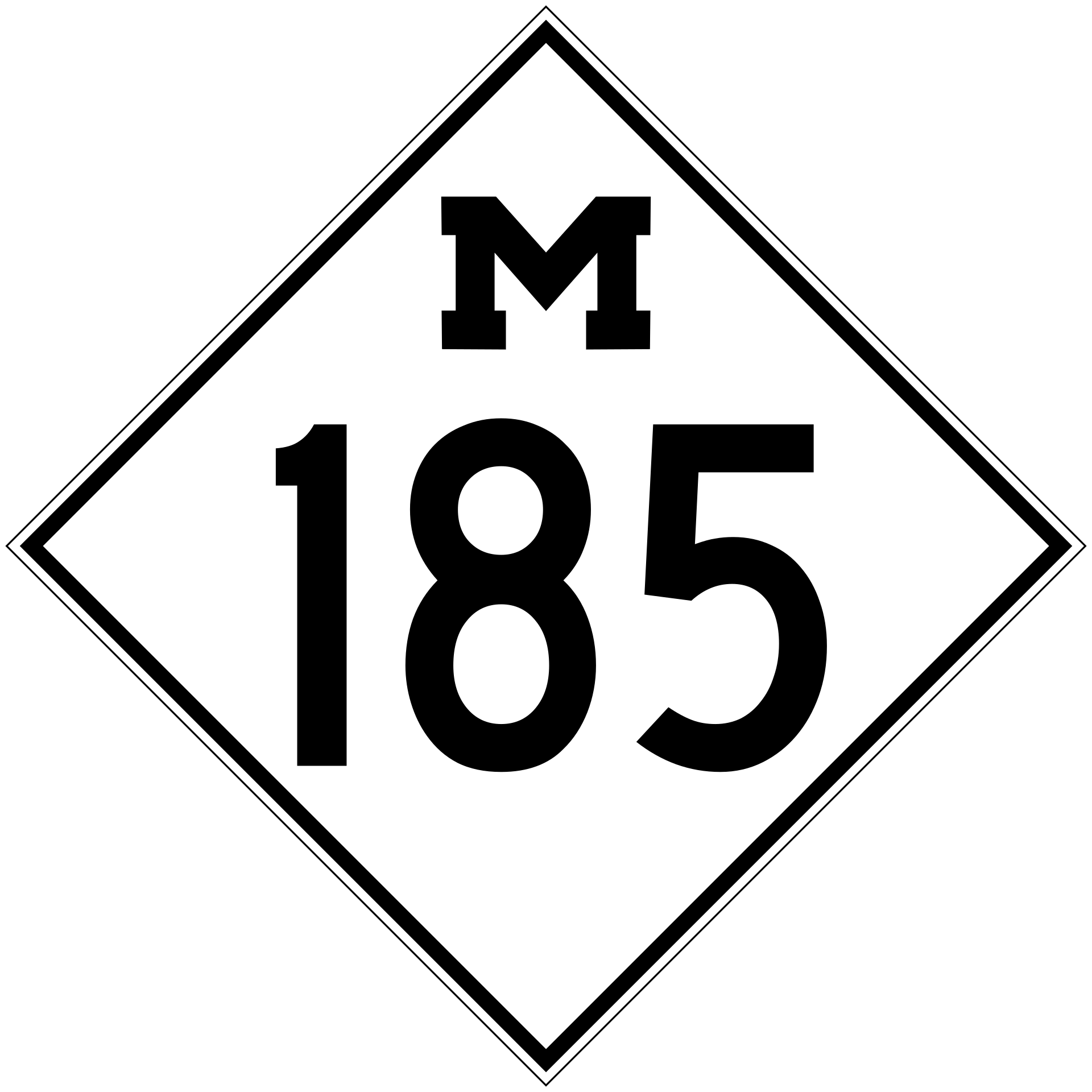
| Termini*: | Cnr Main St (formerly Huron St) & Fort St in downtown Mackinac Island* |
| Length: | 8.004 miles |
| Maps: | Route Map of M-185 – via the Mackinac Island Locator Map by Christopher J. Bessert on MackinacIsland.org |
| Notes: | The nation's only "Motorless State Highway"; in 1896, the City of Mackinac Island drafted an ordinance banning the use of motor vehicles on the island. A few years later, the Mackinac Island State Park Commission—the state park covers more than 80% of the island—followed suit and outlawed motor vehicles within the park as well. Today, the primary users of M-185 are the thousands of tourists piloting carriages and bicycles, or just plain walking. While paved and marked with standard highway pavement markings (a dashed yellow line down the centerline to separate opposing streams of traffic and white edgelines outside the Downtown and Mission Districts), the Lake Shore Dr portion of the roadway from Mission Point Resort around the Island and back downtown to the Windermere Point area is only approximately 12-feet wide, or the width of a single traffic lane on standard "motorized" highways. |
| * As M-185 is a circular'highway—it completely circles Mackinac Island—and therefore has no particular termini—starting and ending points. The Mackinac Island State Park Commission has erected mileposts along M-185 (see example the top of this listing) using the State Park Visitor Center at Main & Fort Sts as Mile 0.0, which is used here as the termini. Interestingly, MDOT's own "PR (Physical Reference") Finder"/"Control Section Atlas" application, an online mapping system which replaces the old printed Control Section and Physical Reference mapbooks of the past, the route of M-185 "begins" and "ends" at the intersection of Main St & Bourisaw Ln, the narrow, dead-end street leading inland away fromt the lake approximately halfway between Market St and French Ln on the southwestern end of downtown. This is just likely based on a GIS (Geographic Information Systems) data function whereby the route begins at the southernmost point, which would technically be at the cnr of Main St & Bourisaw Ln, but as this is more a function of GIS data rules than reality "on the ground," the Zero Milemarker in front of the State Park Visitor Center will still be used as the joint termini for this listing. | |
  |
|
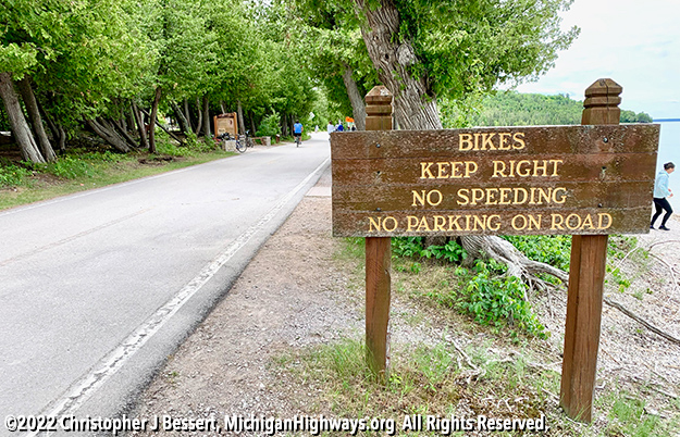 A "rules sign" along M-185 reminding tourists of some of the more common-sense type rules when riding around Mackinac Island. Photo by Christopher J Bessert |
|
| History: | The history section of this listing includes happenings and occurrences that are related to or affected the route of M-185 but occurred before the actual establishment of the route in question. |
| 1898 (July 6) – The village council of the Village of Mackinac (what is today the City of Mackinac Island) resolves that "the running of horseless carriages be prohibited within the limits of the village." This is for several reasons, partly "that noisy, smelly newfangled automobiles would scare the horses," but also because of the powerful Mackinac Island Carriage Tours operation which fears the automobiles will wreak havoc on their established business. | |
| 1901 – The Mackinac Island State Park Commission follows the lead of the village-now-city government in officially imposing a ban on automobiles from the State Park itself, which comprises the majority of the land area on the Island. Summer resident Earl C. Anthony "brought a car to the island, scared and injured some horses and several carriages were damaged." | |
| 1898–1901 – The Mackinac Island State Park commission constructs the present-day M-185/Lake Shore Dr around the perimeter of the Island over the course of a few years, resulting in a roadway completely encircling Mackinac Island for the first time. Until this point, several different roadways led down to the shoreline from various points on the Island, including the Stonecliffe Shore Rd, British Landing Rd, Scotts Shore Rd and others, while only Huron St (present-day Main St) in the Downtown and Mission Districts runs roughly parallel to the shoreline in the southermost part of the Island. | |
| 1910 – Final construction activities on the Lake Shore Road (present-day Lake Shore Dr) are completed by the state park. | |
| 1933 (Jul 12) – Mackinac Island State Park Commission officials appeal to State Highway Commissioner Murray D. Van Wagoner for the State Highway Dept to accept jursidiction of Lake Shore Dr running around the edge of the Island as they claim the commission's budget is unable to cover the cost to maintain the roadway and it would better be part of the state highway system. On June 12, the entire 8-mile length of Lake Shore Dr as well as Huron St (aka "Main Street") downtown is transferred to state control as a state trunkline, marking the official debut of M-185. |
|
| 1935 – Mackinac Island summer cottager, Floyd Tollefson, who owns a home on the northwest corner of the Island known as Pointe aux Pins, challenges the City ordinance banning vehicles from M-185 and the rest of the Island's roadways by driivng his vehicle from his cottage into the downtown area. Tollefson is arrested and pays a fine for violating the 37-year-old ban on motorized vehicles. He appeals his conviction to the circuit court which sides with the City, preserving the vehicle ban. | |
| 1955, 1958 (Apr 1) – A major construction project by Moral Re-Armament (MRA), "an international moral and spiritual movement" that had begun holding conferences on the Island in the 1940s, in the Mission Point area utilized gravel-hauling trucks which pitted the city council against the State Park staff, with the latter threatening to issue fines to the organization due to the operation of the trucks through the park. In 1955, the gravel-hauling trucks badly damage 2½ miles of M-185, badly rutting the roadway and "breaking through the dust layer and spoiling the road for carriage traffic." MRA never pays for the damage to the roadway and the State of Michigan sues the group in April 1958 to recoup the $2,700 it cost them to pay for the damage. | |
| c.1960 – At some time around 1960, the route of M-185/Lake Shore Dr is slightly rerouted onto a straighter alignment through the Moral Re-Armament campus (later Mackinac College, then Inn on Mackinac, now Mission Point Resort) to accommodate construction of some of the organization's buildings. The Mackinac Island State Park Commission trades the existing 66-foot-wide right-of-way in the area to the MRA in exchange for a straighter 34-foot right-of-way along which M-185 is reconstructed. | |
| 1960 – Mackinac Island's ban on motor vehicles is incorporated into state law, previously only having been a city ordinance prohibiting their use on the Island. | |
| 1960 (Sept 26–Dec 1) – M-185 is completely hard-surfaced throughout with asphalt for the first time. While paved in the Downtown and part of the Mission District for decades, the remainder of the route of M-185/Lake Shore Dr around the perimeter of the Island consisted mostly of an oiled and graded combination limestone-and-manure roadway—the limestone coming from the primary physical makeup of the Island itself and the manure from the countless horses which have traversed the roadway for more than a half century since it was first completed all the way around the Island. While the State Highway Dept used to simply grade and oil the unpaved portion of the highway each year, with the sale of the department's fleet of state ferries after the opening of the Mackinac Bridge, it became more cost-effective to finally pave the highway to reduce overall and annual maintenace costs. The cost to rebuild and pave M-185 is $96,576 and is completed by December 1. | |
| 1969 (July-Aug) – The segment of M-185 on the east side of the Island undergoes repair due to erosion from high lake levels in Lake Huron. The Dept of State Highways ships in trucks, bulldozers and heavy earth-moving equipment to the Island and moves 1,200 tons of rock from the Island's airport to the shoreline along the Island's east side where the erosion is taking place. | |
| 1975 (Aug) – For the first time in the history of M-185, the highway now sports a painted centerline separating directions of traffic. The centerline was painted on the entire eight-mile length of the non-motorized highway following a $200,000 resurfacing project and $225,000 of additional repair and erosion control projects. | |
| 2003 – The street name of M-185 through the downtown section of Mackinac Island is changed from Huron St to Main St during an Enhanced-911 effort. "Huron St" name signs along Main St through the Downtown and Mission Districts were not replaced for several years afterward, however. | |
| 2012 – The concept of a 2,000-plus-mile trail (a 1,260-mile hiking route and a 775-mile long biking route) running from Belle Isle in the Detroit River to Ironwood at the western tip of the Upper Peninsula and travelling through much of the state is announced, with all of M-185 on Mackinac Island to be included in the route. To read the M-185/Mackinac Island segment of the Iron Belle Trail, hikers and bicyclists need to utilize the passenger ferry services running from Mackinaw City and St. Ignance to the Island or fly in via aircraft. | |
| 2015 (Jan 26) – The 2,000+ mile hiking and biking trails running between Belle Isle in Detroit and Ironwood are officially named the Iron Belle Trail. With the exception of the very beginning and ending segments, M-185 constitutes one of two joing hiking-biking segments along the route—the other being the Mackinac Bridge, although hikers and bikers need to be transported across the bridge by Mackinac Bridge Authority personnel (with the exception of the annual Mackinac Bridge Labor Day Bridge Walk—the only day of the year when hikers, or anyone, are allowed to walk the length of the bridge.) | |
| 2019–2020 – During the winter of 2019–20 and the spring of 2020, rising lake levels on Lake Huron causes severe damage along M-185 along the eastern shore of the Island, especially during major storm events. The road is closed to "traffic" (bicycles, carriages and pedestrians) for several months while gravel is deposited into the eroded sections. The roadway was completely reopened in August 2020. | |
| 2021 (Spring) – Final repaving of the damaged segments of M-185/Lake Shore Dr from the flooding events of 2019–2020 is completed in the spring of 2021, completing the repair job begun early the previous year. | |
| Controlled Access: | No portion of M-185 is freeway or expressway. |
| NHS: | No portion of M-185 is on the National Highway System (NHS). |
| Memorial Highway: | At present, no portion of M-185 has been designated as part of a Memorial Highway. |
| Photographs: |
|
| Weblinks: |
|
| Back to M-183 | Route Listings Home | On to M-186 |