

Maps
Featured here are links to many of the maps featured on the Michigan Highways website. (Please note any of the original maps on this website created by Christopher Bessert are copyrighted and may not be used for any purpose without prior permission.)
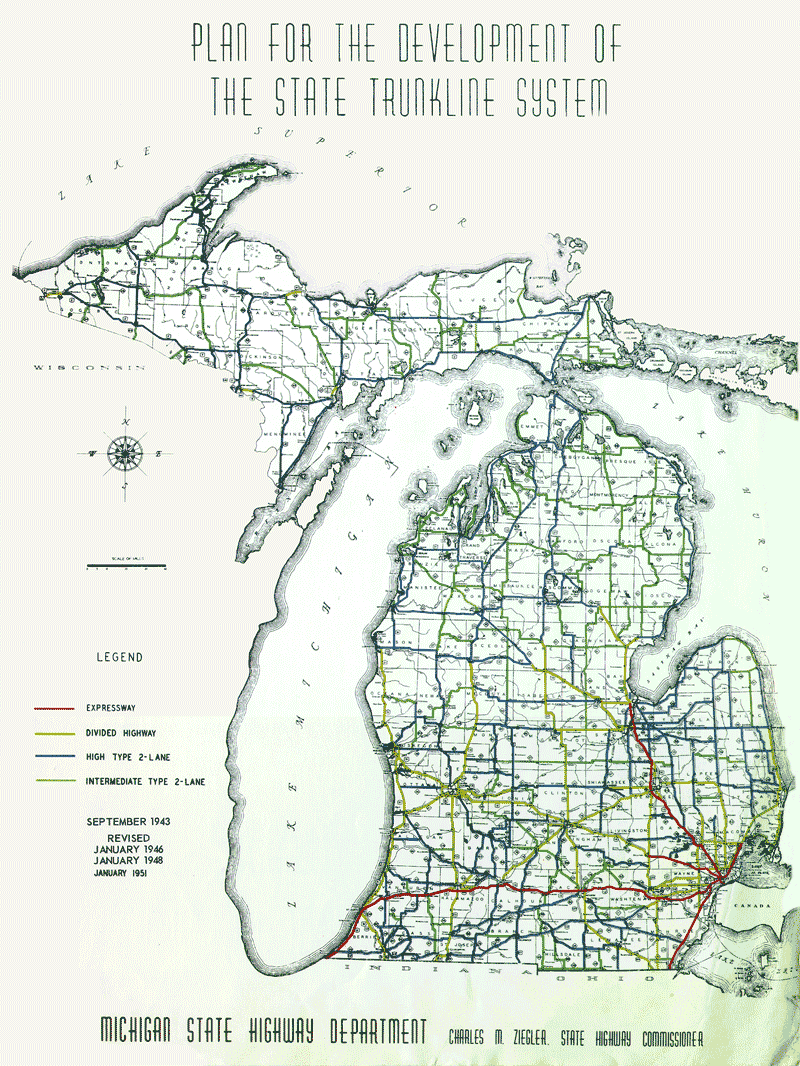
- 1951 Trunkline Plan: "Plan for the Development of the State Trunkline System" (Revised January 1951)
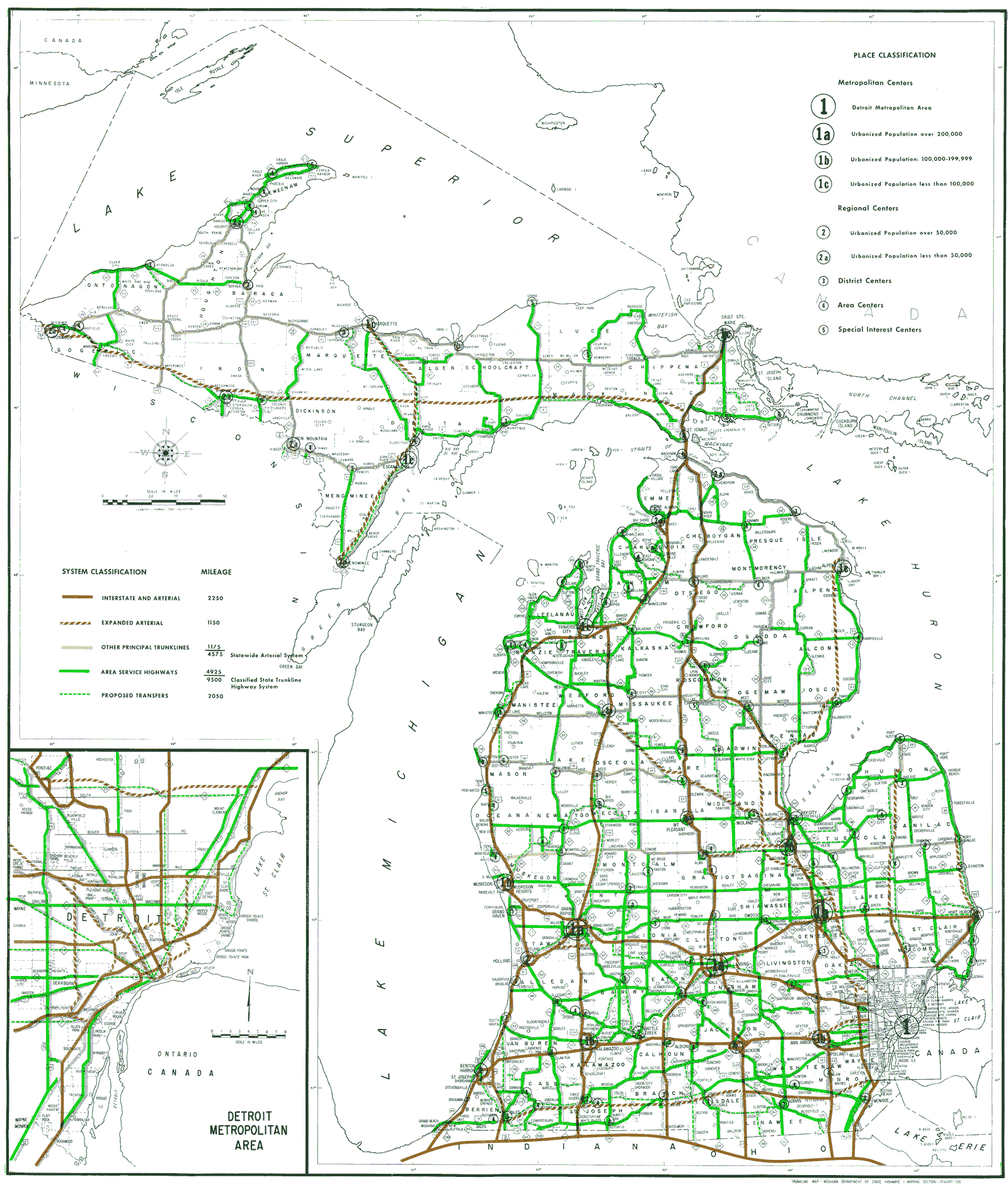
- 1968 Trunkline Plan: "A State Trunkline Plan Classifying Highways for Needs Studies and the Development of Construction Programs (Revised January 1968)":
- 1968 Trunkline Plan Map (GIF – 323 KB)
- 1968 Trunkline Plan Map
 (1.45 MB)
- Diagonal Highways Map, 1936 – a larger version of the map from the Diagonal Highways, 1935-36 article.
- Downtown Adrian: Trunkline Routing Map – showing all trunkline routes through Adrian, 1915-present.
- Capitol Loop Map - showing the route of downtown Lansing's Capitol Loop.
 Colon Area State Trunklines map
- Downtown Detroit Trunkline Map – showing the various state trunkline highways and their termini in downtown Detroit. (Map overhauled with minor updates, January 13, 2013.)
- Intercounty Highway System Map, 2015
- Suggestions for Possible Expansion of the Intercounty Highway System, 2011
- The New M-217
- Proposed M-37 Hastings-Battle Creek Expressway
- The Cadillac Area: 2001
- The Cadillac Area: 1999-2000
- Houghton & Higgins Lake Area Trunkline History Map, 1939–Present
- Iron Mountain Bypass Alternatives, 1994
- Niles Area Trunklines, 2010–
- M-20/M-120/M-82 Maps (1969–1971)
- M-26 in the South Range Area: 2006
- M-26 in the South Range Area: 2005
- M-28: Possible Rerouting near Marquette (2004-05)
- M-28: Proposed 1930s Realignment between Newberry and Munising
- M-32: Gaylord-Hillman Route & Proposed Alignment
- M-231 Route Map (2015)
- Mackinaw Scenic Shortway (1939-1942) map
- Ontonagon State Trunkline Changes 2006
- Projected 1980 Michigan Freeway System map, 1961
- Proposed Waukonda-Klock Expressway, 1953
- Trunkline Maintenance Map
- US-27 "Gap Signing" Proposal Map, 1991
- US-131 Manton Bypass Map (2003)
- US-131 Manton Bypass Map as Constructed (Sept. 19, 2003)
- US-131 Constantine Bypass – Before/After
- US-31 Freeway in Berrien County
- Originally-proposed I-96/I-69/US-27/I-496 Interchange near Lansing
- many more maps to be added!
The Michigan Department of Transportation website also contains a wealth of maps, some of which are listed here:
- MDOT Maps
- Key Dates in Map History (archived)
- Official State of Michigan Transportation Map
- Order a Free State Map
- County Base Maps (from DTMB, replaces previous MDOT General Highway Map series)
- Act 51 Mileage Certification Maps
- MDOT Right-of-Way Map Files
- MDOT Average Daily Traffic (ADT) Map (interactive)
- MDOT Average Daily Traffic (ADT) Map Archives
- National Funcational Classification (NFC) Map
Also of passing interest might be a glimpse of the collection of Official Michigan Highway Maps I have collected over the years:
One of the handiest, most-consulted cartographic sources consulted for this website:
- Michigan County Atlas by David M. Brown (6th Edition, 2025)