
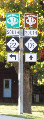
Lake Superior Circle Tour
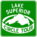 As the first "official" routing of the Great Lake Circle Tours,
the approximately 1,300-mile long Lake Superior Circle Tour can trace its
history back to a loosely-organized "circle coute" around the Big Lake
in the 1960s. Promoted by local tourist organizations by way of brochures,
pamphlets and other promotional materials, the earlier incarnations of
a loop route around the largest freshwater lake in the world were not signposted
and travellers had to rely on the tourist brochures to find their way.
As the first "official" routing of the Great Lake Circle Tours,
the approximately 1,300-mile long Lake Superior Circle Tour can trace its
history back to a loosely-organized "circle coute" around the Big Lake
in the 1960s. Promoted by local tourist organizations by way of brochures,
pamphlets and other promotional materials, the earlier incarnations of
a loop route around the largest freshwater lake in the world were not signposted
and travellers had to rely on the tourist brochures to find their way.
In 1985, Michigan First Lady Paula Blanchard, who was an advisor to the Michigan Department of Commerce at the time, pitched the idea to establish a tour route around Lake Superior at a tourism conference that fall. Soon after, the Michigan Department of Transportation drafted a design for the signs and, working with the Wisconsin Department of Transportation (WisDOT), Minnesota Department of Transportation (Mn/DOT) and the Ontario Ministry of Transportation (MTO), helped devise a route around the largest of the Great Lakes. LSCT signs were posted during the summer of 1986.
Interestingly enough, more of the LSCT exists in Michigan than in any other state or province—approximately 515 miles! Ontario comes close with approximately 474 miles, with Wisconsin (142 mi) and Minnesota (154 mi) far behind.
Lake Superior Circle Tour Route
In Michigan, the mainline of the LSCT follows signed state trunkline routes in its entirety, although in some places the nearest state highway to the Lake Superior may be more than 25 miles away. This route listing lists the official route as well as the various locally-designated and marked "Lake Superior Circle Tour Loops and Spurs," which are generally posted with brown signs. These loop and spur routes are detailed following the mainline route below:
- The LSCT enters Michigan from Wisconsin at Ironwood. Follow the Lake Superior Circle Tour route into Wisconsin at the Wisconsin Highways website.
- Even as the mainline circle tour enters Michigan, a locally-designated LSCT Loop Route is signed closer to Lake Superior bridging between the two states.
- From Ironwood, the circle tour continues easterly on US-2 into Wakefield.
- At Wakefield, the LSCT turns east-northeasterly to follow M-28 to Bergland.
- From Bergland, the route heads northerly on M-64 to Silver City, continuing easterly on M-64 to Ontonagon.
- At the northern end of M-64 at US-45 in Ontonagon, the LSCT continues ahead via M-38 southeasterly to Greenland.
- At the junction with M-26 outside Greenland, the route turns northeasterly to follow that highway into Houghton.
- After crossing the Houghton-Hancock Lift Bridge, the LSCT continues northeasterly via M-26 through Dollar Bay, Hubbell, and Lake Linden, then into Laurium.
- Between Laurium and Calumet where M-26 meets back up with US-41, the Circle Tour continues northeasterly via US-41/M-26 into Keewenaw County.
- From Phoenix where M-26 splits off toward Eagle River, the LSCT follows US-41 all the way to Copper Harbor.
- The route turns westerly at Copper Harbor to follow M-26 along the lakeshore through Eagle Harbor and Eagle River back to US-41 at Phoenix.
- The circle tour backtracks southwesterly via US-41, past Calumet and Laurium to Hancock and Houghton.
- While the LMCT remains on US-41 between Hancock and Calumet, an LSCT Loop Route is signed concurrently with M-203, which loops west from US-41 at Hancock, passes F J McLain State Park, returning to US-41/M-26 at Calumet.
- Now in Houghton, the route continues southerly to follow US-41 through Baraga and L'Anse, then pairs up with US-41/M-28 to continue easterly to Ishpeming, Negaunee and Marquette.
- The circle tour continues through Marquette on US-41/M-28 and on to Harvey.
- At Harvey, the LSCT turns to continue its easterly course via M-28 through Munising and Seney toward Newberry.
- At Seney, where the mainline circle tour route continues east toward Newberry, an LSCT Spur Route was formerly signed along M-77 northerly to a terminus in Grand Marais, on the Lake Superior shoreline, but when the road signs along M-77 were replaced in 2012–13, the LSCT Spur Route signs were left off and the spur is no longer signed.
- In the Newberry area, the route turns northerly to follow M-123 through downtown Newberry, then arcs northeasterly through the Tahquamenon Falls State Park and into Paradise.
- Where M-123 makes a 90° turn to head southerly at Paradise, the LSCT does the same and continues back to M-28 near Echerman.
- The route re-joins M-28 at the eastern M-123 junction and continues easterly to I-75 at Exit 386.
- The circle tour then turns northerly to follow I-75 for its last 10 miles in Michigan toward Sault Ste Marie.
- The LSCT enters Ontario via the International Bridge at Sault Ste Marie.
- Continue on the Lake Superior Circle Tour into Ontario at the Ontario Highways website.
Note: The "Circle Tour Road Route" description from the GLIN website is not only vague, but incorrect! While a good shortcut route, the LSCT does not use M-28 between Bergland and the junction of US-141 & US-41 near Covington south of L'Anse. Other errors in the routing shave hundreds of miles from the acutal, posted route of the Lake Superior Circle Tour. The route included on this website has been personally researched by the website author in the field.
Lake Superior Circle Tour Loop and Spur Routes
 Lake
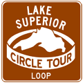
Superior Circle Tour - Loop Route (Little Girls Point)
Lake
Superior Circle Tour - Loop Route (Little Girls Point)
When it enters Michigan, the LSCT at Ironwood is approximately 10 miles from the Big Lake, as the crow flies. To provide for a easy-to-navigate route to the Lake Superior shore at Little Girls Point as well as the westernmost point in Michigan, a locally-desinated Loop Route heads north from the mainline in the Ironwood area. Although it follows a state highway route in Wisconsin, the route on the Michigan side is county roads, which precludes it from being signed as an official portion of the LSCT. The route:
- At the Montreal River bridge, the loop route enters Michigan and the road is now designated as Gogebic CR-505, which it will remain all the way back to Ironwood.
- The loop route contines on CR-505 through some turns, entering Ironwood from the north.
- This routing ends at the LSCT mainline along US-2 northeast of downtown Ironwood.
Lake Superior Circle Tour - Loop Route (Calumet)
In the Calumet/Laurium area, from the jct of US-41 & M-26, a Lake Superior Loop Route departs the mainline LSCT to run through downtown Caulmet to M-203 on the north side of the village before turning back east to US-41/M-26 northeast of town. As with all Loop and Spur Routes, this route is designated with white-on-brown circle tour signs, using the same LSCT "logo." The route:
- The LSCT Loop Route begins at jct US-41/M-26 between Laurium and Calumet and proceeds northwesterly via the 6th St Extension.
- The loop route continues north through Calumet via 6th St to M-203.
- At M-203, the loop turns east to follow M-203 back to where it rejoins the mainline LSCT along US-41/M-26 northeast of Calumet.
 Former Lake
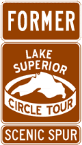
Superior Circle Tour - Scenic Spur (Grand Marais)
Former Lake
Superior Circle Tour - Scenic Spur (Grand Marais)
Between Munising and Paradise, no state trunkline (or other major highway) runs along the Lake Superior shore, leaving the community of Grand Marais, situated right on the Big Lake, 25 miles north of the mainline LSCT. Therefore, a spur route was signed leading away from the LSCT at Seney to provide travellers with a signed route to the Lake at this point. Unfortunately, when MDOT replaced all of the signs along M-77 north from Seney in 2012–13, the Scenic Spur signs were not replaced and, thus, this route is now unsigned. The formerly-signed route:
- The LSCT Spur Route began at the eastern jct of M-28 & M-77 in Seney.
- The spur route continued northerly via M-77 for 25 miles into Grand Marais.
- This spur ended concurrently with M-77 in downtown Grand Marais.
Back to: Great Lakes Circle Tour page.
Additional Information
- Great Lakes Circle Tour - new website from the author of MichiganHighways.org.
- Great Lakes Circle Tour – project archive from the Great Lakes Commission. It was the GLC who originally helped establish the Great Lakes Circle Tours, however as of the early 2020s, the Commission has seemed to have abandoned the concept and no longer supports the Circle Tours in an active manner.
- Lake Superior Circle Tour (archived) – from the Great Lakes Information Network (GLIN), which "is a partnership that provides one place online for people to find information relating to the binational Great Lakes-St. Lawrence region of North America." Please note that the "Circle Tour Road Route" description from the GLIN site is not only vague, but incorrect in several places! (See note above following the detailed routing for more information.)
- Lake Superior Circle Tour Online – from the publishers of the excellent Lake Superior Magazine, headquartered in Duluth. The site is currently under development, but visitors are encouraged to visit the magazine's site for Lake Superior touring information. Lake Superior Magazine also publishes an annual Lake Superior Circle Tour Travel Guide and even offers anyone who requests one a free map of Lake Superior! (Alas, you have to pay a small shipping & handling charge unless you order other products from the site.)
- Lake Superior Circle Tour – "North of Superior Tourism Association is proud to present the Circle Tour as a cooperative marketing initiative to bring together like minded destinations that are accessible to travelers of the Lake Superior Circle Route. (This site mainly deals with destinations in Northern Ontario.)