Mackinac Island Street & Trail Map: Detail 3
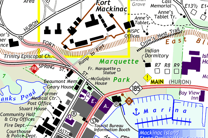
Below is an excerpt from the back (downtown inset) side of the Mackinac Island map by Chris Bessert. It shows a portion of the downtown area from Astor St on the west to the Bay View and Island House on the east and north through the fort. Some notable features include the accurate labelling of all public buildings, including those along Market Street; locations of public restroom facilities and automated teller machines (ATMs); all places of lodging indicated (in purple) and labelled or keyed to an alphabetical listing; indicating the locations of historic cottages keyed to a listing elsewhere; and showing individual slips at the marina.
Contact
Questions about the Mackinac Island Map may be directed to its creator via any of the means listed at right. Hardcopies of the map for closer inspection may also be requested at the same address.
| Christopher
Bessert 1753 Morning Dew Drive SW Byron Center, Michigan 49315 (616) 878-4285 chris.bessert@gmail.com |