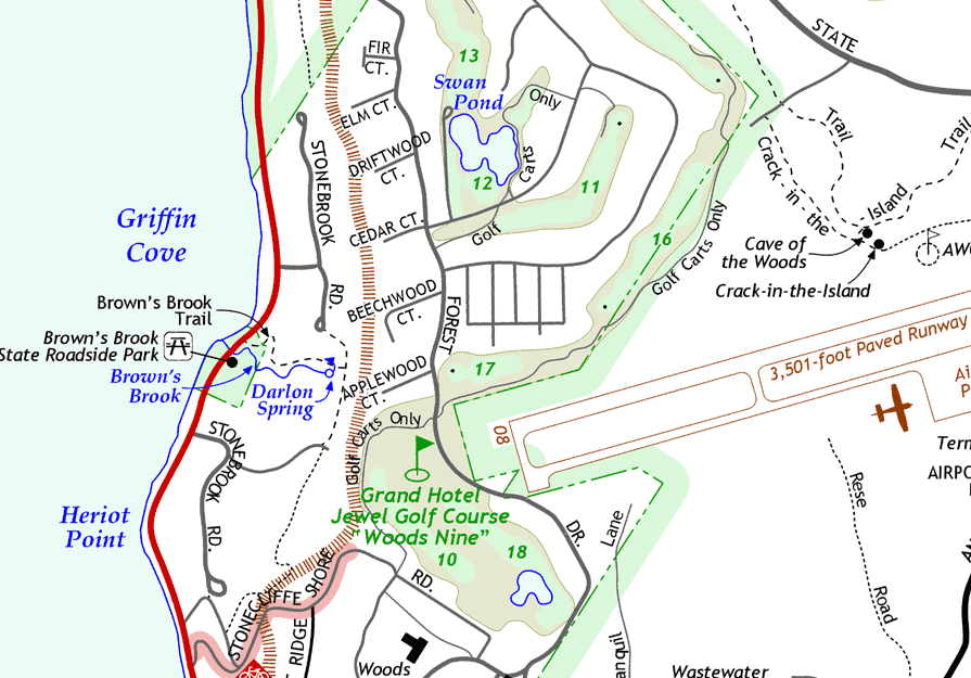
Mackinac Island Street & Trail Map: Detail 2
Below is another excerpt from the front ("whole-island") side of the Mackinac Island map by Chris Bessert. It shows a portion of the west side of the Island from the Woods Restaurant at Stonecliffe on the south to the northern portion of the "Woods Nine" golf course. Some notable features include accurate positioning of the Cave of the Woods and Crack-in-the-Island (and their surrounding foot trails); the new state park property at Brown's Brook; numbered holes on the golf course; and even the golf cart paths. The newer streets on the west side of Forest Drive have been named--although those names appear on no other maps or street signs in the area! However, the streets on the east side of Forest Drive still need to have their names provided and added to the map.
Contact
Questions about the Mackinac Island Map may be directed to its creator via any of the means listed at right. Hardcopies of the map for closer inspection may also be requested at the same address.
| Christopher
Bessert 1753 Morning Dew Drive SW Byron Center, Michigan 49315 (616) 878-4285 chris.bessert@gmail.com |