

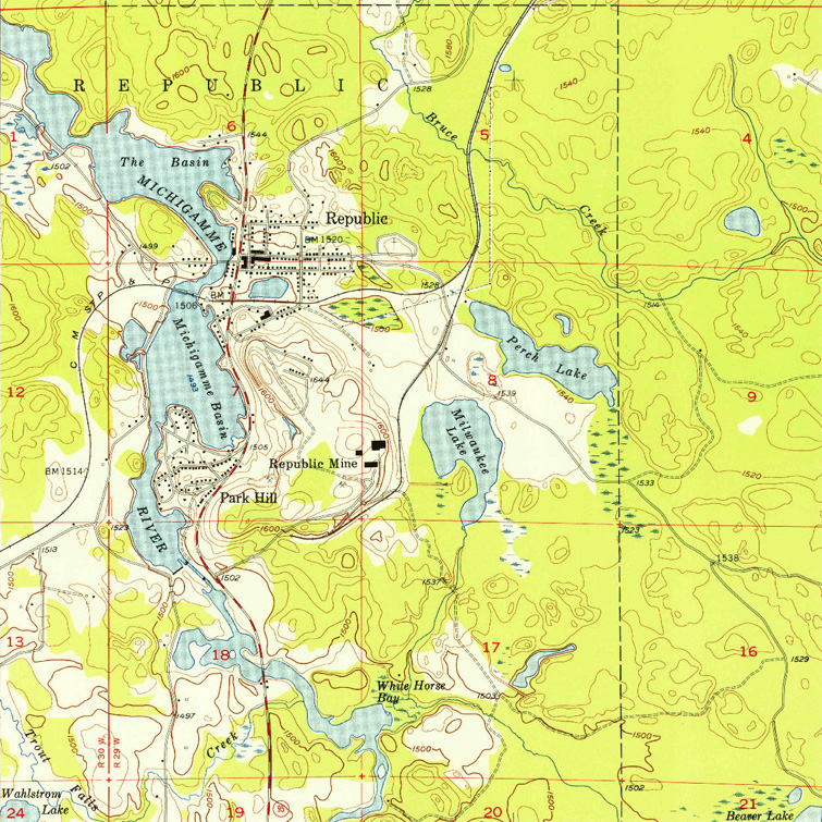
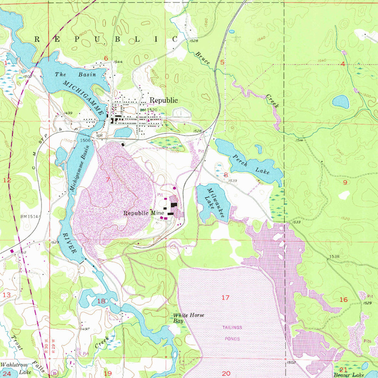
M-95: Republic Mine Reroute (1958)
The following excerpts from the 1955 and 1977 "Republic, Michigan" USGS topographic quadrangle maps show the difference before and after the expansion of the open pit mining operations at the Republic Mine. The 1955 map is on the left, while the 1977 map—with purple tint to indicate revisions from the previous edition—on the right. Use the slider button—the round button with the two arrows in the center of the image—to move back and forth between the two editions of the map and note the changes along M-95 in the area of the mine. Note the area on the west side of the highway known as "Park Hill." Some of these homes were moved to South Republic, while others were demolished to make way for the new mining operations.
![]() Apparently, the image comparison slider function below was non-operational for quite some time prior to February 29, 2024. While it has been essentially repaired, the two map images are not exactly aligning when viewed in Safari in iOS (iPhones). This is a known issue and a fix is being researched.
Apparently, the image comparison slider function below was non-operational for quite some time prior to February 29, 2024. While it has been essentially repaired, the two map images are not exactly aligning when viewed in Safari in iOS (iPhones). This is a known issue and a fix is being researched.
Back to M-95 Route Listing.